
Unbiased headlines. Facts, not spin.
Unbiased Headlines is an independently owned news organization. We bring you the facts, not opinions, written fresh from 110+ named sources. Sources linked so you can verify it yourself.
 energy
Notable (5/10)
Nature study ties Earth's missing billion years of rock to mantle-driven uplift and ice erosion
Geologists have been staring at a hole in Earth's rock record since the 1870s. A new paper in Nature says it knows what dug it.
The hole is called the Great Unconformity. In many places, younger sedimentary rock sits directly on much older crystalline "basement" rock, with hundreds of millions of years of strata simply absent between them.
What is missing
The Grand Canyon is the textbook example. A flat layer of sedimentary rock roughly 540 million years old or younger rests directly on basement rock up to 2 billion years old, according to the study's authors, Santosh Dhungana and Nicolas Flament.
Depending on location, the gap runs from around 200 million years to more than a billion. At the extreme, that is up to a quarter of Earth's history.
The boundary shows up across North America and parts of northern China. It also lies beneath younger rocks in northern Europe.
The timing is not trivial. The sediments just above the boundary appear around the Cambrian explosion, which began roughly 540 million years ago and brought a huge diversification of animal life. Scientists have speculated that eroding continents altered the chemistry of seawater and helped animal life flourish.
The proposed cause
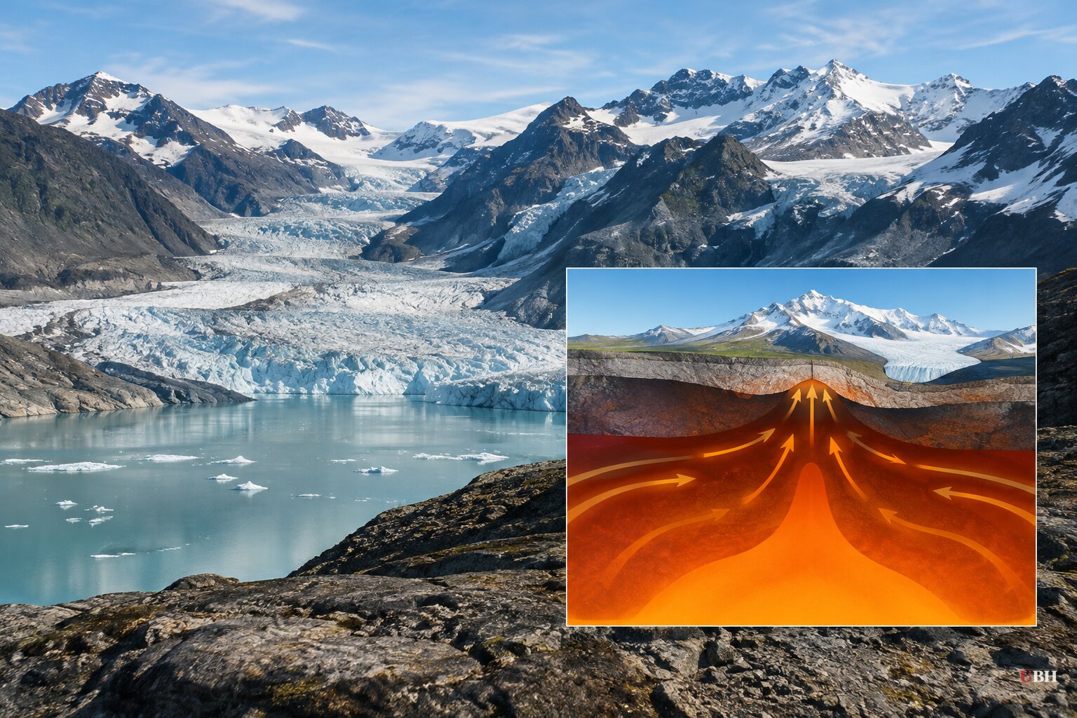
Dhungana, a PhD candidate at the University of Wollongong in Australia, and his supervisor Flament modeled how heat-driven motion in Earth's mantle moved continents up and down. The mantle is a 2,900-kilometer-thick layer of hot, solid rock that creeps over tens to hundreds of millions of years. Rising hot rock and sinking cold rock push and pull the surface above, raising or lowering it by hundreds of meters.
They ran the models on Australia's Gadi supercomputer, simulating the assembly and breakup of ancient supercontinents in the eons before the Cambrian.
Their result: mantle motion pushed continental landmasses upward between roughly 1 billion and 540 million years ago. Exposed to weather, rivers and glaciers, those high surfaces were ground down. Later, as the mantle currents shifted, the continents sank and rising oceans buried the scoured surface under new sediment.
That last step matters. The paper addresses both how the rock was removed and why the boundary survived across such huge areas.
"Our models explain why the Great Unconformity is best preserved in North America and show that it is a first-order surface expression of deep geodynamic processes that transformed global landscapes and sediment fluxes," the authors wrote.
A long list of rival explanations
The authors say the cause has been open for a century and a half. Their own paper lists the earlier proposals: extensive glacial erosion during Snowball Earth, roughly 720 to 635 million years ago; rifting and plume activity; sea-level fall; and mantle-driven dynamic topography.
The obstacle to testing any of them is plain. The main evidence is rock that no longer exists. In the authors' words, those mechanisms had "not been dynamically tested, with limited comparison between global models and global datasets."
This study does not throw out the glacier explanation. It folds it in. Ice does the scouring, but the mantle supplies the elevation that makes the scouring possible.
A separate study in the journal Geology, as described in coverage of the research, points to another contributor. It says the breakup of the supercontinent Rodinia around 800 million years ago left a towering, roughly 6-mile-high cliff called the Great Escarpment of Laurentia. River erosion then chewed at it for more than 200 million years, stripping miles of rock before Snowball Earth glaciers finished the job.
What the model does not claim
The boundary is not one clean event with one date. In North America, the sediments above it range from about 635 million to 482 million years old, according to the paper. A gap that looks uniform today can combine erosion, periods without deposition, later burial and local changes.
The model's predicted pattern fits ancient continental cores in North America, northern Europe and North China. Other regions have different histories. The work does not establish that every missing interval formed at the same time, or that a single mechanism accounts for every location.
The results are also sensitive to reconstructions of Earth's ancient tectonic plates, which remain uncertain. Change the plate map and the modeled uplift can change with it.
There is broad agreement on one point. The processes that carved the gap also set the stage for complex life in the Cambrian, even if the exact cause stays contested.
What comes next
The open question is whether independent teams, using different plate reconstructions, get the same uplift-then-burial pattern for North America, northern Europe and North China. If they do, the mantle explanation gains ground. If the pattern shifts with the plate map, the 150-year argument over the Great Unconformity is not over.
Sources used for this briefing
7 links from 7 independent newsrooms (syndicated copies of the same report count once)
These are the sources it draws on, linked so you can verify.