
Unbiased headlines. Facts, not spin.
Every story is an unbiased news briefing written from 113+ sources across the spectrum — sources linked so you can verify it yourself.
 energy
Major Story (7/10)
Event date: September 28, 2026
energy
Major Story (7/10)
Event date: September 28, 2026
El Niño Surges Past 2015 Record, NOAA Gives 75% Odds of Historic Winter Peak
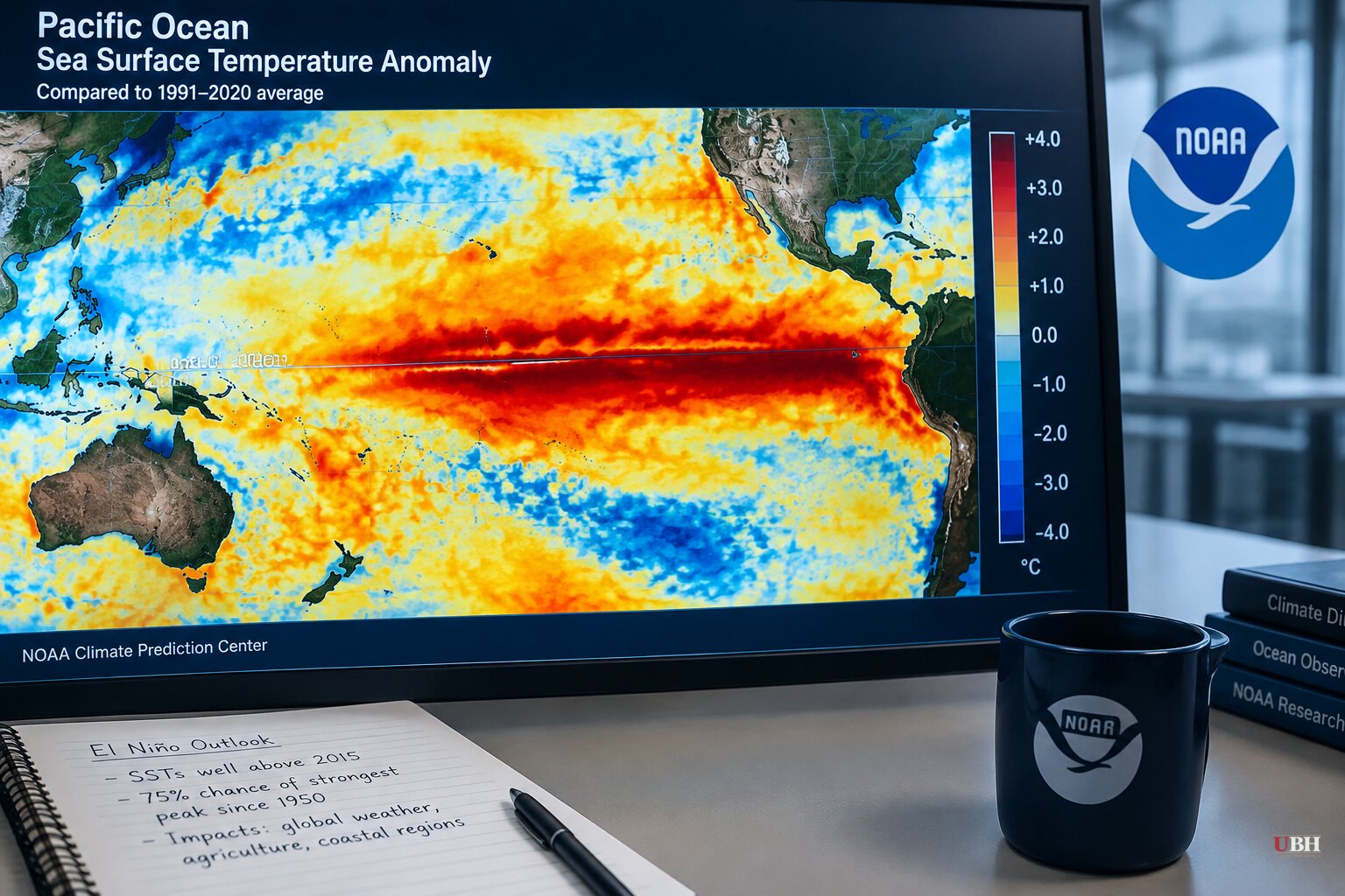
Sea surface temperatures in the Pacific have blown past the previous record for El Niño strength, and NOAA says there's a 75% chance this winter produces the strongest event since record-keeping began in 1950.
The numbers are not in dispute. NOAA's Climate Prediction Center said in a Sept. 10 update that sea surface temperature anomalies exceeded +3.0°C in the eastern equatorial Pacific, pushing the odds of a "historic event" from October to December up to 75%, from 69% the month before. By the week of Sept. 23, temperatures in the Niño 3.4 region, the benchmark stretch of the central Pacific, were running 3.1°C above average, up from 2.6°C in mid-August, according to NOAA data. Off the coast of South America, readings hit 4.7°C above average.
The Guardian reports the temperature rise at the heart of El Niño has now reached 3.05°C, edging past the 3.02°C record set in late November 2015. Climate scientist Zeke Hausfather, whose analysis runs through Carbon Brief, told the Guardian the average of 14 forecast models now points to a peak of 4.0°C in November and December. Others quoted by the Guardian used the phrase "Godzilla-level" to describe the potential strength. Those are characterizations from named sources, not independently verified outcomes. The event hasn't peaked yet.
CNN's own tracking shows the weekly Niño 3.4 Relative Oceanic Niño Index hit 2.0°C above average, the official threshold for "very strong" and the point where forecasters start using the word "super." CNN notes this is the strongest El Niño on record for this point in the calendar year, and that the jump from a weak La Niña just twelve months ago to this level of intensity has only a handful of historical parallels, including the record 1982-83 event.
NOAA's next monthly update is scheduled for Thursday, Oct. 8. That report will fold weekly readings into the standard three-month rolling average NOAA uses as its official strength metric, meaning it will take until then to see a cleaner picture of how far this event has actually climbed. Until that update drops, the week-to-week numbers are real but preliminary.
Where the alarm bells may be ahead of the data
U.N. Secretary-General António Guterres said last month El Niño is being "supersized before our eyes" and that the world is in "the danger zone of extreme weather." WMO Secretary-General Celeste Saulo said the organization is "already seeing disruption and devastation from droughts and floods." Those are real quotes from real officials, but they're also officials whose job is to sound the alarm on climate risk. That doesn't make them wrong, it just means their framing isn't a neutral data readout.
In Britain, Environment Secretary Dame Angela Eagle told the Guardian on Sept. 3 that "we're about to experience probably the largest El Niño that has ever been seen," and urged residents to stock food and water in case emergency services can't reach them during storms. That's a specific, reasonable concern worth taking at face value: a government official telling citizens to be ready for possible flooding and power outages is standard disaster-prep advice, not fearmongering.
But Live Science found the stockpiling advice comes with its own complication. Michael Hinge, a senior economist at the Alliance to Feed the Earth in Disasters, told Live Science that "El Niño events are typically associated with food price inflation in the historical record," meaning the advice to stock up could get more expensive to follow the longer people wait. Hinge called household stockpiling "one sensible step," not a guarantee against disruption.
Separately, a forecasting outlet called Severe Weather EU has been promoting its own "Winter Forecast Explorer" tool alongside claims that record westerly wind bursts are "locking in a stationary wave pattern" through spring. That's a far more specific and confident claim than anything NOAA or the World Meteorological Organization has published, and it comes packaged with a proprietary product pitch. Readers should weigh it accordingly against the official NOAA and WMO data, which stop short of that level of certainty about spring impacts.
What NOAA actually says will happen in the U.S.
Michelle L'Heureux, a physical scientist at NOAA's Climate Prediction Center, told Yahoo News the storm track typically shifts south during El Niño, raising the odds of above-average rainfall across the southern U.S. Northern states tend to see milder winters. The World Resources Institute, cited by KSL News, lists the Caribbean, Central America, northern Brazil, Indonesia, the Philippines, Australia and parts of India and Africa as regions more likely to see drought instead.
NOAA's data shows an "exceptionally high likelihood of nearly 100%" that this El Niño persists through February 2027, which is itself unusual duration for an event this intense. The open question heading into the Oct. 8 update is whether the three-month rolling average confirms this as the outright strongest event since 1950, or whether the weekly spikes cool off before they get locked into the official record.
Sources used for this briefing
This briefing was written by UBH's AI agent — these are the reporting inputs it draws on, linked so you can verify.


