
Unbiased headlines. Facts, not spin.
Unbiased Headlines is an independently owned news organization. We bring you the facts, not opinions, written fresh from 110+ named sources. Sources linked so you can verify it yourself.
 energy
Major Story (7/10)
Storm Series Hits Southern California With Thunder, Wilmington Flooding and a High Surf Advisory Through Tuesday
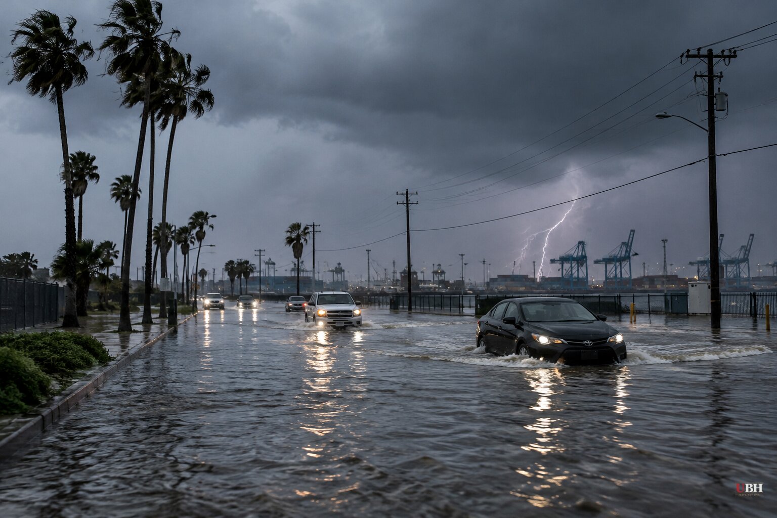
Southern California's dry, unseasonably warm stretch ended overnight. The first of a series of Pacific storms moved through Los Angeles, Orange and Ventura counties, bringing heavy bursts of rain, thunder and lightning.
The National Weather Service (NWS) has two systems on the board for Friday, Nov. 13, through early Saturday, with more behind them.
What has happened so far
Rain started after midnight. Thunder was reported in several areas, including Santa Monica, where a storm-related outage cut power to residents. Officials have not said how many customers lost power or when service will be restored.
A flood advisory for parts of Ventura County ran until 7:15 a.m. Friday. The NWS had warned of flooding in low-lying and poorly drained areas.
In Wilmington, five vehicles, including a semitruck, got stuck in floodwater at Harry Bridges Boulevard and Broad Avenue around 5:20 a.m., the Los Angeles Fire Department said. Spokesperson Jamie Stewart said no one was trapped and no injuries were reported. KTLA reported the flooding appeared to come from a mix of rain and high tides.
That stretch is a detour route. The Vincent Thomas Bridge between San Pedro and Terminal Island is closed for 16 months of construction.
Los Angeles County Supervisor Janice Hahn wrote on X that city and county crews were pumping out the water. "We cannot keep sending commuters through a route that is flooding," she wrote. She asked Caltrans to identify an alternate detour that avoids Harry Bridges and Alameda until a long-term fix is found.
Rain forecast
The first system was expected to taper off Friday morning with about 0.25 inch of rain, and more on mountain slopes. The second, a more widespread frontal system, is due late Friday afternoon or evening and should run into Saturday morning.
The NWS expects 0.25 to 0.75 inch for most areas through Saturday morning, with isolated totals near an inch. Combined totals for the two systems in Los Angeles and Orange counties are forecast at 0.25 to 1 inch. Chances of widespread rain are above 90%.
Most rainfall rates should stay at or below 0.25 inch per hour. Forecasters gave a 20% to 30% chance of localized rates up to half an inch per hour, mainly on mountain slopes and in thunderstorms.
Daytime highs have dropped into the 60s and low 70s, down from the upper 70s and near 90 earlier this week. Inland Los Angeles County can expect sustained winds around 20 mph with gusts of 30 to 35 mph, the NWS said.
Surf and coastal flooding
The coast is the bigger hazard. A High Surf Advisory for Los Angeles County took effect at 2 p.m. Friday and runs through 3 p.m. Tuesday.
Breaking waves of 4 to 7 feet are forecast for Friday. They should peak at 7 to 12 feet Saturday, then ease to 6 to 9 feet from Sunday through Tuesday. West- and northwest-facing beaches take the brunt.
Morning high tides are forecast at 7.0 to 7.4 feet. The NWS warned of rip currents, sneaker waves, heavy shore break and, in its words, "moderate to significant beach erosion and shallow flooding of normal dry beaches and walkways," especially Saturday morning. Lifeguards urge beachgoers to stay out of the water or near occupied towers, and away from rock jetties.
How bad is it?
The label "storm train" has drawn more attention than the NWS's own numbers. Sebastian Westerink, a meteorologist in the NWS San Diego office, told The California Post that any flooding or thunderstorms should be localized. "Nothing crazy, just a few rain storms," he said.
Ryan Kittell of the NWS Oxnard office said no major impacts are expected from the storms due next week. His colleague Mike Wofford said the rain should be on the lighter side, though heavier bursts at times can't be ruled out and minor flood advisories are possible over the weekend.
Internet meteorologist Max Velocity described a far more dramatic picture for Northern California in a video posted Thursday. He said Eureka could see waves up to 35 feet and San Francisco swells as high as 50 feet. Those figures are his. The NWS surf forecasts for Los Angeles County top out at 12 feet.
What comes next
Forecasters expect a break from Saturday afternoon into Sunday. After that, the NWS outlook varies in timing but not in pattern: another system arrives Sunday night or Monday night with a quarter-inch or less, running into Tuesday. A further system is forecast for Wednesday and Thursday, bringing roughly a quarter-inch to an inch.
Two things are still open. The Wilmington detour problem stays unresolved until Caltrans answers Hahn's request. And more rain will fall on that low-lying route before the Vincent Thomas Bridge reopens.
The high surf advisory stays in force until 3 p.m. Tuesday.
Sources used for this briefing
8 links from 8 independent newsrooms (syndicated copies of the same report count once)
These are the sources it draws on, linked so you can verify.