
Unbiased headlines. Facts, not spin.
Unbiased Headlines is an independently owned news organization. We bring you the facts, not opinions, written fresh from 110+ named sources. Sources linked so you can verify it yourself.
 energy
Major Story (7/10)
Record Rain Hits Bay Area, Storm Moves South as California Braces for King Tides Starting Sunday
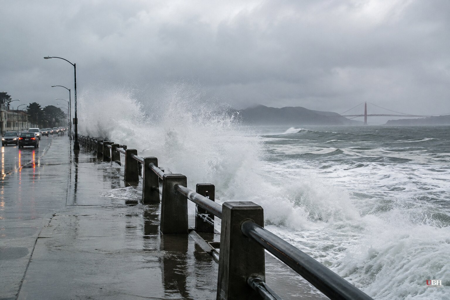
Since waves topped 50 feet in San Mateo County over the weekend, California's coast has taken a second hit: the first atmospheric river storm of the season, which slammed Northern California on Wednesday, Nov. 18, and reaches Southern California today.
The numbers from Wednesday are records. San Francisco logged 2.64 inches of rain, breaking a 108-year-old mark for Nov. 18. San José got 2.04 inches, breaking a 76-year-old record.
Some San Francisco streets were covered in waist-high water. Cars were stranded on flooded Bay Area freeways. More than 51,000 Pacific Gas & Electric customers were without power Wednesday afternoon.
The tide window that worries forecasters
The rain is not what scientists are watching most closely. The exceptionally high king tides begin Sunday and run through Black Friday.
If big swells or heavy rain land on those days, the risk jumps. National Weather Service meteorologist Ryan Kittell said there is not yet much clarity on how much rain will arrive next week, and there is still some chance those days stay dry.
The coast faces two more king tide periods, around Christmas and Martin Luther King Jr. Day.
Reinhard Flick, a researcher at the Scripps Institution of Oceanography at UC San Diego, points to the winter of 1982-83. December storms that year arrived at the lowest tides of the month and caused erosion and some damage. Then at the end of January, storm surge and 13-foot waves arrived with the highest tides of the year. "That's when all hell broke loose," Flick said.
That event caused the worst Southern California flooding in decades and millions of dollars in damage. It wrecked piers in Santa Monica, Seal Beach and San Diego and flooded homes in Malibu, Venice, Playa del Rey and Redondo Beach. The wooden Scripps Pier was so damaged it was replaced with concrete.
What the weekend already showed
Waves above 50 feet were recorded in San Mateo County on Saturday. The Santa Cruz County Sheriff's Office issued an evacuation warning near Capitola. Piers in Ventura, Manhattan Beach, Huntington Beach and San Diego's Pacific Beach closed.
Several inches of water submerged the strand in Orange County's Seal Beach and flooded beachfront homes. At La Jolla Cove, water overflowed the beach and crashed up a staircase.
The National Weather Service's Bay Area office warned of surf up to 35 feet on Sunday and told the public: "Stay out of the water, stay off rocks and jetties, and never turn your back on the ocean!"
El Niño, burn scars and the insurance gap
NOAA's latest update puts the chance of a "historic" El Niño, stronger than any since 1950, at around 60 percent for the October-December and November-January periods.
London-based specialty insurer Atrium found that El Niño winters bring an average of 19 percent more intense storm events along the West Coast than other years: 104 versus 87. "That will likely mean more storms, more property damage and more losses for real estate owners," said Thomas Hobbs, an Atrium executive.
Christina Richardson, a UC Santa Cruz coastal hydrologist, said 80 percent of California coastal erosion occurs during El Niño winters. UC climate scientist Daniel Swain called coastal flooding "a very, very big problem" in a recent briefing.
Scientific American reports that the ocean off California is running more than 10 degrees Fahrenheit above average in places. It also describes sea-level rise from human-caused warming, which scientists say has added between four and nine inches over the past century, as one of several factors stacking on top of El Niño.
The cost question is ultimately about money. Newsweek's analysis says millions of California properties could be at risk while few carry flood coverage. Of the 183,000 California homes in FEMA high-risk flood zones, 65 percent have no federal flood coverage, according to an Insurify analysis cited by Newsweek. Nationally, only 4 percent of homeowners had flood insurance as of 2025, according to FEMA data. That leaves homeowners, and potentially taxpayers, holding the bill after a bad event.
In Los Angeles County, the National Weather Service warned of mudslides and flash flooding in areas burned by the January 2025 Palisades and Eaton fires. It expects 4 to 6 inches of rain in the central coastal mountains and 1 to 3 inches in the southern mountains as the storm moves south today.
Florida is flooding too
On the other coast, Hollywood, Florida, Mayor Josh Levy declared a state of emergency after streets flooded and people were stranded, with the storm damage starting Nov. 17. "It's a historically significant rainfall event in the city," Levy said.
A synagogue roof collapsed and a local hospital flooded. No injuries were reported. Another 4 inches of rain was forecast for the city.
The same system could drop more than 12 inches of rain in some localized areas through Friday, according to some projections. It follows a 1-in-1000-year rainfall event earlier this month that killed two people in Brevard County.
The National Hurricane Center said a nontropical low is expected to form near the northwestern Bahamas on Friday. It gives the system a 20% chance of development in two days and 60% in seven. If it becomes a named storm, it would be Kyle.
The Atlantic season has been quiet by comparison: 10 named storms, one hurricane, Isaias, which struck near Destin in October. The season ends Nov. 30.
The next hard dates are Friday, when the Atlantic low is expected to form, and Sunday, when the king tides begin.
Sources used for this briefing
8 links from 8 independent newsrooms (syndicated copies of the same report count once)
These are the sources it draws on, linked so you can verify.