
Unbiased headlines. Facts, not spin.
Unbiased Headlines is an independently owned news organization. We bring you the facts, not opinions, written fresh from 110+ named sources. Sources linked so you can verify it yourself.
 energy
Major Story (7/10)
NOAA Declares Super El Niño as Pacific Hits 2.0°C Threshold, Strongest Class Since 2015-16
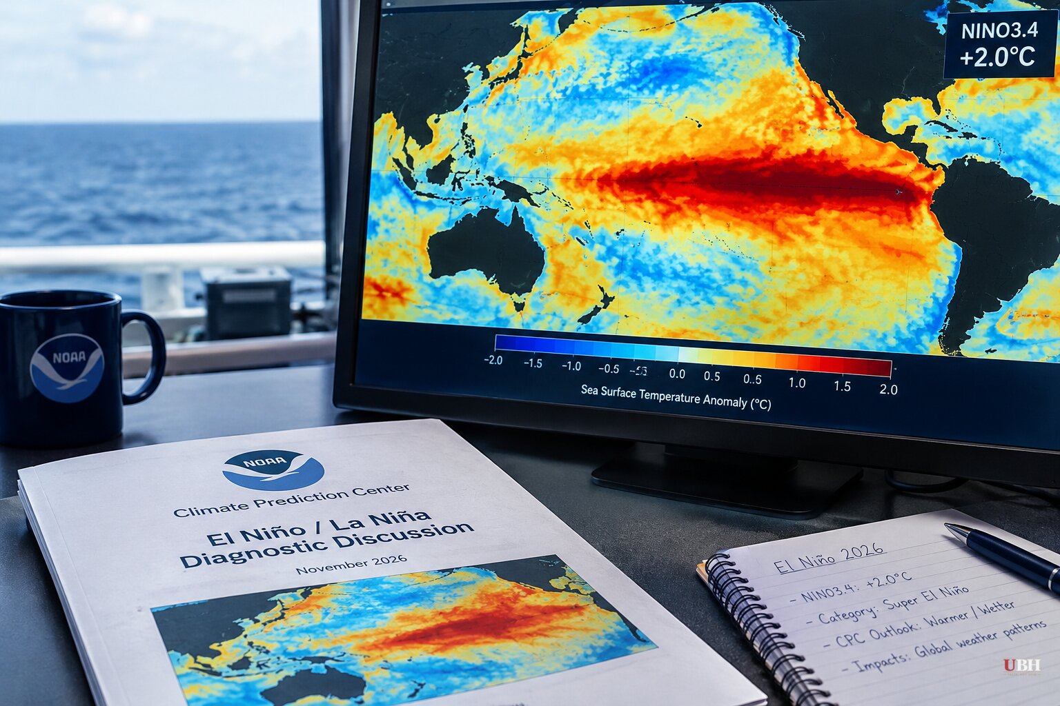
NOAA's Climate Prediction Center announced today, Thursday, Nov. 12, that the 2026 El Niño has officially reached Super El Niño status, also called a Very Strong El Niño.
The trigger: water temperatures in the Niño 3.4 region of the equatorial Pacific hit 2.0°C above average. That is the threshold for the designation.
How it got over the line
Forecasters don't use daily readings. They use a three-month average, which smooths out short-term swings.
The August through October average cleared 2°C. The earlier July through September window did not, so the declaration waited until this update.
El Niño has been in effect since late spring and strengthened through summer and fall. Forecasters had said for months it would reach Super status by late fall. The last Super El Niño ran in 2015-16.
The event is forecast to last into spring 2027, when La Niña conditions are expected to take over. Grist reports it may not peak for another month or two.
Hurricane season already shows the effect
The two ocean basins have gone in opposite directions this year, according to FOX Weather's season tally.
The Eastern Pacific has had one of its busiest seasons on record, with only four names left on the list. Warm water and limited wind shear fueled the activity. Tropical Storm Pena formed in the Central Pacific, the first November tropical storm there since 1982.
The Atlantic has been record under-active, with 10 named storms and just one hurricane so far. Wind shear limited development.
What NOAA expects this winter
NOAA's winter outlook for December through February calls for a warm North and a wet South. It projects more storms from Southern California across the southern tier to Florida.
In a Super El Niño, the Pacific jet stream tends to become extended and active. It works like a conveyor belt, pushing storm after storm across the southern U.S.
"It's a strong, if not historic El Niño going into this winter," Ken Graham, director of NOAA's National Weather Service, said at an October media briefing. "These seasonal predictions are key to helping you prepare and giving you a heads up to assess all the risks and how to mitigate them," he said.
NPR reports forecasters expect warmer temperatures in Northern California and above-average precipitation statewide, especially in Southern California. Past strong events have been costly. In 2015-16, catastrophic flooding hit South Carolina and a blizzard struck the East Coast.
Rain, snow and the Mid-Atlantic
Wetter does not automatically mean snowier. Snow needs cold air, and warm storms just bring rain.
CNN Weather analyzed January-through-March snowfall from 1959 through 2026. In past El Niño winters, snowfall ran above average across the southern U.S., from the Southwest and southern Rockies through the southern Plains, southern Appalachians and Mid-Atlantic. Parts of the Pacific Northwest, northern Rockies, Great Lakes and Interior Northeast saw less. The maps describe history, not this winter's forecast.
Jon Gottschalck, chief of the Operational Prediction Branch at NOAA's Climate Prediction Center and lead forecaster on the winter outlook, said nor'easters in these years are "juiced." "They're very strong, energetic and they're very wet," he said. That could mean above-average snow for Washington, DC, and Baltimore.
A caveat on the numbers: in the South, even well-above-average snowfall can still be a small total, since normal is close to zero.
The limits of the forecast
Nobody is promising specific weather. Forecasters say El Niño shifts the odds toward certain conditions but does not guarantee them. Grist notes that models can predict general regional changes, but no one can say what the weather will be in a given spot a month out.
The outlook also faces a competing signal. BeInsure reports an unusually early disruption of the polar vortex adds uncertainty. A weakened vortex can let Arctic air move into populated parts of North America, while El Niño generally favors warmth across the northern U.S.
Heat, drought and the climate question
The global picture is less tidy than the U.S. one. NASA Jet Propulsion Laboratory climate scientist Josh Willis, who uses the term "Godzilla" for strong El Niños, says severe drought and major wildfires are hitting Indonesia and Southeast Asia, while its "tail" kicks up hurricanes, storms and high tides on the U.S. side of the Pacific. Grist cites drought in the Amazon and extreme rain in the Greater Horn of Africa.
Grist also says scientists have estimated the extra heat alone could kill about 450,000 people worldwide. That is an estimate, and the outlet does not name who produced it.
On the cause, the science is unsettled. Grist says scientists are still working out how climate change influences El Niño, though some research suggests rising temperatures have produced stronger events. Art Miller of the Scripps Institution of Oceanography put the mechanism in plain terms in September: the ocean holds roughly 1,000 times more heat than the atmosphere, so small surface changes can drive big atmospheric effects.
NPR notes this El Niño is layered on top of warming from fossil fuel emissions.
What comes next
The peak is still ahead, possibly a month or two out. The open question for the next three months is whether El Niño's southern storm track or a disrupted polar vortex wins out in the East. Seasonal forecasts can't settle that, and the winter itself will.
Sources used for this briefing
7 links from 6 independent newsrooms (syndicated copies of the same report count once)
These are the sources it draws on, linked so you can verify.