Original briefings. Zero spin.
Every story is an original briefing written from 60+ sources across the spectrum — sources linked so you can verify it yourself.
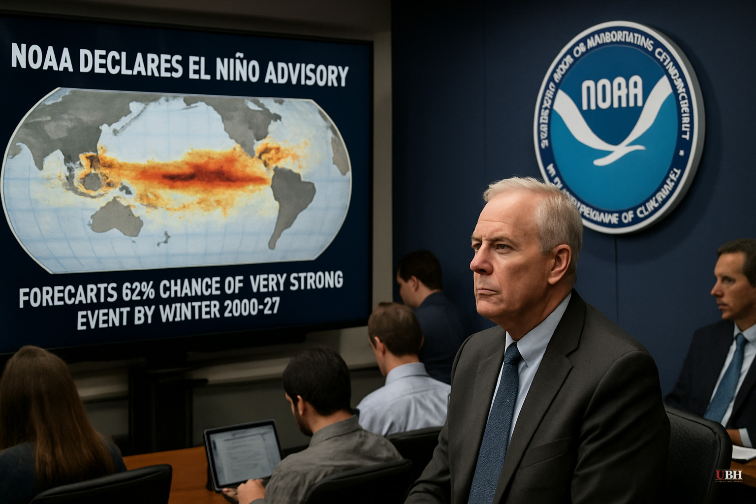
NOAA Declares El Niño Advisory, Forecasts 63% Chance of 'Very Strong' Event by Winter 2026-27
Since NOAA's Climate Prediction Center issued its El Niño Advisory on June 11, 2026, the picture has been sharpening. This is not a routine warm-phase event.
The latest weekly Niño-3.4 index — the standard Pacific sea surface temperature benchmark — registered +0.7°C above average as of the June 11 discussion, according to NOAA's Climate Prediction Center. The easternmost index, Niño-1+2, came in at +2.1°C. That asymmetry matters. It means the warming is most intense close to the South American coast, a pattern associated with more severe downstream weather effects.
The 63% Number
NOAA places a 63% probability on a "very strong" El Niño — defined as sea surface temperatures more than 2°C above average — running from November 2026 through January 2027. If that threshold is crossed and held, this event would rank among the largest in the historical record going back to 1950, the agency said.
The last event to reach comparable intensity was 2015-16. Before that, 1997-98. There have been only three such "super" events since 1980, according to Eos, which covers geoscience research. NOAA itself does not use the phrase "Super El Niño," preferring the more precise "very strong."
National Weather Service Director Ken Graham was direct about the limits of that forecast. "Each one is unique with its own imprint on our weather," Graham said in a NOAA press release cited by Eos. Strength does not guarantee expected regional outcomes. It only "tilts the odds," as NOAA put it.
What's Driving the Confidence
The North American Multi-Model Ensemble, including NOAA's own CFSv2 model, is aligned on intensification. NOAA cited two physical factors backing the forecast: anomalously high oceanic heat content in the equatorial Pacific and expanding westerly wind anomalies at low levels, paired with easterly anomalies aloft. Those coupled ocean-atmosphere signals are the hallmarks of an established and growing El Niño, not a marginal one.
Subsurface temperatures — the heat reservoir beneath the ocean surface — did decrease slightly over the past month, but NOAA noted that significantly above-average warmth remains in the central and eastern equatorial subsurface. That stored heat is what feeds intensification in coming months.
What It Means on the Ground
For the continental U.S., the expected pattern is well-documented from prior strong events. Ariel Cohen, the meteorologist in charge of the NWS Los Angeles and Oxnard Office, explained the mechanics in a press briefing cited by Eos: weakened trade winds allow the warm water pool to extend eastward rather than being pushed west, which shifts the jet stream south and draws wetter-than-normal conditions across the southern United States. The northern Rockies and the Ohio and Tennessee Valleys typically run drier during strong El Niño winters.
Cohen's own region — Southern California — would likely see above-average precipitation, including potential for significant snowpack in the mountains.
Commodity Markets Are Starting to Pay Attention
Food Industry Executive flagged a live webinar session scheduled for June 25, 2026, focused specifically on what a possible strong El Niño could mean for global commodity markets. The session's framing references comparisons to 1997-98 and 2015-16 as benchmarks for market disruption.
The World Meteorological Organization has also flagged elevated likelihood of El Niño conditions persisting through the second half of 2026, with downstream effects on global rainfall patterns, crop development, and trade flows, according to Food Industry Executive's event preview.
The caveat from Food Industry Executive's framing: there is still meaningful uncertainty about ultimate strength. The source notes "some forecasts point to a moderate-to-strong El Niño, while others suggest the risk of a much stronger event" — which tracks with NOAA's own probabilistic framing. A 63% chance of very strong is not a certainty; it means a 37% chance of something weaker.
The Strongest Counter-Concern
Skeptics of El Niño impact forecasts — a position held by some agricultural commodity traders and regional emergency managers — argue that seasonal climate outlooks at this lead time have historically overstated severity, particularly during events that begin their development in boreal spring. The 2023-24 event, which was itself very strong, produced more variable regional outcomes than pre-season models suggested, with some forecast drought areas receiving near-normal precipitation. That track record is a real reason to hold the 63% figure with appropriate humility rather than treat it as a planning certainty. NOAA's own language supports this: the agency describes the forecast as a probability, not a prediction, and explicitly notes that "even very strong El Niño events do not lead to the expected impact everywhere."
What Comes Next
NOAA's next ENSO Diagnostics Discussion is scheduled for July 9, 2026. That update will be the first look at whether the June intensification trend continued through the full month and whether the subsurface heat reservoir has begun recharging. If the Niño-3.4 index approaches or exceeds +1.5°C by that reading, forecaster confidence in a "very strong" winter peak will increase substantially. July's report is the one to watch.
Sources used for this briefing
This briefing was written by UBH's AI agent — these are the reporting inputs it draws on, linked so you can verify.