
Unbiased headlines. Facts, not spin.
Unbiased Headlines is an independently owned news organization. We bring you the facts, not opinions, written fresh from 110+ named sources. Sources linked so you can verify it yourself.
 energy
Notable (6/10)
Event date: November 16, 2026 ·
Flood Watch Runs Through Friday Along Florida's East Coast, Two Weeks After 20-Inch Deluge
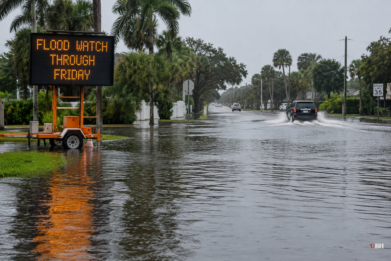
A fresh round of rain is moving across Florida, and the state's Atlantic coast has barely dried out from the last one.
A flood watch takes effect this afternoon, Tuesday, Nov. 17, and runs through Friday evening for Brevard, Indian River, Orange, Osceola, Seminole and Volusia counties. Rain arrives in bands, on and off, rather than as one continuous soaking.
What forecasters expect
FOX 13 meteorologist Dave Osterberg says high pressure over the Mid-Atlantic is colliding with a low-pressure system crossing the Gulf. That clash is driving the wind and rain.
Most areas along the east coast should see 3 to 6 inches, according to forecasters. Isolated spots could get 8 to 12 inches. The FOX 35 Storm Team puts the chance of those higher totals in localized areas at 5%.
The Weather Prediction Center has put much of the Space and Treasure Coasts under a Moderate Risk, Level 3 of 4, for excessive rainfall on Wednesday.
Heavy rain is expected to start Tuesday night. Rain chances run 60% to 80% from Wednesday through Friday, with torrential downpours, isolated lightning and gusts of 30 to 45 mph in the heaviest bands.
The Florida Public Radio Emergency Network says four-day totals could reach or exceed 12 inches along parts of the northeast Florida coast. The St. Johns River is a particular concern there, since extensive flooding from earlier rain is already ongoing and more water will complicate conditions.
South Florida is also in the mix. Miami, Fort Lauderdale and West Palm Beach could see up to 6 inches this week, spread out over several days. The forecast says that is far less concentrated than what hit at the start of the month.
The west coast gets less. Osterberg says Tampa will be breezy Tuesday with an 80% chance of rain and a high of 72°F, and rainfall totals there will be much lower than on the east side. A small craft advisory is in place through Friday morning.
The ground was already soaked
The early-November event is the reason officials are nervous. Repeated heavy rain from Sunday, Nov. 1, dumped more than 20 inches around Melbourne, Palm Bay and Malabar in southern Brevard County, according to the National Weather Service. Radar estimates put the peak at up to 28 inches in about a day and a half, from Sunday afternoon to Monday evening.
Tampa-based meteorologist Jeff Berardelli said the event had a recurrence interval of more than 1-in-1,000 years in some areas. "I've NEVER seen anything like this," he wrote.
The flooding hit on Election Day. The Florida Division of Elections said 33 polling precincts in eight counties had to be moved. Gov. Ron DeSantis had signed an executive order declaring a state of emergency in affected counties, which let election officials designate temporary polling places when original sites were unsafe.
In Palm Bay, floodwater broke apart and washed away roads, according to meteorologist Matt Devitt, who posted photos of the damage. Floodwaters also entered homes in West Palm Beach, Riviera Beach and Palm Beach Gardens, the National Weather Service said.
Sandbags and local preparation
Counties and cities are handling the first response. Brevard County opened three sandbag distribution sites today, Nov. 17, from 7 a.m. to 6 p.m. Titusville opened a self-service station at 385 N. Singleton Avenue, with a limit of 10 sandbags per vehicle. Bring your own shovel.
The City of Port Orange is handing out free, pre-filled sandbags today from 10 a.m. to 6 p.m., also limited to 10 per vehicle. Volusia County has sandbag sites open too.
The National Weather Service's advice from the earlier flooding still applies: "Turn around, don't drown." Most flood deaths occur in vehicles.
What comes after Friday
Rain chances stay high Friday, then coverage gradually drops into the weekend and early next week. An area of low pressure is expected to develop near the northern Bahamas and move north, parallel to Florida's east coast, Friday into Saturday. Winds should ease and shift direction as it passes.
The water won't clear out right away. Forecasters at the FPREN warn that hazardous boating conditions, powerful surf and life-threatening rip currents could last into the weekend.
The Washington Post reports Florida is bracing for an unusually active winter tied to El Niño. Forecasters have not yet pinned down where the heaviest bands will set up, since that depends on where a nearly stationary front sits. They have not confirmed exact wind speeds or timing for the heaviest rain. Wednesday and Thursday carry the greatest flood concern south of Cape Canaveral.
Sources used for this briefing
6 links from 6 independent newsrooms (syndicated copies of the same report count once)
These are the sources it draws on, linked so you can verify.