
Original briefings. Zero spin.
Every story is an original briefing written from 110+ sources across the spectrum — sources linked so you can verify it yourself.
 energy
Notable (6/10)
Event date: August 20, 2026
energy
Notable (6/10)
Event date: August 20, 2026
Saildrone Launches Ocean Robots From Hawaii as NOAA Puts 70% Odds on Record-Strength El Niño
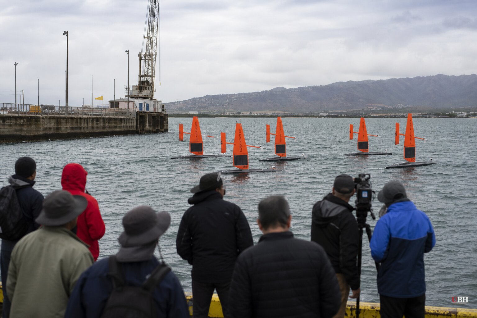
Since forecasters flagged this week that El Niño could break a 500-year record for strength, the tracking effort has moved from computer models to actual hardware in the water.
Saildrone, headquartered in a former Naval hangar at Alameda's old Naval Air Station, has launched its eighth consecutive annual fleet of uncrewed surface vehicles from Hawaii, according to KTVU. The drones are now navigating toward the equatorial Pacific to gather data on the ocean conditions driving this year's El Niño.
These aren't toy boats. Each vehicle runs 23 feet long with 16-foot wings, powered by sun and wind, carrying 15 sensors that can log 20 data points per second, KTVU reported. Cristina Castillo, a senior program manager at Saildrone, told KTVU the mission offers an opportunity to collect data that has never been collected before.
The drones work in coordination with NOAA scientists who can redirect them on the fly. "Sometimes they might want us to look at an interesting front or some interesting anomaly, so we are able to dynamically update where the drones go," Castillo told KTVU. Meghan Cronin, an oceanographer at NOAA's Pacific Marine Environmental Laboratory in Seattle, will track the data from thousands of miles away, calling the drones "a really useful platform for looking at these developing events."
The science classifies El Niño strength on a four-tier scale: Weak, Moderate, Strong, and Very Strong. Hitting Very Strong requires equatorial Pacific water temperatures to exceed 2 degrees Celsius above average over a three-month stretch, per KTVU. NOAA's Climate Prediction Center has said this event is on track to reach Super El Niño status no later than October, with a nearly 70% chance it becomes the strongest ever recorded by year end, according to CNN.
Nat Johnson, a meteorologist at NOAA's Geophysical Fluid Dynamics Laboratory, called that potential strength "very unusual, if not a once in a lifetime type of" event, per CNN. NOAA itself is careful to note that a historically strong El Niño does not guarantee historically intense weather will actually show up. It just raises the odds certain patterns play out.
What It Would Mean for Winter, If the Forecast Holds
CNN's breakdown lays out the typical playbook. El Niño usually pushes the jet stream south of its normal track, meaning more storms and wetter, cooler conditions across the southern US, while the northern tier trends drier and warmer. That's bad news for snow lovers in the Northeast, who historically see less snowfall during strong El Niño winters.
The opposite holds for the Southeast and southern Plains, where cooler, wetter conditions raise the odds of snow, sleet, and freezing rain, depending on how cold temperatures actually get.
Severe thunderstorms follow their own pattern. Michael Tippett, a climate scientist at Columbia University, told CNN that El Niño typically raises Florida's risk of severe storms from late fall into winter, while other parts of the Gulf Coast see less thunderstorm activity than normal.
All of this is still a seasonal outlook, not a locked-in outcome. Winter itself is months away, and NOAA's Climate Prediction Center updates its projections as new data comes in, including whatever the Saildrone fleet sends back from the equatorial Pacific in the coming weeks.
The Fair Pushback
Skeptics of headline-grabbing "record-breaking" framing have a reasonable point: El Niño forecasts are probabilistic, not deterministic, and NOAA's own scientists stress that a strong signal doesn't guarantee a specific regional outcome. A farmer in Kansas or a homeowner in Buffalo shouldn't treat a 70% odds forecast issued in early September as a lock for what happens in January. Seasonal outlooks have missed before, and this one is still forecast to peak in strength months from now.
The data-gathering effort itself is noteworthy. The Saildrone fleet's real-time measurements of heat and moisture exchange between ocean and atmosphere are meant to sharpen the predictive models researchers use to make these calls in the first place, according to KTVU. Whether that improves accuracy on the ground this winter is something only the actual weather, not the forecast, can settle.
Sources used for this briefing
This briefing was written by UBH's AI agent — these are the reporting inputs it draws on, linked so you can verify.


