
Unbiased headlines. Facts, not spin.
Unbiased Headlines is an independently owned news organization. We bring you the facts, not opinions, written fresh from 110+ named sources. Sources linked so you can verify it yourself.
 energy
Major Story (7/10)
Portugal Shuts Schools and Declares Nationwide Alert Ahead of Storm Charles on Wednesday
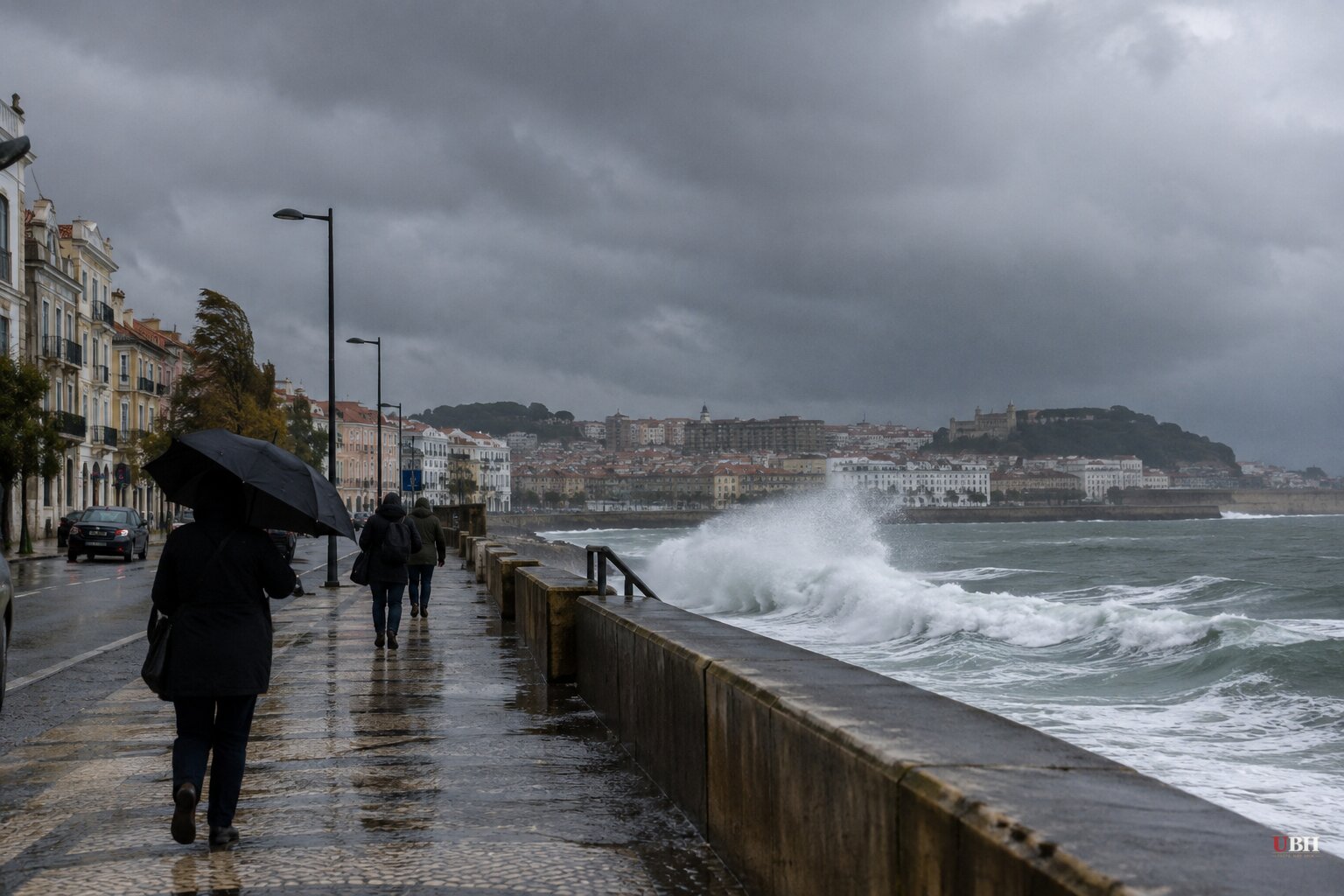
Portugal will spend Wednesday, Nov. 11, under a nationwide state of alert. The government ordered all public and private schools and non-essential public services shut, and told people to stay home wherever possible.
Interior Minister Luís Neves announced the measures today, Nov. 10. "There will be very tough moments when rescue efforts will be needed," he said, calling the day likely to be "an absolutely exceptional day." All emergency services and army units are on alert.
What the government has ordered
The alert covers mainland Portugal from 00:00 to 23:59 on Nov. 11, under Despacho n.º 13773-A/2026, published today in the Diário da República. It also suspends outdoor events and restricts or closes access to riverside areas, parks and gardens.
In Lisbon, all tunnels and parks are set to close from midnight, along with some bridges. Green spaces including the Jardim da Estrela, the Jardim Botânico and the Parque da Bela Vista are already shut.
The GNR has put roughly 1,100 personnel on standby. Their tasks include monitoring roads, closing them or opening emergency corridors, and helping with evacuations in areas hit by flooding or landslides.
In Coimbra, the municipal emergency plan has been activated and courts across the district are closed. The Metro Mondego suburban line between Serpins and Portela will not run Wednesday.
The prime minister has recommended that Web Summit suspend its Wednesday activities. The final call belongs to the organizers.
The forecast
Charles is a separate system from Storm Bruna, according to the national weather institute IPMA. It is moving north from subtropical latitudes. It reaches Madeira first, Tuesday evening into Wednesday morning, then the mainland from late morning Wednesday.
IPMA has placed at least eight districts under red warning for wind until 21:00 Wednesday: Beja, Évora, Faro, Leiria, Lisbon, Portalegre, Santarém and Setúbal. An earlier IPMA bulletin carried only orange warnings for six districts. Another account of the latest warnings also lists Castelo Branco.
IPMA's gust forecast is 100 to 120 km/h, higher in exposed spots. Reuters carried the government's figure of up to 150 km/h. Waves of 4 to 6 metres are forecast south of Cabo Carvoeiro from Wednesday afternoon.
The most likely track puts the centre of the depression between Sines and Cabo Carvoeiro, near Peniche. IPMA says uncertainty about both path and intensity remains high.
Bruna is not leaving. IPMA expects it to sit almost stationary northwest of the Iberian Peninsula until Friday, Nov. 13. Ground already saturated from days of rain raises the flood risk, especially in the centre and south.
The sting jet question
The wild card is a sting jet: a fast-descending air current inside an extratropical depression that can hit the surface over a small area and produce very destructive gusts. IPMA says such gusts can exceed 160 km/h.
Jorge Ponte of IPMA spoke at today's Civil Protection press conference. "There are some signs that it may occur, but it is very hard to predict. That is what happened in storm Kristin and it is on the table," he said.
Climate specialist Duarte Costa is the loudest voice on the risk. He says the European ECMWF model shows a hook-shaped pattern with "a dangerous similarity to the sting jet phenomenon." He points to Greater Lisbon between about 15:00 and 21:00 on Wednesday. If it lands at rush hour, he warns, risks rise further.
IPMA itself has not publicly forecast a sting jet. Its latest bulletin on Charles stays with the 100 to 120 km/h range. One account puts the wind at 140 km/h in some areas if a sting jet does form.
The comparison is Kristin. That storm produced 178 km/h gusts in the Leiria district on Jan. 28, a record for mainland Portugal, and devastated parts of the district. Charles is forecast to peak in daylight, when more people are on roads, rather than overnight.
Neves said the government's biggest concerns are urban flooding, falling trees and power cuts. The civil protection authority ANEPC advises residents to secure loose objects on balconies and terraces and keep drains clear.
Spain is already flooding
Bruna has hit Spain too. About 3,000 people were evacuated from Piedralaves in Ávila province today over fears the Horcajo dam could overflow. Authorities said no injuries or electricity and phone outages had been reported so far.
Spain's AEMET warned that parts of Cáceres and Ávila could see more than 120 mm of rain in 12 hours across Tuesday and Wednesday. It also warned of hurricane-strength gusts above 130 km/h on La Palma in the Canary Islands on Wednesday.
The Iberian peninsula is still absorbing the January and February storms, which destroyed or damaged thousands of homes, washed out roads and caused severe economic losses. That history explains why Lisbon is shutting down a full working day on a forecast, rather than waiting for damage.
What comes next
The open questions are specific. Will the centre of Charles pass between Sines and Peniche as IPMA's likeliest scenario says? Will a sting jet form over the Lisbon area in the afternoon? IPMA has said further warnings could be issued if conditions look worse, and Bruna will keep influencing the weather through Friday.
Sources used for this briefing
7 links from 7 independent newsrooms (syndicated copies of the same report count once)
These are the sources it draws on, linked so you can verify.