
Unbiased headlines. Facts, not spin.
Unbiased Headlines is an independently owned news organization. We bring you the facts, not opinions, written fresh from 110+ named sources. Sources linked so you can verify it yourself.
 energy
Notable (6/10)
NOAA's Winter Outlook Calls for Heavy Storms in the South and West Coast, While Oregon Forecasters Say Their State Is a Toss-Up
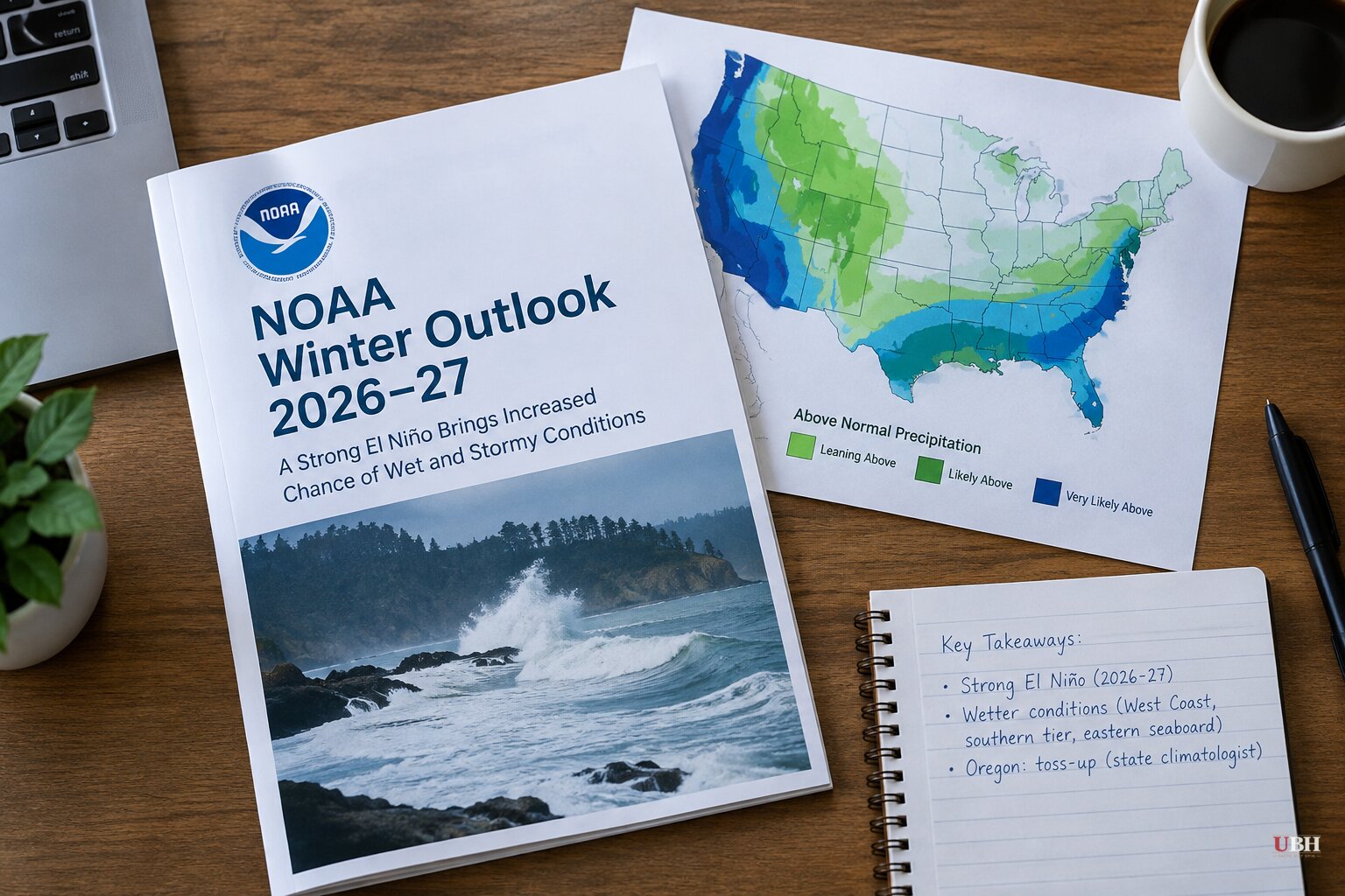
Since forecasters began warning of a historic El Niño this fall, and since its effects were tied to Panama Canal restrictions and drought in Sri Lanka, the main open question has been what it does to the U.S. this winter. NOAA has now answered part of that. The Pacific Northwest, Oregon in particular, is still waiting on a clear answer.
What NOAA's official outlook says
NOAA's 2026-27 winter outlook is built around the near-record El Niño. The agency expects the event to peak in intensity in December and shape weather across the Lower 48 through the winter.
Much of the country is forecast to be milder and wetter than average. That does not necessarily mean less snow than usual, according to NOAA forecasters.
The usual El Niño pattern points the jet stream at the southern tier of the country. That tends to bring more storms and cooler, wetter weather to southern states. Northern states typically turn drier and milder, and NOAA notes that means less snow on average in inland Northeast areas.
The outlook calls for above-average precipitation along the West Coast, across the southern states and along the eastern seaboard.
NOAA meteorologist Jon Gottschalck said some southern-tier storms may turn northeast along the East Coast. Depending on the availability of cold air, they could bring heavy rain and snow to Mid-Atlantic and Northeast cities. "These storms could be very strong," Gottschalck said.
In the Southeast and parts of the southern Plains, snow, sleet and freezing rain depend on how cold it gets and whether cold air lines up with storms. NOAA also says El Niño is not the only factor. The polar vortex will influence cold and snow, especially across the northern tier.
Why a "super" El Niño matters
"Super El Niño" is not an official scientific classification. It is a label commonly applied to events with ocean temperature anomalies of at least 2.0°C above average in a specific region of the equatorial Pacific.
In February 2026, NOAA switched from the Oceanic Niño Index to a new measure, the Relative Oceanic Niño Index, to rate these events.
Warmer ocean water feeds more evaporation, and warmer air holds more moisture. NOAA says that gives any storm in its path the potential for unusually heavy rain and mountain snow.
The National Weather Service says parts of the Pacific had sea surface temperatures in September more than 4°C above previous years. Forecasts indicate the event could exceed the strength of any El Niño since 1950.
Oregon sits in the middle
The Pacific Northwest does not fit the simple map. In a typical El Niño, the region sees drier and warmer conditions as the jet stream drops south toward California and the Southwest.
The U.S. Geological Survey says current winter forecasts expect below-normal precipitation and warmer-than-normal temperatures across much of the region. About half of the forecasting models, though, predict a wetter-than-normal winter for southeastern Oregon.
"The honest answer is we're not quite sure," said Larry O'Neill, Oregon's state climatologist and an oceanography professor at Oregon State University.
John Christian, a University of Oregon assistant professor of geography, said Washington and British Columbia are usually more predictable, with drier weather, while California tends to be wetter. "Oregon is sort of in the middle of this seesaw, so it is hard to predict whether it will be a notably wetter or drier winter in Oregon," Christian said.
He said he has seen some forecasts leaning drier, but not all models agree. Looking at past strong El Niños, some winters were wetter in Oregon and some were drier.
Christian also said forecasts started to agree last spring that a strong El Niño was coming, based on ocean heat observations and models. "And we are seeing that indeed play out," he said.
Local forecasters weigh in
The 34th Annual Winter Weather Forecast Conference, hosted by the Oregon chapter of the American Meteorological Society, was scheduled for 10 a.m. today, Oct. 24, at the Oregon Museum of Science and Industry in Portland. The event was free and open to all ages, and meteorologists from across the Pacific Northwest were set to discuss what a "Super El Niño" could mean for the region.
A Portland meteorologist at KOIN has also published a local outlook after comparing decades of snowfall, rainfall and temperature records from past strong El Niño winters. The station notes that in a typical El Niño, Portland sees drier and warmer winter conditions, but that not all El Niños are alike.
What to watch
The last El Niño was declared in 2023 and lasted through spring 2024. This one is forecast to peak in December. That leaves the question for Oregon: whether the state lands on the drier side of the seesaw that the USGS outlook leans toward, or the wetter side that roughly half the models show for the southeast.
The next NOAA ENSO update will show whether the event is still strengthening ahead of its expected December peak.
Sources used for this briefing
6 links from 5 independent newsrooms (syndicated copies of the same report count once)
These are the sources it draws on, linked so you can verify.