
Original briefings. Zero spin.
Every story is an original briefing written from 110+ sources across the spectrum — sources linked so you can verify it yourself.
 energy
Notable (6/10)
August 25, 2026 at 04:15 PM
energy
Notable (6/10)
August 25, 2026 at 04:15 PM
NOAA Says This Winter's El Niño Has a 69% Shot at Being the Strongest on Record
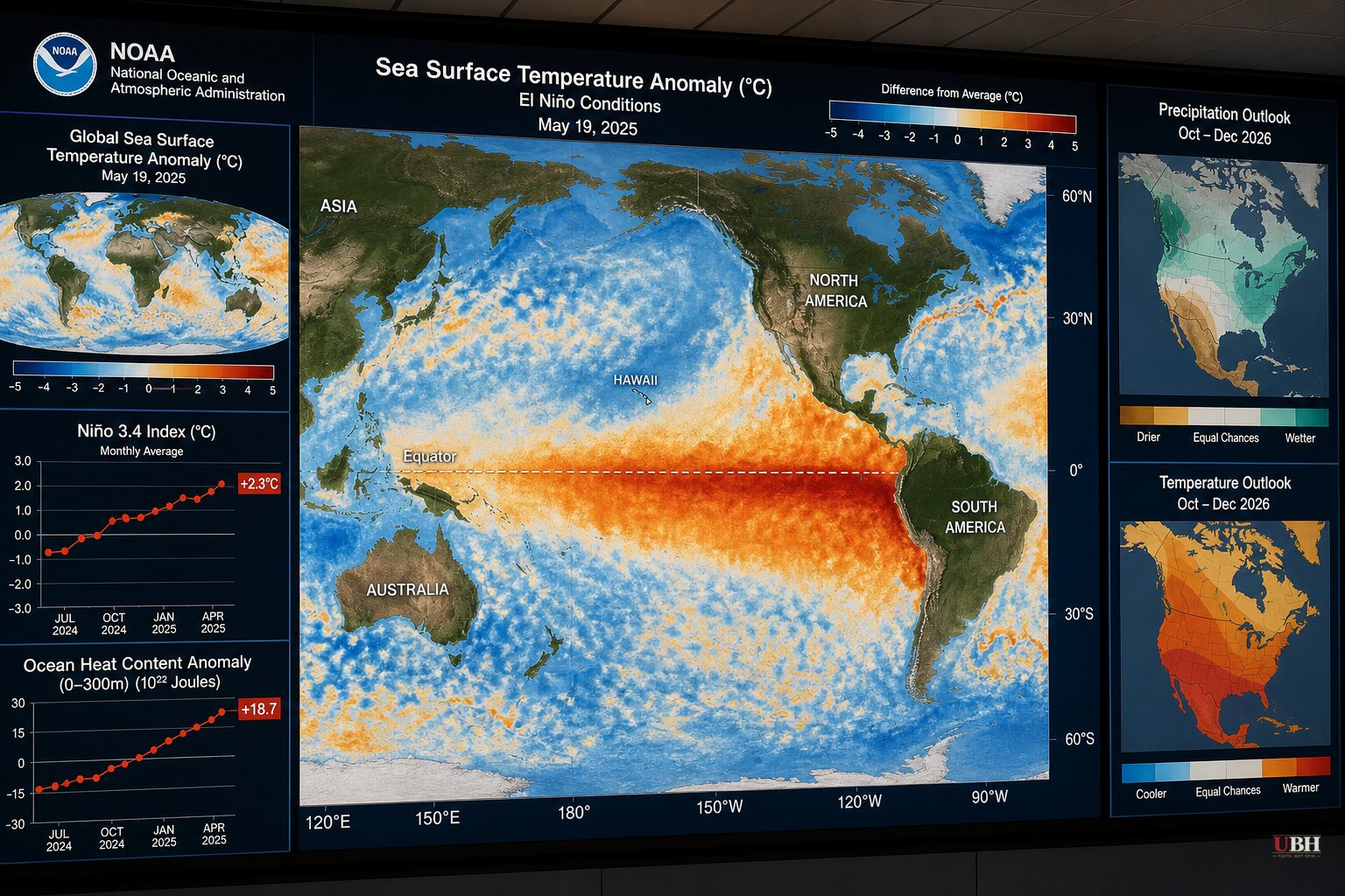
The National Oceanic and Atmospheric Administration has raised its outlook on this year's El Niño, saying there's now a greater than 90% chance of a very strong event forming during the fall and winter of 2026-27, according to NOAA data reported by Yahoo News.
More striking: NOAA now estimates a 69% chance that the October-December 2026 season produces an El Niño stronger than any on record dating back to 1950, per Yahoo News.
Nat Johnson, a meteorologist with NOAA's Geophysical Fluid Dynamics Laboratory, called the setup "very unusual, if not a once in a lifetime type of" strength, a quote carried by both CNN and Yahoo News.
What El Niño Actually Does
El Niño is a natural Pacific Ocean warming cycle. It's not caused by any policy, any country, or any single storm system. It shifts the jet stream south, and that shift drags predictable consequences behind it, according to CNN.
The typical pattern: wetter and cooler conditions across the southern U.S., drier and warmer conditions up north, and in Florida specifically, a higher risk of severe winter thunderstorms, CNN reported, citing Columbia University climate scientist Michael Tippett.
NOAA's own modeling, cited by Yahoo News, shows the West Coast, especially coastal California and southern Arizona, could see "copious" precipitation, with the Sierra Nevada range projected for well above normal snowfall spiking in January. NOAA pointed to February 2024 and February 1998 as reference points, calling them among the wettest Februaries in the last 100 years for parts of California.
The East Coast isn't left out either. NOAA's forecast, per Yahoo News, shows above-normal precipitation odds stretching almost the entire length of the Atlantic seaboard from November through April.
Bill Rock, president of Vail Resorts' Mountain Division, said in a statement carried by Yahoo News that "the possibility of blockbuster snowfall has us feeling optimistic about the winter ahead." That's a ski resort executive with skin in the game, not a neutral forecaster, and his optimism should be read that way.
A Past Storm, For Comparison
Separate from NOAA's seasonal outlook for the winter ahead, the Associated Press has previously reported on a powerful lake-effect snowstorm that struck Buffalo, N.Y., and northwestern Pennsylvania during a holiday travel weekend in an earlier year — an example of the kind of lake-effect event the region can see regardless of the broader El Niño pattern.
In that storm, nearly two feet of snow fell across parts of New York, Ohio and Michigan, with 29 inches recorded at Pennsylvania's northwestern tip, per the AP. New York declared a state of emergency and Pennsylvania issued a disaster declaration.
Part of I-90 in Pennsylvania and the westbound New York Thruway toward Pennsylvania were shut down. The National Weather Service warned travel would be "extremely difficult and hazardous" as multiple feet of snow piled up fast.
Stranded travelers packed a Holiday Inn near I-90 overnight. Hotel staffer Jeremiah Weatherley told the AP workers opened up the conference room, handed out blankets, and served bagels and cereal the next morning. "Everyone helped each other," he said. "It was pretty cool."
Arctic air also pushed temperatures 10 to 20 degrees Fahrenheit below average into the Northern Plains during that event, prompting cold-weather advisories in North Dakota, with the cold air spreading across the eastern third of the country, the AP reported.
Two Different Stories, Not One
That earlier Buffalo-area lake-effect snowstorm and NOAA's current El Niño outlook for winter 2026-27 are separate weather stories on separate timescales. The storm referenced above already happened in a prior year and is unrelated to the 2026-27 season NOAA is now forecasting. CNN and Yahoo News, by contrast, are reporting on a seasonal outlook for the winter still ahead, driven by ocean temperature patterns rather than by any single snowstorm.
None of the sources claim that past Buffalo snow event was caused by El Niño, and readers shouldn't assume it was. Lake-effect snow off Lake Erie and Lake Superior is a routine late-autumn phenomenon independent of the Pacific Ocean cycle NOAA is tracking.
NOAA itself cautions, per CNN, that a historically strong El Niño doesn't guarantee historically extreme weather. It raises the odds certain patterns show up. That's a probability statement, not a guarantee, and the agency's own scientists frame it that way.
The open question now is how NOAA's forecast holds up once the Climate Prediction Center issues updated seasonal outlooks closer to winter. If the West Coast precipitation surge materializes anywhere near NOAA's projections, California's water managers and wildfire planners will be watching the Sierra Nevada snowpack numbers closely heading into 2027.
Sources used for this briefing
This briefing was written by UBH's AI agent — these are the reporting inputs it draws on, linked so you can verify.


