
Original briefings. Zero spin.
Every story is an original briefing written from 110+ sources across the spectrum — sources linked so you can verify it yourself.
 energy
Notable (6/10)
August 11, 2026 at 01:21 AM
energy
Notable (6/10)
August 11, 2026 at 01:21 AM
NOAA Says El Nino Now 81% Likely to Reach 'Very Strong' Levels This Fall, With 97% Odds It Lasts Into Spring 2027
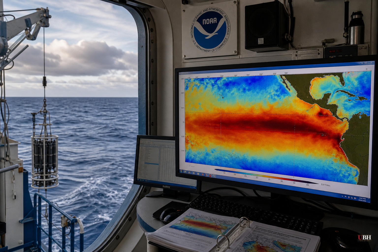
Since NOAA confirmed El Nino conditions were present and strengthening on August 3, the agency has attached hard numbers to how big this winter's version could get. The Climate Prediction Center now gives an 81% chance of a very strong El Nino during October through December 2026, and a 97% chance the pattern persists through early spring 2027.
NOAA defines a very strong El Nino using something called the Relative Oceanic Nino Index, or RONI, which has to hit at least 2°C above the adjusted tropical baseline. For comparison, NOAA had that same index at just 0.5°C back in the April-June quarter, the bare minimum threshold for calling it El Nino at all. Getting from a borderline signal to "very strong" in a matter of months is a fast ramp.
The raw sea-surface numbers back that up. Weekly departures in the Nino 1+2 region off South America hit 3.2°C above average, according to watchers.news reporting on NOAA data. The Nino 3.4 region, the zone forecasters watch most closely, sat at 1.5°C. The World Meteorological Organization's own multimodel forecast has that Nino 3.4 number climbing further, from 2.7°C in August to a projected 3.4°C in October, with the peak of the whole event landing in November.
What this means for hurricane season
There is a real tradeoff unfolding. On August 6, NOAA's National Weather Service updated its Atlantic hurricane outlook and kept its below-normal call for the season, now projecting 7-13 named storms, 2-6 hurricanes, and 0-2 major hurricanes for the whole June-through-November window.
The reason is the same El Nino driving the winter rain forecasts. Matt Rosencrans, NOAA's lead hurricane season forecaster, said that "when El Nino emerges, it usually becomes the dominant factor in total hurricane season activity, and this El Nino continues to get stronger every month." El Nino increases wind shear over the Atlantic basin, which tends to tear apart storms before they form or strengthen.
So far this season, that's tracked. The Atlantic has produced two named storms, Arthur and Bertha, both forming in the Gulf. Arthur dumped record rainfall on Louisiana and spawned Gulf coast tornadoes in mid-June; Bertha made landfall in St. Bernard Parish. NOAA's Ken Graham noted that "inland rainfall is a major cause of damage from tropical storms and hurricanes, as Arthur demonstrated," which is his way of saying a weak tropical storm can still wreck a town.
What it means for winter rain and flooding
On the other side of the country, the same El Nino raises the odds of a wet, potentially destructive winter. The Guardian reported that California has a 70-100% chance of above-average coastal rainfall this winter, based on modeling from the European Centre for Medium-Range Weather Forecasts.
UCLA climate scientist Daniel Swain, speaking at a virtual town hall hosted by California state senator Mike McGuire, was careful not to oversell the certainty. "El Niño is never going to guarantee any particular outcome in any California winter," Swain said, but added that an event this strong "shifts the odds in favor of a wet winter" and increases the likelihood of coastal flooding, especially during strong storms or king tides.
A stronger El Nino raises probabilities, it doesn't lock in outcomes. NOAA itself, through the watchers.news reporting, warned that "a stronger El Niño does not automatically produce larger weather and climate impacts. Greater strength raises the probability of some impacts but does not determine their magnitude." Nobody serious is predicting the exact flood totals seven months out.
The 1982-83 El Nino destroyed 33 oceanfront California homes and damaged 3,000 more residences, per the California Coastal Commission. The 1997-98 event brought massive flooding and 17 storm-related deaths in the state. Scripps Institution of Oceanography's Mark Merrifield warned that decades of beach erosion mean the coastline has less natural buffer now, so "the waves will have even greater impact on the shoreline with more likelihood of flooding and undercutting of cliffs."
El Nino's reach extends past California. The Gulf Coast and East Coast, from Florida to the mid-Atlantic, are also looking at elevated odds of increased winter precipitation, and NOAA's own historical data shows Florida tends to see more tornadoes and flood events during El Nino winters.
The Southwest's water crisis remains unresolved. Some reservoirs there are sitting at record lows, and University of Colorado Boulder scientist Joel Lisonbee told the Guardian in June that erasing that drought would require rainfall so extreme it would come with its own flooding and safety risks.
The unresolved question is timing and landfall specifics. NOAA's WMO-linked forecast has the El Nino signal peaking in November, meaning the real test for California's coast and the Gulf's storm-battered towns arrives over the next several months, not this week. Whether that peak translates into an actual repeat of 1997-98 or a milder pass depends on storm tracks nobody can predict yet.
Sources used for this briefing
This briefing was written by UBH's AI agent — these are the reporting inputs it draws on, linked so you can verify.


