
Original briefings. Zero spin.
Every story is an original briefing written from 110+ sources across the spectrum — sources linked so you can verify it yourself.
 energy
Major Story (7/10)
Event date: August 24, 2026
energy
Major Story (7/10)
Event date: August 24, 2026
NOAA Gives Record El Niño 69% Odds of Topping Every Winter Since 1950, and California's Fire Scars Make It Worse
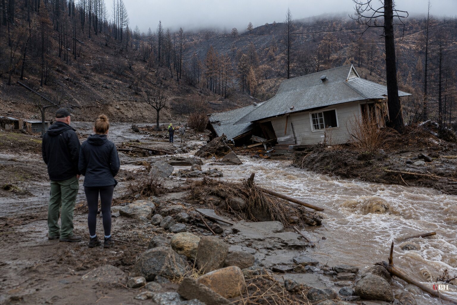
NOAA's Climate Prediction Center confirmed on August 24, 2026 that the Niño-3.4 monitoring region is running 1.8°C (3.2°F) above average, with waters off South America hitting 3.2°C (5.8°F) above normal. Those numbers have no precedent at this stage of an El Niño's development, according to NOAA. The agency puts the odds at 69% that this winter beats every El Niño on record since 1950, and better than 90% that it reaches "very strong" status. NOAA's next formal update comes September 10, 2026.
CBS News reported the same 90%-plus probability for a "very strong" event and the same 69% figure for a historic, record-topping El Niño, citing NOAA's Climate Prediction Center directly. CNN, citing the same forecast trend, calls it a likely candidate for strongest on record and points to February 1998 as the closest historical comparison, when nearly a year's worth of rain fell on downtown Los Angeles in a single month during that decade's Super El Niño.
Dr. Daniel Swain, a climate scientist affiliated with UCLA, the National Center for Atmospheric Research, and The Nature Conservancy, told an American Community Media briefing that virtually every current forecast shows this event strengthening beyond anything previously observed. Swain said there's no formal scientific definition of a "super El Niño," but that this year might need a new category altogether. He expects peak impacts in California between December and March, driven by two separate mechanisms: a wetter storm track aimed at the central and southern part of the state, and a temporary rise in coastal sea levels that will stack on top of already-elevated seas from long-term warming.
The Wrinkle Nobody's Flood Map Accounts For
This winter diverges from 1998 and from the 2015-16 El Niño, which CNN notes dropped far less rain on California than expected. California's 2025 and 2026 fire seasons burned millions of acres. Wildfire doesn't just remove vegetation. It cooks the soil itself.
Jen Pierce, a geologist at Boise State University who studies how fire reshapes landscapes, explained in a piece republished by Yellow Scene Magazine that fires burning above 1,000°F create a hydrophobic layer in the soil. Organic compounds vaporize at the surface and condense in the cooler soil just below, forming a wax-like barrier water can't penetrate. Where healthy soil might absorb an inch of rain an hour, burned soil sheds nearly all of it as immediate runoff.
Pierce points to Colorado's late July 2026 debris flows near Ouray and the town of Beulah as a recent example of this exact mechanism playing out on burned terrain. Tech Times cites the 2018 Montecito disaster as the clearest large-scale precedent: on January 9, 2018, about half an inch of rain fell in five minutes over the Thomas Fire burn scar, and the resulting debris flow hit heights of 15 feet, moved up to 20 miles per hour, and killed 23 people and damaged at least 400 homes.
This isn't unique to California. Oregon's Department of Emergency Management, in a release dated August 27, 2026, documented burn-scar flooding tied to the 2020 Holiday Farm and Beachie Creek/Lionshead fires, plus a 2024 event where flooding along the Silvies River, worsened by runoff off the Falls Fire burn scar, overwhelmed levees and affected nearly 950 homes in Harney County. Douglas County saw the Deer Creek at Roseburg hit a historic crest of 15.91 feet during March 2025 storms that hit prior burn areas.
Why the Flood Maps Fall Short
FEMA's National Risk Index, compiled from historical flood frequency data rather than forward-looking burn-scar modeling, already ranks desert and mountain counties like San Bernardino (12.96 annualized inland-flood events) and Pima County, Arizona (12.82) among the most flood-prone in the country, according to WorldAtlas. But that index reflects the historical record. It doesn't automatically account for a hillside that burned last year and now behaves like pavement.
Oregon's emergency management office put it plainly in its release: if a burn scar near you occurred within the past five years, you may experience flooding where you never have before, and residents should check with their insurance agent about flood coverage before rain starts. Standard homeowners insurance generally does not cover flood damage.
CNN cautions that "El Niños of the past are not necessarily an accurate guide to El Niños of the future." The 2015-16 Super El Niño underperformed rainfall expectations for California significantly. Forecasters can predict an El Niño's strength with reasonable confidence, per NOAA, but where exactly the resulting atmospheric rivers make landfall, and on which specific burn scars, remains uncertain until storms are days out.
NOAA's next assessment, due September 10, 2026, should sharpen that picture. Until then, whether California and Oregon emergency officials can get flood insurance and evacuation warnings in front of the specific hillside neighborhoods sitting below scars FEMA's maps were never built to flag remains the central challenge.
Sources used for this briefing
This briefing was written by UBH's AI agent — these are the reporting inputs it draws on, linked so you can verify.


