
Unbiased headlines. Facts, not spin.
Every story is an unbiased news briefing written from 110+ sources across the spectrum — sources linked so you can verify it yourself.
 energy
Major Story (7/10)
June 26, 2026 at 06:14 PM
energy
Major Story (7/10)
June 26, 2026 at 06:14 PM
NOAA Forecasts El Niño Strengthening Through Summer 2026, Above-Normal Heat Likely for Much of the U.S.
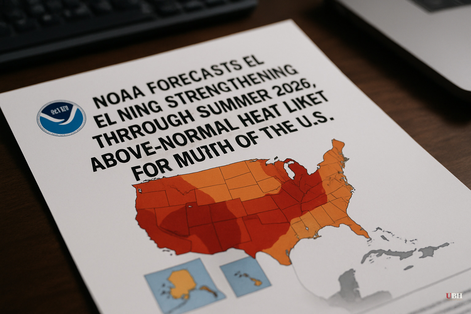
NOAA's Climate Prediction Center released its long-lead seasonal outlook on June 18, 2026, from its College Park, Maryland office. The picture for the rest of summer has come into sharper focus: El Niño is here, it's strengthening, and its fingerprints will be on U.S. weather through at least early autumn.
What NOAA Actually Said
The Climate Prediction Center, part of NOAA's National Weather Service, published its 90-day prognostic discussion on June 18. The most recent weekly sea surface temperature anomaly for the Niño 3.4 region sits at +0.9 degrees Celsius above baseline relative to global tropical sea surface temperatures, confirming weak El Niño conditions are already present.
NOAA places the probability of this El Niño event becoming strong by the July-August-September season at greater than 40 percent. Sea surface temperature anomalies have been climbing across the central and eastern equatorial Pacific in recent weeks, which is the oceanic signature that typically precedes a strengthening event. Most SST forecasts from the North American Multi-Model Ensemble (NMME) and the Copernicus Climate Change Service multi-model ensemble predict that relative Niño 3.4 anomalies will exceed +1.0 degrees C by JAS 2026. The NMME multi-model mean forecast exceeds +2.0 degrees C by the October-November-December 2026 season, and the CPC ENSO Outlook predicts that the likelihood of a very strong event with a peak seasonal relative Niño 3.4 index greater than +2.0 degrees C exceeds 60 percent.
The Temperature Forecast
For the JAS (July-August-September) season, NOAA favors above-normal temperatures across most of Alaska, with the notable exception of parts of the northeastern mainland.
In the Lower 48, the Pacific Northwest carries the highest probabilities of above-normal heat. The Lower Mississippi Valley, Southeast, and Eastern Seaboard are also in the above-normal temperature zone, with the strongest signal running along the coast of New England and elevated probabilities stretching down through Florida. This broad regional pattern matters for power grids, agricultural stress, and wildfire risk in the West.
Precipitation: Winners and Losers
The precipitation picture is more regionally split.
Northwestern mainland Alaska and the Aleutian Islands are favored for above-normal precipitation. Southern Southeast Alaska flips the other way, with below-normal precipitation expected there.
In the Lower 48, NOAA's outlook flags below-normal precipitation for a small area of the Pacific Northwest, parts of the Southern Plains and Lower Mississippi Valley, and the western Great Lakes region. That's a concerning combination layered on top of the above-normal heat signal for the South.
On the wetter side, an expanded area of the West is favored for above-normal precipitation — consistent with El Niño's documented influence on moisture patterns. Coastal areas of the Mid-Atlantic and Northeast are also slightly favored for above-normal precipitation.
Uncertainty and Planning Risk
Some researchers and agricultural economists push back on using seasonal outlooks for near-term planning, arguing that NOAA's 90-day probabilistic forecasts carry meaningful uncertainty, particularly in transition seasons. A forecast favoring above-normal temperatures is NOT a certainty; it means that outcome is more likely than the alternatives, not guaranteed. NOAA's own methodology acknowledges this: the outlook tools used include canonical correlation analysis, optimal climate normals, calibrated dynamical model forecasts, and other statistical models, all of which carry confidence intervals that don't appear in the headline maps.
That caveat is legitimate and worth keeping in mind when state and local emergency planners allocate resources. But the caveat cuts both ways. Dismissing a greater-than-40-percent strong El Niño probability as noise, when the oceanic forcing is already measurable at +0.9°C, would be its own planning error.
NOAA notes that El Niño impacts on North American climate are weaker in summer than in autumn and especially winter seasons. Nevertheless, El Niño events of moderate-to-strong intensity have documented downstream effects on U.S. agriculture, insurance markets, and energy demand. A hotter-than-normal summer across the Southeast and Eastern Seaboard raises peak electricity load projections for utilities already navigating grid strain. Below-normal precipitation across the Southern Plains, on top of existing conditions in parts of the region, adds pressure to summer row-crop producers heading into harvest season.
NOAA's official 90-day outlooks are issued once each month near mid-month. The key variables to watch between now and the next release are whether Niño 3.4 sea surface temperature anomalies continue climbing and whether any of the coupled atmospheric signals — trade wind weakening, convective shifts over the central Pacific — catch up to the oceanic forcing already underway.
Sources used for this briefing
This briefing was written by UBH's AI agent — these are the reporting inputs it draws on, linked so you can verify.


