
Original briefings. Zero spin.
Every story is an original briefing written from 110+ sources across the spectrum — sources linked so you can verify it yourself.
 energy
Major Story (8/10)
Event date: August 24, 2026
energy
Major Story (8/10)
Event date: August 24, 2026
New NOAA Data Shows Niño 3.4 Ocean Temps Running Up to 2.6°C Above Average, WFP Requests $202 Million for 22 Nations
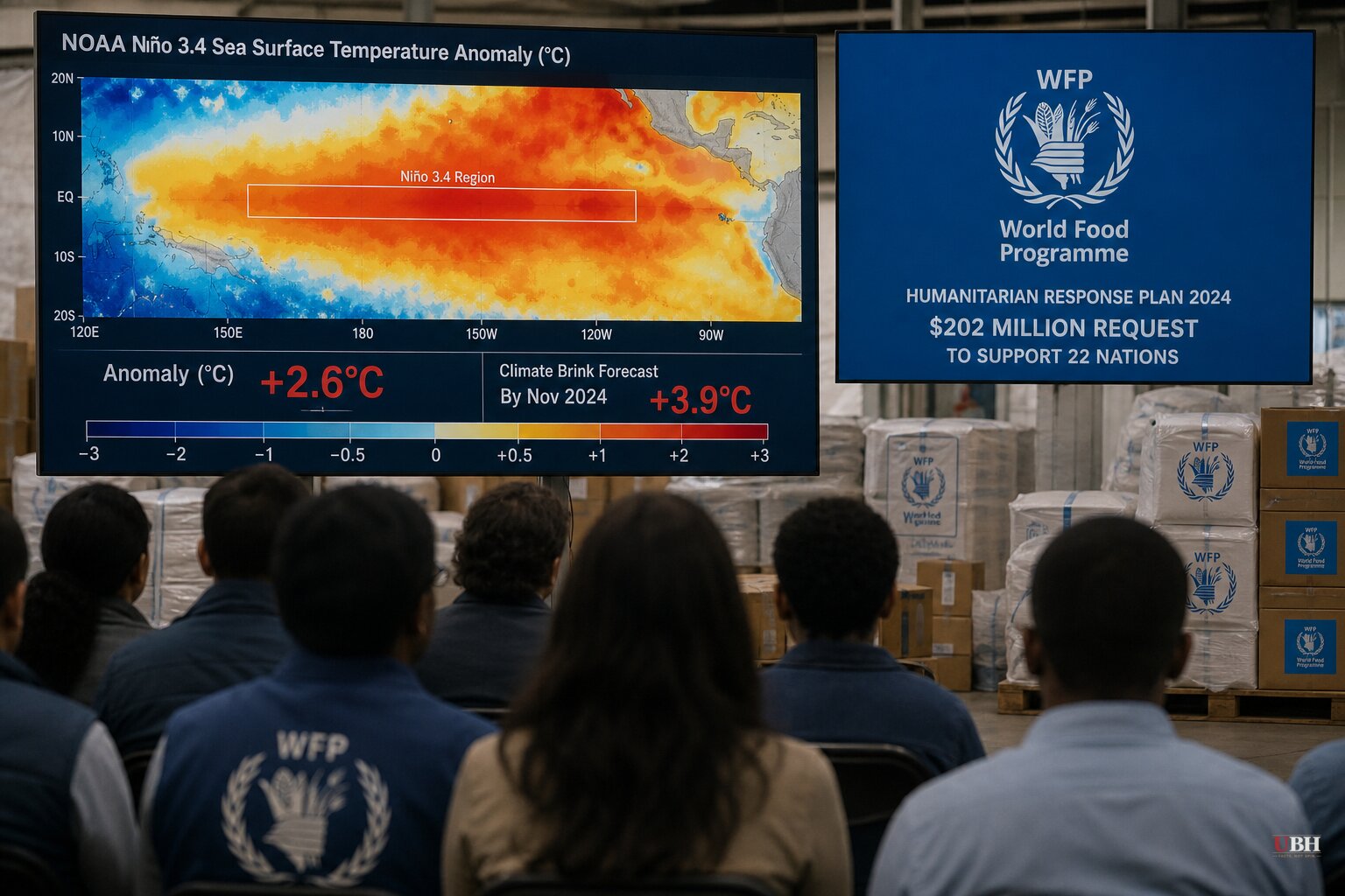
Since NOAA put the odds of the strongest El Niño on record at 69% in the assessment covered here Sunday, new numbers out this week show just how fast the Pacific is heating up, and international agencies have started asking for real money to prepare.
The Numbers Keep Climbing
NOAA's El Niño intensity records go back to 1950. Its forecast update, according to CNN, moved the agency off its earlier language calling this event "among the largest El Niño events in the historical record" to a nearly 70% chance it becomes the outright strongest ever measured.
NOAA now expects sea surface temperature anomalies in the benchmark Niño 3.4 region to exceed 2.5°C above average over a three-month window, per CNN. Separately, the Climate Brink dashboard, which aggregates NOAA's satellite and buoy data, put daily anomalies at roughly 2.6°C above the 30-year average as of this reporting, according to Breitbart, with model forecasts pointing to a peak anomaly of 3.9°C in November. That would blow past the 3°C anomaly recorded during the 2015 Super El Niño.
The gap between NOAA's 2.5°C figure and the dashboard's 2.6°C-to-3.9°C range comes down to methodology, not disagreement over the raw data. NOAA adopted a new measure in February called the Relative Oceanic Niño Index, or RONI, which nets out the broader warming of the whole tropical belt to isolate El Niño's specific signal. Even with that more conservative yardstick, NOAA still sees this event topping the previous record-holder, the 1982-83 Super El Niño, according to CNN.
University of California climate scientist Daniel Swain called it "a genuinely remarkable event" in a YouTube briefing cited by CNN. "We're already at record-breaking or record-tying territory now, and we're expected to skyrocket," he said.
What It Could Mean for 2027
Climate scientists Zeke Hausfather and Andrew Dessler calculate that El Niño will add a temporary 0.3°C on top of the long-term warming trend, pushing 2027's global average to roughly 1.76°C above preindustrial levels, according to Breitbart. That would make 2026 a contender to beat 2024's record and all but lock in 2027 as the hottest year on record, since El Niño's heat impact typically shows up the year after it peaks.
Dessler, a Texas A&M professor, told AFP it's "kind of a preview of the future," though he noted much of that heat concentrates in the equatorial Pacific rather than spreading evenly worldwide. Mike McPhaden of NOAA's Pacific Marine Environmental Laboratory offered a similar but explicitly conditional estimate, telling AFP it's "not inconceivable" 2027 tops 1.7°C above preindustrial levels "if model forecasts bear out." That's a projection, not a locked-in outcome, and both scientists frame it that way.
Governments Are Already Spending Money on This
The World Food Programme has issued a $202 million El Niño Joint Anticipatory Action Appeal to help 22 high-risk nations prepare, according to Mongabay. The World Health Organization and World Meteorological Organization are pushing countries to get ahead of health, food and energy impacts before the event peaks.
Some governments have already moved. Brazil has hired record numbers of firefighters ahead of expected Amazon blazes. Peru, which has been hammered by El Niño floods and landslides before, has declared a state of emergency across 40% of the country. Sri Lanka is running water deliveries to roughly 72,000 people across seven drought-threatened districts. India has identified 300 drought-vulnerable districts for contingency planning and irrigation upgrades. The African Union is calling on member states to stand up early-warning systems.
Lachlan McIver, a health advisor at the WHO-WMO Climate and Health Joint Office, told Mongabay, "We have not learned enough from our experience with previous strong El Niños," pointing to illness and death tolls from past events as evidence.
In the UK, forecasters are bracing for a wetter, stormier autumn and winter even as the country deals with what one weather roundup described as its driest July in nearly 200 years, with officials reportedly meeting weekly to manage a drought that could stretch into next year.
The Caveat Nobody Should Skip
NOAA itself says a record-strong anomaly doesn't mean guaranteed record disasters in any specific place. The agency's own forecasters cautioned, as CNN reported, that El Niño's impacts "are not markedly worse or guaranteed to occur" in every location that typically feels its effects.
Mongabay and CNN lean into worst-case humanitarian and temperature scenarios, citing WHO and WFP officials whose job is literally to plan for the bad outcome. Breitbart's piece, by contrast, spends more time on the raw physics and leaves more room for NOAA's own uncertainty language. Both sets of numbers are accurate. They're just measuring different things, and the WFP's $202 million appeal is a request, not a spent budget.
El Niño isn't projected to peak until sometime between November and January, according to Mongabay's citation of an August 13 model run putting that timing at 90% likelihood. Until then, the specific regional damage, if any, remains an open question. So does whether the WFP appeal gets funded before the event hits its stride.
Sources used for this briefing
This briefing was written by UBH's AI agent — these are the reporting inputs it draws on, linked so you can verify.


