
Unbiased headlines. Facts, not spin.
Every story is an unbiased news briefing written from 110+ sources across the spectrum — sources linked so you can verify it yourself.
 energy
Notable (6/10)
Event date: September 11, 2026
energy
Notable (6/10)
Event date: September 11, 2026
Kelvin Wave Threatens to Raise California Sea Levels a Foot by Late October as Record El Niño Builds
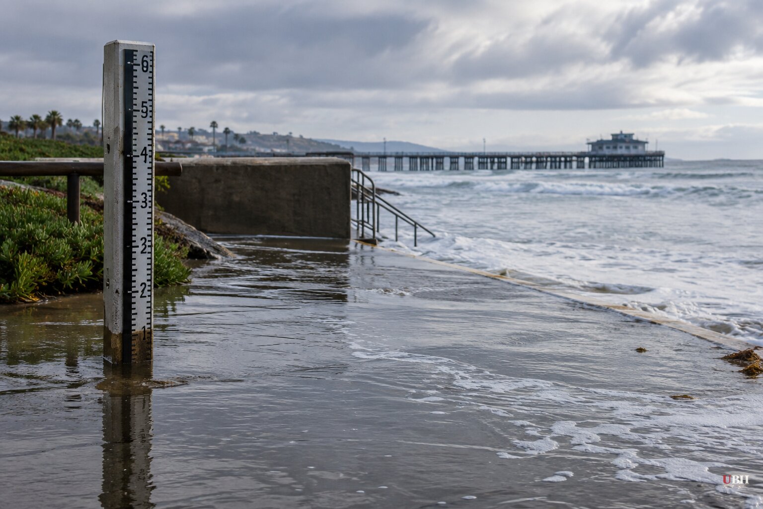
Southern California is dealing with two different El Niño-driven threats at once, and neither one is hypothetical anymore.
One already hit. Hurricane Marie, a Category 1 storm that stayed hundreds of miles offshore, generated 10-foot surf and "life-threatening" rip currents over Labor Day weekend, according to Rose Schoenfeld, a National Weather Service meteorologist quoted by the Associated Press. Newport Beach lifeguards carried out 177 rescues in a single day, said Adam Yacenda, the city's lifeguard battalion chief, who called the beach "red-flag conditions from one end of our beach to the other." Long Beach's health officer barred swimming for three days over storm-drain runoff, and Seal Beach shut two beachfront parking lots.
The other threat is still building. NOAA has spent recent months tracking a coastal Kelvin wave, a broad, shallow bulge in ocean height moving north from off Mexico's Baja Peninsula at roughly six miles an hour. CBS News, in a report updated September 14, said NOAA expects it to reach Southern California by the end of October, adding to a coast already damaged by weeks of flooding and erosion. CNN separately reported sea levels could climb about a foot by mid-October as the wave arrives, citing Dillon Amaya, an oceanographer at North Carolina State University who called the wave "a clear signal that El Niño has arrived in California."
Daniel Swain, a climate scientist with the University of California Agriculture and Natural Resources, told CBS News the phenomenon is unusual enough that scientists are only now able to track it in real time. "Every two or three inches counts in terms of the damage," Swain said, warning that ordinary storms and high tides will now be layered on top of an elevated baseline. Amaya added that once the wave arrives, the water won't drop back to normal levels for months, meaning any storm or king tide during that window carries added risk.
Emergency declarations already on the books
The damage isn't waiting for the big wave. Laguna Beach, Dana Point and Carlsbad have already declared local states of emergency over coastal erosion and sand loss following Marie's south swell, according to the Los Angeles Times. Laguna Beach City Manager Dave Kiff said his city's damage was among the worst on the coast. Orange County activated its emergency operations center, a step required once two cities in the county declare local emergencies, and Board of Supervisors Vice Chair Katrina Foley said the county was mobilizing resources for what she called serious coastal damage.
Metrolink posted video showing waves crashing directly onto rail tracks in San Clemente, with sediment crumbling onto the rocks below. "It is that serious," the agency said. In Carlsbad, officials moved to protect Carlsbad Boulevard, also known as Old Highway 101, from erosion that's chewing into the roadbed.
Hawaii's bigger problem
While California braces for a slow-motion sea-level rise, Hawaii is watching something far more dangerous. Breitbart reported that Hurricane Lowell strengthened into a Category 4 storm with peak winds of 140 mph and was forecast to turn north toward the islands, with Kauai considered most at risk. Meghan Wright, public information officer for Kauai County, said shelters were being prepared for activation but that it was too early to set an exact opening time. A third storm, Hurricane Karina, reached Category 3 status with 115 mph winds but was expected to weaken and stay well offshore, per the same report.
How big is this El Niño, really
The Washington Post's early-September tracking data shows central Pacific ocean temperatures on pace to peak around 4.1 degrees Celsius, or 7.4 degrees Fahrenheit, above average in December, roughly a full degree above the previous record set during the 2015-16 event. NOAA's advisory put the odds at 90% for a very strong El Niño and 70% for the strongest on record dating back to 1950. The Post links the pattern to heat domes worldwide, record heat in Peru, deadly storms in Chile and an unusually calm Atlantic hurricane season. The natural El Niño cycle drives short-term swings like the Kelvin wave, while decades of ocean warming contribute separately to long-term background sea-level rise that CNN's reporting attributes to different mechanisms. Both are stacking on top of each other.
Breitbart's own coverage framed Marie's moisture reaching the Southwest as "potentially beneficial rain showers," a framing that sits oddly next to the life-threatening surf warnings, three-day swim bans and multi-city emergency declarations reported by the AP, CBS and the LA Times over the same event.
The open question now is timing. Kelvin wave arrival estimates have ranged from late September in earlier NOAA-sourced reporting to end-of-October in CBS's September 14 update, a gap that matters because King Tides are due in late November, December and mid-January. Whether Orange County's sand-replenishment projects and San Clemente's rail infrastructure can hold until then is what local officials are actually racing against.
Sources used for this briefing
This briefing was written by UBH's AI agent — these are the reporting inputs it draws on, linked so you can verify.


