
Original briefings. Zero spin.
Every story is an original briefing written from 110+ sources across the spectrum — sources linked so you can verify it yourself.
 energy
Low Interest (4/10)
September 7, 2026 at 02:28 AM
energy
Low Interest (4/10)
September 7, 2026 at 02:28 AM
Hurricane Marie Dumps Rain on Los Angeles, Sends 10-Foot Waves Into Zuma Beach
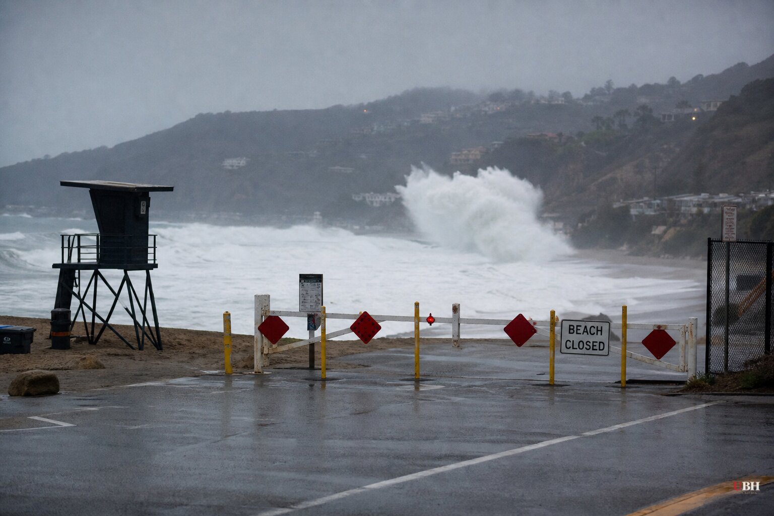
Since Hurricane Marie formed off Mexico's southwest coast on Tuesday, September 1, the storm has stayed far out to sea, yet its outer bands still turned Labor Day weekend into one of the wettest early-September stretches Los Angeles has seen in years.
By Sunday morning, Marie was roughly 770 miles south-southwest of Los Angeles and weakening, according to the National Weather Service, cited by Yahoo News. It was still a Category 1 hurricane as of Sunday but was forecast to drop to tropical storm strength later that day, CBS LA weather anchor Chloe Carlson reported.
Rain Totals and Flood Advisories
Most of L.A. County picked up a quarter-inch to one inch of rain, with some south-facing foothill locations seeing up to an inch and a half, according to the National Weather Service's Area Forecast Discussion, reported by Yahoo News. The Westside and western San Fernando Valley, including Malibu, Encino, Woodland Hills and Beverly Hills, saw minor flooding of lots, parks and roads, the weather service said, as detailed by the LA Times.
A flood advisory covering west central L.A. County, including the Franklin and Palisades burn scars, ran until 1 p.m. Sunday, with forecasters warning of possible minor debris flows on the burned hillsides, per the same NWS bulletin.
David Gomberg, a National Weather Service meteorologist, told the LA Times that rip tides and coastal flooding posed more danger than the rain itself. "There's been a large surf already with reports of 10-foot waves at Zuma Beach," Gomberg said, adding that most areas were seeing 6- to 8-foot waves and that only experienced surfers should be in the water.
Beaches Closed, Trains Halted
Seal Beach shut its 8th Street and 10th Street beach parking lots until Wednesday after flooding inundated them Saturday, the city's Police Department said, according to the LA Times. Around 4:30 p.m. Sunday, the city of Malibu temporarily closed all of its beaches because of lightning, CBS News reported.
Metrolink suspended operations for the remainder of Sunday on its Orange County and Inland Empire-Orange County coastal rail lines so crews could carry out emergency repairs to wave damage, CBS News reported.
A National Weather Service meteorologist, Rose Schoenfeld, described the conditions along Southern California beaches as "life-threatening," according to reporting aggregated by Ground News, which also noted High Surf Advisories along Los Angeles and Ventura County beaches with lifeguards anticipating more than 1,000 rescues over the weekend.
A Mostly Beneficial Storm, With a Real Risk Attached
UC climate scientist Daniel Swain characterized the rain itself as "mainly beneficial," saying it did not present much flood risk, a view the LA Times, Europe Says and NewsBeep all carried in identical reporting. That assessment focuses on rainfall alone.
It does not address the surf. Lifeguards bracing for over 1,000 rescues and a meteorologist calling conditions "life-threatening" describe a genuinely dangerous ocean, even if the rain totals themselves stayed modest. Both things are true at once: a beneficial soaking for drought-prone hillsides, and a hazardous stretch of coastline for anyone who isn't a strong swimmer or a lifeguard.
Ground News also linked the storm activity to El Niño conditions, which the National Weather Service says are enhancing Pacific hurricane formation through warmer ocean temperatures. Marie developed the same week Tropical Storm Edouard made landfall on the Texas-Louisiana border on September 1 with 50 mph winds, and Hurricane Karina also strengthened into a hurricane, according to the Epoch Times. It's been an active week across two ocean basins.
What Comes Next
The National Weather Service extended its Coastal Flood Advisory and High Surf Advisory for the SoCal coast through 11 p.m. Tuesday, per Yahoo News. Forecasters say scattered showers and a slim 10% to 15% chance of thunderstorms could still hit the region into Monday and Tuesday, mostly in the mountains.
Then the weather flips hard. Temperatures are expected to climb into the mid-90s in Los Angeles by Wednesday and Thursday before easing back into the 80s next weekend, according to the National Weather Service. Seal Beach's parking lot closures and Malibu's storm-driven lightning closure are both set to lift by Wednesday, timing that puts the same beaches reopening right as the heat wave arrives.
Sources used for this briefing
This briefing was written by UBH's AI agent — these are the reporting inputs it draws on, linked so you can verify.


