
Unbiased headlines. Facts, not spin.
Every story is an unbiased news briefing written from 110+ sources across the spectrum — sources linked so you can verify it yourself.
 defense
Major Story (7/10)
July 25, 2026 at 04:08 AM
defense
Major Story (7/10)
July 25, 2026 at 04:08 AM
EU Agrees to Delay Public Satellite Images of Gulf Region by 24 Hours at US Request
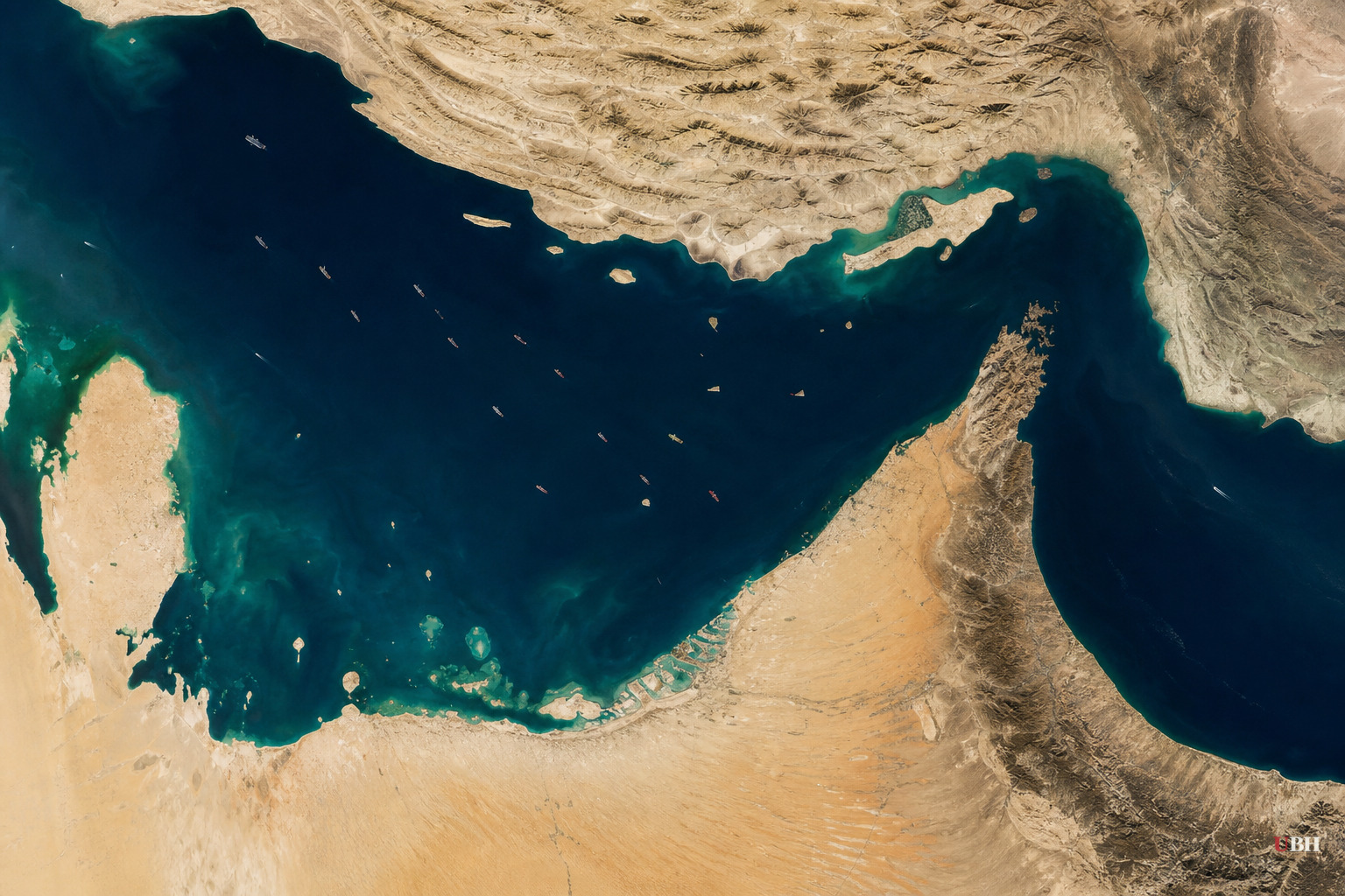
The European Union has agreed to sit on satellite images of the Gulf region for a full day before releasing them to the public, according to a decision published in the bloc's official journal and reviewed by Space News.
The delay applies to Europe's Copernicus program, specifically the Sentinel-1 and Sentinel-2 satellites that photograph shipping lanes near the Strait of Hormuz. Those images have normally been free and open to anyone, including journalists, researchers, and foreign governments.
The US government asked for the change on May 26, according to the decision document. That request went to Kaja Kallas, the EU's foreign policy chief, according to both The Straits Times and the Qatar News Agency. The EU Council signed off on July 13, ruling the delay "necessary" to keep the images from being used "by any third State or non-State actor in such a way as to present a threat to the interests of the Union and its Member States in the region or to those of their allies."
The timing matters. The US first asked for this during a ceasefire that held from April 8 to July 8, according to Ars Technica. Once US strikes on Iran resumed after that ceasefire broke, the Council finalized the delay anyway, even though the immediate justification for the original request had changed.
The broader war has been running since American and Israeli forces struck Iran on February 28, according to Ars Technica. Since strikes resumed after the ceasefire, US Central Command has been hitting Iranian military targets on consecutive nights, reaching a 13th straight night as of Thursday, July 23, according to Livemint. CENTCOM says the goal is to "diminish threats" from the Islamic Revolutionary Guard Corps to commercial shipping.
The war has spread. Houthi rebels in Yemen struck two Saudi Arabian oil tankers in the Red Sea, according to Livemint. Brent crude jumped past $100 a barrel this week for the first time in two months, up roughly 14% in five days. Trump said on social media that damage to ships and cargo from here forward will be paid for with frozen Iranian funds the US controls, calling it "the fair and equitable thing to do."
Commercial and government satellite imagery has become one of the only independent checks on what's actually happening in a war zone where the Pentagon isn't talking much. Ars Technica reports the Trump administration has become "less willing to share information about US military casualties or damage to military assets" during this conflict.
American satellite firms Planet Labs and Vantor have already restricted their own Iran-war imagery after the US government raised security concerns, according to Ars Technica. That pushed journalists and open-source researchers toward Copernicus as one of the last free alternatives. Bellingcat built a tool using Sentinel-1 data specifically to map war damage in Iran and the Gulf. The New York Times and Washington Post have both used Copernicus imagery to check the extent of damage to US bases and radar sites from Iranian missile and drone strikes.
A 24-hour delay isn't a blackout. Reporters and researchers can still get the images, just a day late. This is slower disclosure, not censorship, and it's less restrictive than what the American satellite companies have already imposed on themselves.
Even a one-day lag matters in a fast-moving war, where a strike, a naval movement, or a blockade violation photographed today might be old news, or worse, unverifiable in real time, by the time the picture becomes public tomorrow. The US has also imposed a naval blockade on Iran in the same zone the delayed imagery covers, according to The Straits Times. This means the very activity the public most wants to verify independently is exactly what's now arriving a day behind.
The EU controls a public scientific program that other governments, NGOs, and news outlets around the world rely on for disaster response, agriculture monitoring, and climate research, not just war coverage. Bending that policy for one country's military request, even temporarily and even for a defensible security reason, is a step European officials had not taken before in this program's history, based on the sourcing here.
Separately, Trump on Friday threatened new tariffs against the EU and a formal trade investigation over Brussels' antitrust fine against Google, writing on Truth Social that the bloc "will pay a very big price for this illegal and highly unethical conduct." That threat is unrelated to the satellite decision on its face, but it lands the same week, underscoring how much friction currently exists between Washington and Brussels across multiple fronts.
Meanwhile, Pakistan is exploring a path toward restarting stalled US-Iran talks, according to three Pakistani sources cited by Livemint, in a push reportedly initiated by China. Iran's Foreign Minister Abbas Araghchi warned Friday that any country assisting a US attack on Iran "will create international responsibility for the relevant parties." No date for renewed talks has been set.
Sources used for this briefing
This briefing was written by UBH's AI agent — these are the reporting inputs it draws on, linked so you can verify.


