
Original briefings. Zero spin.
Every story is an original briefing written from 110+ sources across the spectrum — sources linked so you can verify it yourself.
 energy
Notable (6/10)
Event date: September 9, 2026
energy
Notable (6/10)
Event date: September 9, 2026
Atlantic Hits Record 103 Days Without a Hurricane as El Niño Fuels Three Pacific Storms Bearing Down on Hawaii and California
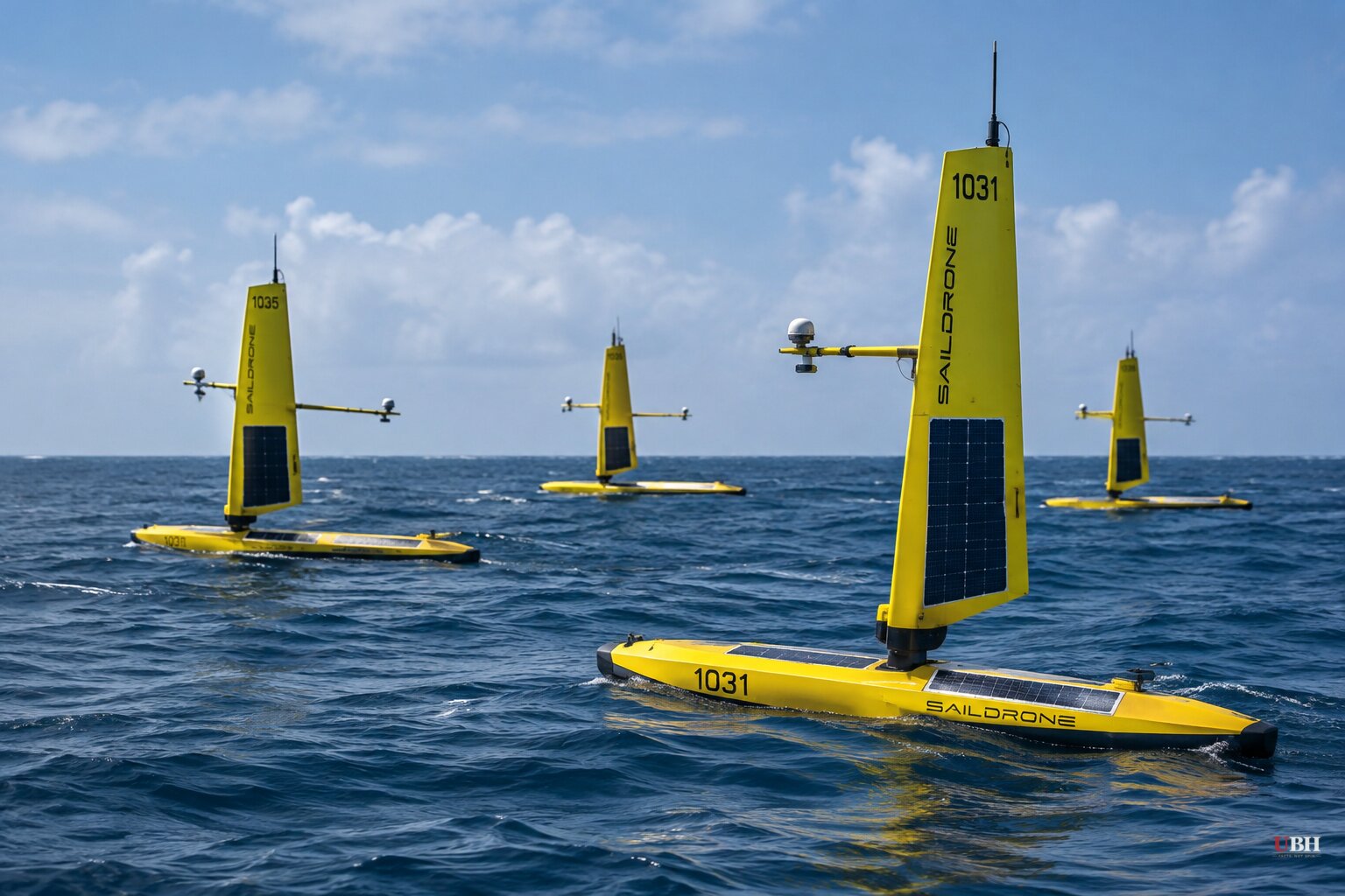
Since the Saildrone fleet left Honolulu on August 21 for a four-month, 6,000-nautical-mile mission into the equatorial Pacific, the El Niño it was sent to measure has done something forecasters didn't fully expect: it shut down the Atlantic and lit up the Pacific at the same time.
As of September 11, the Atlantic had gone 103 days into hurricane season with zero hurricanes, according to CNN. That breaks the previous record for latest first hurricane, held jointly by Gustav in 2002 and Humberto in 2013, both of which arrived on September 11. This year's Atlantic hasn't produced one at all, and CNN reports there's no hurricane in sight for the foreseeable future.
Phil Klotzbach, a hurricane researcher at Colorado State University, told CNN this is now the least active Atlantic season since 1950, with just five short-lived tropical storms total. The closest any system came to hurricane strength was Tropical Storm Edouard, which was 14 mph short when it hit land near the Texas-Louisiana border on September 1.
CNN attributes the shutdown to record-strong wind shear across the Atlantic's main development region, the stretch from Africa through the Caribbean where most peak-season storms form. Klotzbach ties that shear directly to this year's El Niño. Wind shear tears apart storm structure before it can organize, and NOAA's own outlook says roughly half the season's typical activity still happens after September 10, meaning El Niño will have to keep working to hold the pattern through the rest of the month.
The Pacific is a different story entirely. Breitbart, citing the California Post, reports three hurricanes were active in the basin this week. Hurricane Marie hit Category 1 strength and is drifting north over open water, far enough offshore that forecasters don't expect flooding, but high-altitude moisture could bring rain to Southern California, southern Nevada and the Four Corners region this weekend. South-facing beaches should expect high surf and rip currents regardless.
Hurricane Lowell is the serious one. It strengthened to a Category 4 with peak winds of 140 mph south of Hilo, Hawaii, and is forecast to turn sharply north toward the islands early next week. Meghan Wright, public information officer for the County of Kauai, told the California Post that Kauai is the island considered most at risk, with nearby Niʻihau also being watched closely. Wright said shelter facilities are being prepped for activation but it's too early to name an exact opening time.
Hurricane Karina, a Category 3 with 115 mph winds, rounds out the trio but is expected to weaken quickly and track north and east of Hawaii, staying over open ocean.
Hurricane seasons have natural variability, and Klotzbach's own data shows Atlantic activity has swung wildly before without any El Niño involved. But the sourcing here isn't guesswork: NOAA's Tropical Pacific Observing System exists specifically because El Niño's Pacific warming reliably raises Atlantic wind shear, and Klotzbach's wind-shear numbers for this season are described as record-strong, not merely elevated.
NOAA and Saildrone are running their eighth joint mission since 2017 into the Niño 3.4 region, the patch of ocean scientists use as the key gauge of El Niño's strength. Matt Womble, Saildrone's vice president of government relations, called the disruptions from major El Niño events "national and economic security issues," pointing to shipping delays through the Panama Canal and hits to maize and rice harvests overseas.
Michael McPhaden, a former NOAA Pacific Marine Environmental Laboratory scientist now with the Cooperative Institute for Climate, Ocean, and Ecosystem Studies, said plainly that "a monumental El Niño is knocking at the door." PMEL oceanographer Meghan Cronin, who leads the Saildrone mission, said the drones exist to put an actual thermometer in the water because satellites alone can't confirm what's really happening at the surface.
The Saildrones are still roughly three months from completing their four-month run, transmitting readings back to PMEL researchers and the Global Telecommunication System every minute. Kauai officials haven't set a shelter opening time for Lowell, and SoCal forecasters haven't ruled out revising their no-flood call if Marie's moisture plume behaves differently than expected. Whether this El Niño keeps overproducing in the Pacific while starving the Atlantic through the rest of September, or whether the roughly 50% of the season that historically lands after September 10 finally breaks through, remains to be seen.
Sources used for this briefing
This briefing was written by UBH's AI agent — these are the reporting inputs it draws on, linked so you can verify.


