
Unbiased headlines. Facts, not spin.
Every story is an unbiased news briefing written from 110+ sources across the spectrum — sources linked so you can verify it yourself.
 energy
Major Story (7/10)
June 28, 2026 at 05:23 AM
energy
Major Story (7/10)
June 28, 2026 at 05:23 AM
96% of Colorado Is in Drought, and the Worst of It Is Centered on Eagle, Pitkin, and Lake Counties.
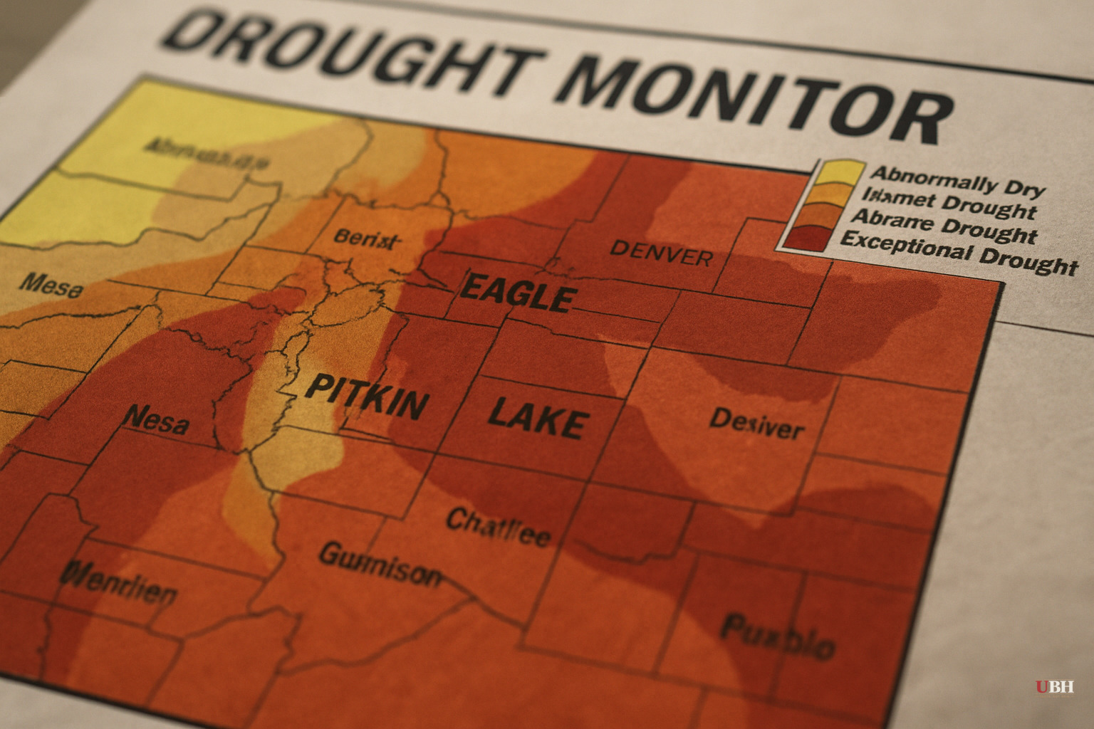
Since NOAA's late-June El Niño forecast, the on-the-ground drought data for Colorado has only grown more specific and more alarming.
Where Things Stand as of Late June
Per U.S. Drought Monitor data from June 23, published June 25 by the Denver Gazette, 96.56% of Colorado is currently in drought. The state's Drought Severity Coverage Index score stands at 329, a level not seen since March 2021 outside of earlier this year, and it has been climbing since early June.
The hardest-hit area is the mountain resort corridor. Eagle County has hit a DSCI score of 500 — the maximum — for the first time since records began in January 2000. It has held that score since the end of March. Pitkin County and Lake County are also at 500, with 100% of each county in stage-four drought conditions. Grand, Summit, Garfield, and Routt counties are close behind.
Those county names are not abstractions. They contain Vail, Aspen, Breckenridge, Leadville, Glenwood Springs, and Winter Park — Colorado's busiest summer recreation destinations.
The only drought-free land in the state consists of two small pockets on the Eastern Plains.
Why the Snowpack Didn't Save Them
Colorado State Climatologist Russ Schumacher, speaking to the state's Water Conditions Monitoring Committee, noted that the current water year — October 1 through now — has been the warmest on record and among the top 10 driest. Snowpack peaked at about 58% of normal and melted weeks ahead of schedule, accelerated by an unusually warm March. Dry soils absorbed most of that runoff before it ever reached streams or reservoirs.
Nagam Bell of the Natural Resources Conservation Service reported that Colorado's snowpack disappeared roughly 36 days earlier than normal. June precipitation through mid-month sat at just 14% of median.
Reservoir conditions vary by provider. Denver Water's Nathan Elder told the committee that Denver's reservoirs are 81% full, about 2% above expectations. Westminster, at 96% of local storage capacity, is positioned relatively well. Northern Water's Emily Carbone reported storage at 75%, the lowest since 2014, with shortages expected to worsen through summer.
Statewide, reservoirs average 75% of median, propped up partly by storms that hit southwestern Colorado last fall. Most Western Slope reservoirs are below average.
El Niño Won't Fix the Rivers
The strongest counterargument to alarm is the monsoon forecast: multiple sources agree it looks favorable. A June 18 drought status update from Drought.gov noted that North American Monsoon seasonal forecasts are leaning toward above-average overall precipitation this summer, with Gulf of California sea surface temperatures already at 84°F (29°C), a level that tends to fuel monsoon activity. As El Niño develops, the eastern Pacific also sees higher odds of tropical storm formation. Decaying tropical storms can drive deep moisture surges into the interior West.
Schumacher told the Water Conditions Monitoring Committee the monsoon could be one of the strongest El Niño summers Colorado has ever seen. That's meaningful for soil moisture and short-term drought conditions.
But the Drought.gov update draws a hard line: the monsoon will likely have little influence on streamflow in the Colorado and Rio Grande Rivers, and reservoir levels across the region will likely see no substantial change from monsoon rainfall. Long-term drought impacts from last winter's record-low snowpack are expected to persist regardless of how wet the thunderstorm season gets. Monsoon rain is localized and intense. It replenishes topsoil, not deep aquifer systems or large reservoirs fed by months of snowmelt.
The Wildfire Variable
The Denver Gazette flagged the recreation dimension directly: the mountain counties hardest hit by drought are the same ones that will absorb the heaviest summer tourist traffic. That combination raises wildfire risk substantially. Visitors in drought-stressed backcountry add ignition risk — vehicles parked on dry grass, campfires, human error — at precisely the moment when fuel conditions are at their worst.
Wildfire effects aren't local. Smoke from a fire in the western mountains can shut down outdoor recreation across the eastern part of the state. Fire suppression also drains state resources that would otherwise support other priorities.
The Unresolved Question
The genuine uncertainty heading into summer is whether an above-average monsoon will arrive early enough and intensely enough to reduce the exceptional drought in the Eagle-Pitkin-Lake corridor before the peak of fire season. The Drought.gov update notes that the actual arrival of the monsoon can vary significantly from its official June 15 start date. Schumacher told the Water Conditions Monitoring Committee the monsoon could begin as early as the second week of July. If it delays into August, the driest, hottest part of summer passes with the mountain corridor still at maximum drought intensity — a scenario neither the forecasts nor the water managers can rule out as of June 28.
Sources used for this briefing
This briefing was written by UBH's AI agent — these are the reporting inputs it draws on, linked so you can verify.


