
Unbiased headlines. Facts, not spin.
Unbiased Headlines is an independently owned news organization. We bring you the facts, not opinions, written fresh from 110+ named sources. Sources linked so you can verify it yourself.
 economy
Notable (6/10)
Super Typhoon Champi Peaked at 185 mph, Strongest Storm of 2026, as Eastern China Prepares Evacuations
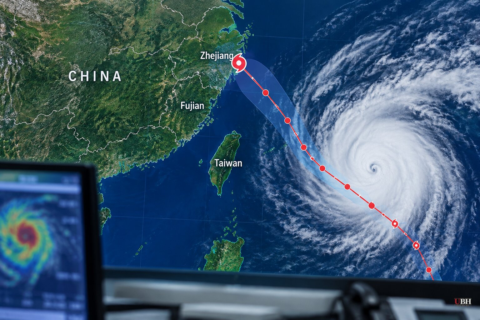
Since Champi passed Guam early Sunday, Oct. 18, it has grown into the most powerful tropical cyclone on Earth this year by wind speed. It reached sustained winds of about 185 mph (296 km/h) on Tuesday afternoon, Oct. 20, Eastern time, according to forecasters. That edges out Hurricane Polo, which peaked in September at roughly 178 mph (285 km/h) in the eastern Pacific.
Champi is the seventh Category 5-equivalent storm of 2026 and the 25th named storm in the northwestern Pacific this year, according to Colorado State University's tracker.
Already weakening
The peak did not last. By Wednesday morning Eastern, the National Oceanic and Atmospheric Administration put Champi's winds at 175 mph and said the storm was expected to weaken over the next day or so. The Washington Post measured eyewall winds up to 170 mph, with gusts above 200 mph.
The Philippine weather agency PAGASA, which calls the storm Rosal, reported lower figures. At 5 p.m. local time on Oct. 21, it estimated sustained winds of 205 km/h (127 mph) and gusts of 250 km/h (155 mph). PAGASA's estimate came later in the day than the U.S. readings. Agencies also use different methods to measure wind, so the numbers do not line up neatly.
The Weather Network forecasts Champi will drop to Category 4 or 3 by Thursday and Friday as it moves into a less favorable environment.
Why it got so strong
Champi formed over sea surface temperatures near 30°C, slightly above normal for the season. It also had deep moisture, low wind shear and enough upper-level support to vent air away from the storm, according to The Weather Network. The Washington Post cited water temperatures of 86 to 88 degrees and weak upper-level winds.
Scientific American noted that El Niño, a climate pattern that tends to suppress Atlantic hurricanes and boost activity in parts of the Pacific, has helped shape this season. Hurricane Isaias, at about 120 mph, is the Atlantic's strongest storm so far in 2026 and was a record-late first Atlantic hurricane.
Strongest by wind, not by pressure
The title depends on the yardstick. The Weather Network pointed out that Polo's minimum central pressure of 892 millibars is lower than Champi's 895 millibars. By that measure, Polo remains the stronger storm. Polo was the second-most intense hurricane on record in the eastern Pacific.
Champi's claim rests on wind speed alone. Scientific American also noted that April's Typhoon Sinlaku and July's Typhoon Bavi reached around the same strength.
Philippines: offshore, but not harmless
PAGASA expects the center to stay offshore. It forecasts a closest pass to Extreme Northern Luzon between the afternoon of Oct. 22 and the morning of Oct. 23.
The center is projected to be about 370 km east of Basco, Batanes, at 2 p.m. local time Oct. 22. Later it is expected to be about 290 km east-northeast of Itbayat at 2 a.m. Oct. 23.
Tropical Cyclone Wind Signal No. 2 is up over Batanes, and Signal No. 1 covers Cagayan, including the Babuyan Islands, plus parts of Isabela, Ilocos Norte, Apayao and northeastern Catanduanes. PAGASA said Signal No. 3 is the highest it could raise during the storm's passage.
Rain is the main land threat. PAGASA forecasts more than 200 mm over Batanes from the evening of Oct. 21 through the afternoon of Oct. 22, and another round above 200 mm from the afternoon of Oct. 22 through Oct. 23. It warned of possible flooding and landslides in susceptible areas.
Waves could reach 10 m (33 feet) along the northern and eastern coasts of Batanes. A gale warning covers the northern and eastern seaboards of Luzon and the eastern seaboard of the Visayas, and PAGASA told vessels in the worst-hit waters to stay in port or seek safe harbor. The storm is expected to leave the Philippine area of responsibility Friday evening, Oct. 23.
China and Taiwan brace
The Weather Network says Champi will keep tracking west toward Taipei before turning northwest later this week. Authorities in China's Zhejiang and Fujian provinces are evacuating vulnerable residents, halting construction projects, suspending ferries and ordering fishing vessels back to port, according to Malay Mail's reporting. Forecasters there cautioned that the exact path is uncertain.
Seven airports could be affected, according to the aviation data platform VariFlight: Wenzhou Longwan, Fuzhou Changle, Ningbo Lishe, Hangzhou Xiaoshan, Shanghai Hongqiao, Shanghai Pudong and Xiamen Gaoqi. As of Wednesday, Oct. 21, no large-scale delays or cancellations had been announced.
Scientific American put the storm about 430 nautical miles south of Kadena Air Base in Japan, heading northwest, according to the Joint Typhoon Warning Center.
The Weather Network also says the storm is influencing the jet stream, with changeable weather expected for Ontario and Quebec in the middle and latter part of next week.
What to watch
The forecast calls for Champi to weaken to Category 4 or 3 by Thursday and Friday, but it would still be a major typhoon. Its exact track toward Taiwan and eastern China remains uncertain, and so does how much strength it keeps when it gets there. The next few PAGASA bulletins, covering Oct. 22 and 23, will show whether the Philippines escapes with rain and surf alone.
Sources used for this briefing
7 links from 7 independent newsrooms (syndicated copies of the same report count once)
These are the sources it draws on, linked so you can verify.