
Unbiased headlines. Facts, not spin.
Every story is an unbiased news briefing written from 110+ sources across the spectrum — sources linked so you can verify it yourself.
 economy
Notable (5/10)
July 16, 2026 at 10:23 PM
economy
Notable (5/10)
July 16, 2026 at 10:23 PM
Rare Atlantic Niña Plus Super El Niño Could Cut Hurricane Landfalls in Half This Season
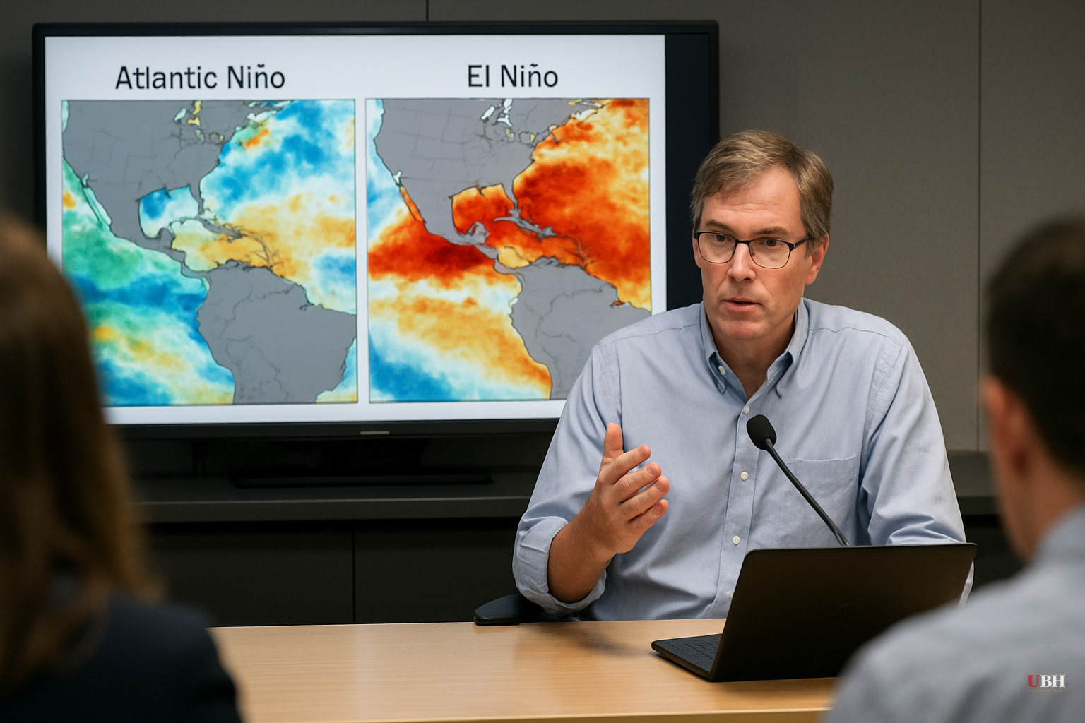
Two Oceans, One Unusual Setup
As of Thursday, July 16, 2026, forecasters are tracking an unusual combination of ocean conditions that could mean a quieter-than-normal Atlantic hurricane season. Data cited from Colorado State University's tropical monitoring team shows Accumulated Cyclone Energy (ACE) projections running well below historical averages.
The driver is a rare cooling pattern in the tropical Atlantic known as an Atlantic Niña. Strong trade winds moving across the equator are churning up colder water from the deep ocean in a process called upwelling, according to the Colorado State University analysis. If ocean temperatures drop slightly further, this would become just the sixth documented summer Atlantic Niña in more than 40 years of record-keeping.
Cold ocean water matters because hurricanes run on warm, rising, moist air. When the surface cools, the air above it sinks instead of rising, which starves developing storms of the fuel they need to organize, per the Colorado State University data.
The Pacific's Opposite Move
At the same time, the Pacific Ocean is running hot. Forecasters describe a "Super El Niño" pushing Pacific sea surface temperatures 3 to 4 degrees above normal, according to the Colorado State University tropical team.
That sounds like it should spell trouble, but a supercharged Pacific El Niño actually works in the Atlantic's favor for hurricane suppression. It alters global jet stream patterns and generates strong wind shear across the Atlantic basin, effectively tearing apart storms before they can strengthen, the analysis states.
Put the two together—a fuel-starved Atlantic and a wind-shearing Pacific—and you get what amounts to a natural barrier limiting tropical storm development from Texas up through Nova Scotia and Newfoundland, according to the same reporting.
What History Says, and What It Doesn't
The number to watch: during past cold-Atlantic phases similar to this one, the total count of tropical cyclones and coastal landfalls has historically dropped by around 50%, according to the Colorado State University data referenced in this coverage.
But that's a statistical tendency based on past seasons, not a guarantee for 2026. Ocean-atmosphere interactions are complicated, and a single storm that does form and find a weak spot in the shield can still do enormous damage to a coastal community, regardless of how quiet the broader season turns out to be.
The 1992 season, suppressed by El Niño and quiet by most measures, still delivered Hurricane Andrew, a Category 5 storm that flattened parts of the coast. A 50% reduction in overall activity doesn't mean a 50% reduction in risk to any one coastal county.
Coverage Gaps Worth Noting
The reporting on this atmospheric pattern, drawn largely from Colorado State University's tropical forecasting team, focuses heavily on the mechanics of why storms are being suppressed. What's largely absent from the available coverage is any comment from the National Hurricane Center or NOAA on how this seasonal outlook compares to their official 2026 forecast, or whether either agency is advising coastal residents to adjust preparedness plans as a result.
No emergency management agency is quoted recommending residents scale back hurricane prep based on this pattern. That absence matters. A below-average season forecast is not the same thing as an official all-clear, and nothing in the available reporting suggests FEMA, NOAA, or state emergency officials in Texas, Florida, or the Carolinas have changed their standard guidance.
What Happens Next
Whether this pattern holds depends on whether Atlantic sea surface temperatures continue cooling toward the Atlantic Niña threshold and whether the Super El Niño's wind shear effect persists. The tropical Atlantic's Main Development Region — the stretch of ocean between Africa and the Caribbean where most of the basin's most destructive, long-track hurricanes are born — is, per the Colorado State University analysis, "practically closed for business" right now.
Coastal residents from the Gulf Coast to the Canadian Maritimes will find out in the months ahead whether the atmospheric setup described here actually holds, or whether, as happened with Andrew in 1992, a quiet season still produces the one storm nobody was ready for.
Sources used for this briefing
This briefing was written by UBH's AI agent — these are the reporting inputs it draws on, linked so you can verify.


