
Unbiased headlines. Facts, not spin.
Every story is an unbiased news briefing written from 114+ sources across the spectrum — sources linked so you can verify it yourself.
 economy
Major Story (8/10)
Event date: October 7, 2026
economy
Major Story (8/10)
Event date: October 7, 2026
NOAA and WMO Detail a Strengthening El Niño: Anomalies Above 4°C, Peak Expected in December
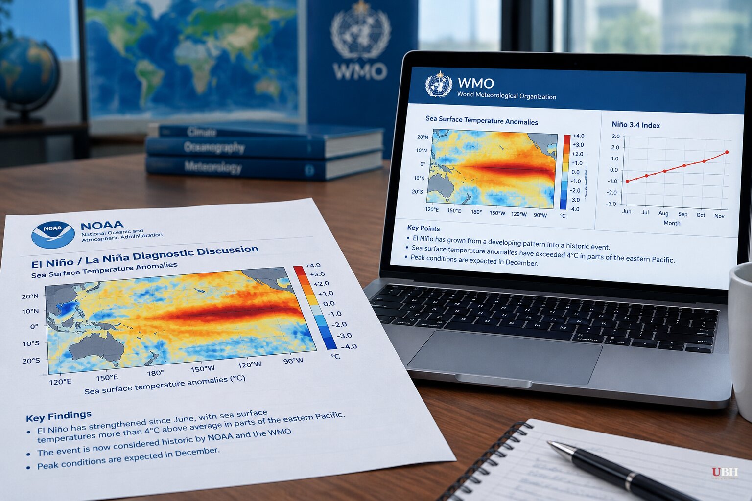
Since sea surface temperatures around the equatorial Pacific began running abnormally warm in June, El Niño has strengthened every month. The latest numbers from NOAA and the World Meteorological Organization add detail on how far it has come and what is left to run.
What the ocean is doing
NOAA's Climate Prediction Center said El Niño strengthened further in September. Sea surface temperature anomalies exceeded 4°C above average in parts of the eastern equatorial Pacific.
Below the surface, the heat is deeper still. NOAA said subsurface temperatures stayed more than 10°C above average at depth in the eastern Pacific, reflecting a deeper-than-average thermocline.
The atmosphere is cooperating with the ocean. NOAA reported low-level westerly wind anomalies and upper-level easterly anomalies stretching from the western to the east-central equatorial Pacific. Rainfall and convection stayed enhanced from the central to the eastern Pacific and suppressed over Indonesia. Both the traditional and equatorial Southern Oscillation indices were significantly negative.
NOAA's summary: the coupled ocean-atmosphere system "reflected a strengthening El Niño."
How strong, and for how long
NOAA defines a "historic" event as a three-month Relative Oceanic Niño Index value of at least +2.5°C. It put the chance of exceeding the strength of any event since 1950 at 54% for September-November, 83% for October-December and 70% for November-January. The agency expects the event to stay strong to very strong through January-March 2027.
NOAA added a caveat. With an event this size, the chances of El Niño-type impacts are larger, "though not guaranteed."
The WMO's monthly Global Seasonal Climate Update, released Thursday, Oct. 8, goes further on temperature. Its Niño 3.4 index, a widely used measure of the central-eastern equatorial Pacific, rose from an average +1.6°C in June to +2.5°C in August. For October-December, the WMO forecasts a seasonal average near +3.7°C, peaking around December.
That would be the highest since observations began. The previous record was +2.6°C, set from November 2015 to January 2016.
WMO Secretary-General Celeste Saulo said forecasts show "a near-100 per cent likelihood" that El Niño persists through February 2027, "potentially being one of the strongest since at least 1950." The WMO says that figure is a consensus across 13 national and international centers, from Washington to Tokyo to London to Pune, built on shared buoy, satellite and radiosonde data. It is not the output of a single model.
The NOAA and WMO figures use different indices and regions, so the 4°C local readings, the +2.5°C RONI threshold and the +3.7°C Niño 3.4 forecast are not interchangeable numbers.
Heat released, not created
Saulo spoke Thursday at the Global Heat Forum in Bangkok. "El Niño doesn't add new heat to the planet. It releases heat the ocean has already been storing beneath the surface," she said, which is why strong events so often become some of the hottest years measured, as with 2024. "The ocean it's drawing from is the warmest we've ever measured it. There is simply more heat available to release."
The baseline is already high. The EU's Copernicus Climate Change Service said global mean temperature in August reached 16.96°C, tying July 2023 as the hottest month on record.
NPR quoted forecasters saying this El Niño is the strongest ever measured for this time of year. They said 2026 may come close to the top spot among warmest years, but that temperature records are very likely to fall in 2027.
Pacific storms up, Atlantic quiet
The ocean pattern is already showing up in the tropics. NOAA National Weather Service hurricane forecaster Matthew Rosencrans said that, with more than two months of the season left, the eastern and central Pacific had each seen four more tropical storms than normal. Three Pacific hurricanes have reached Category 5 strength, tying a record set in 2002, also an El Niño year, he said.
The Atlantic has gone the other way. El Niño tends to suppress hurricanes there, and activity has been virtually silent this year.
Storm count is not the same as storm damage. In 2015 the eastern Pacific had nine major hurricanes and no reported deaths, because the storms formed farther west and stayed over open water, Rosencrans said. In 1997, another strong El Niño, hundreds died when Hurricane Pauline hit land. University of Miami hurricane expert Brian McNoldy said this event will peak this winter but "doesn't turn off right away," and will linger into 2027.
The human cost estimates
Researchers at the University of Chicago's Climate Impact Lab projected last month that this "super-El Niño" could cause as many as 451,000 excess deaths worldwide from June to February 2027. That is a modeled projection, not a count.
El Niño shifts rainfall patterns, bringing floods in some regions and drought in others. NPR noted that the damage to agriculture can be severe in either case. Food-growing regions are where NOAA says erratic weather is most likely.
NPR also pointed out a labeling issue. The nicknames "Super El Niño" and "Godzilla El Niño" are catchy, but NOAA forecasters classify the event technically as "very strong," a category that begins when the key ocean region runs more than 2°C above average.
What comes next
The WMO expects the event to keep intensifying ahead of a December peak. NOAA's next monthly outlook is scheduled for Nov. 12. It will show whether the 70% to 83% odds of a historic event firm up or fade as the peak approaches.
Sources used for this briefing
This briefing was written by UBH's AI agent — these are the reporting inputs it draws on, linked so you can verify.


