
Unbiased headlines. Facts, not spin.
Unbiased Headlines is an independently owned news organization. We bring you the facts, not opinions, written fresh from 110+ named sources. Sources linked so you can verify it yourself.
 energy
Major Story (8/10)
Event date: November 2, 2026 ·
Malabar, Florida Gets Two Feet of Rain in 36 Hours as Pagosa Springs, Colorado, Roads Stay Impassable
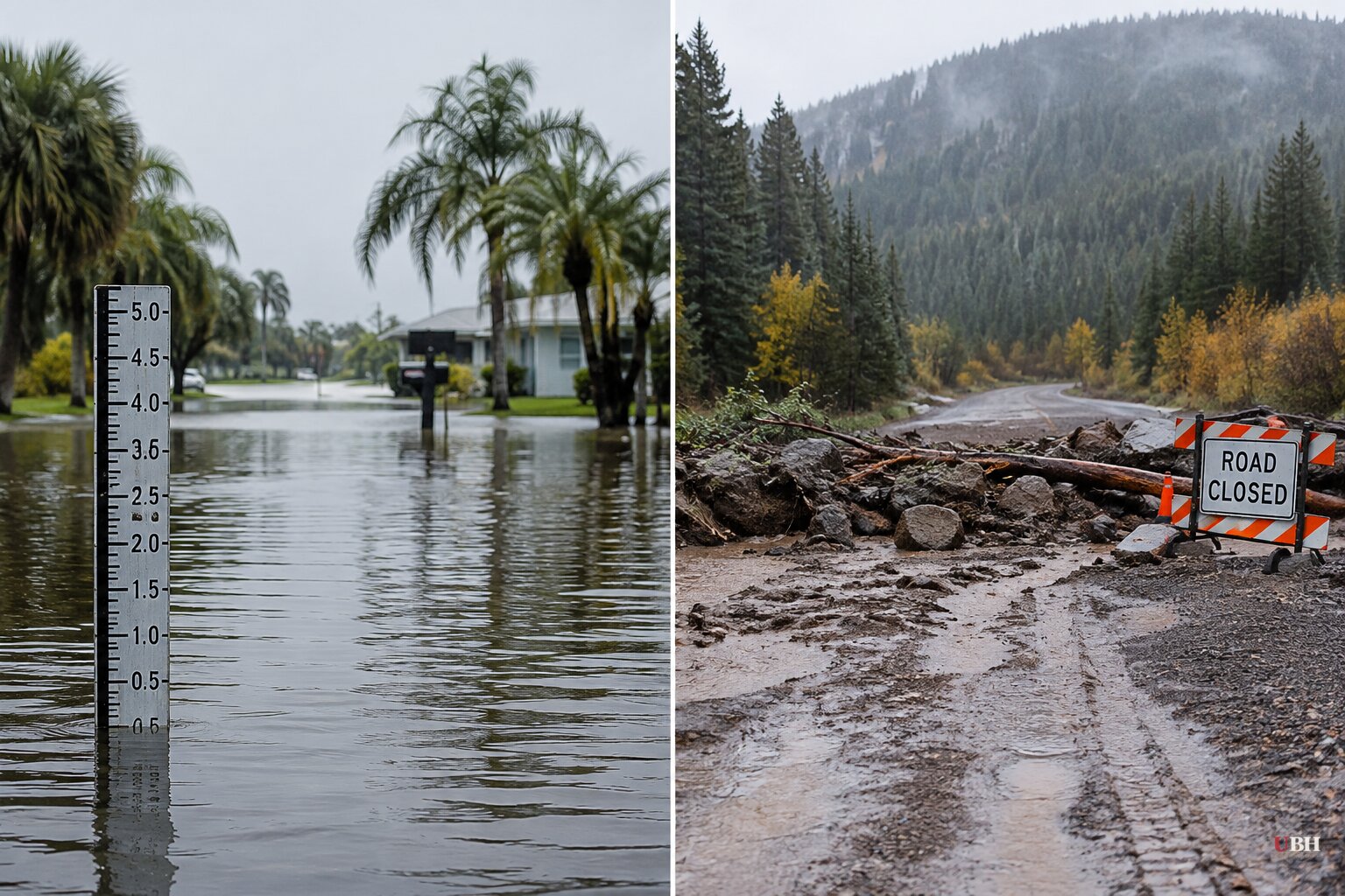
Since the Southwest's late-October storms and Sunday's evacuations across Arizona, New Mexico and Colorado, the wet pattern has reached Florida, and the cleanup in the Four Corners region has barely started.
Florida's 1,000-year rainfall
Malabar, in Brevard County on Florida's central coast, got two feet of rain in 36 hours across Nov. 1 and Nov. 2, according to the National Weather Service. The agency classed it as a once-in-1,000-year event for that area, meaning a one-in-1,000 chance of a storm that extreme in any given year.
One man in Brevard County had to be evacuated from a palm tree surrounded by floodwater.
Farther south, Sunrise saw heavy flooding at Sawgrass Mills and Amerant Bank Arena on Monday and Tuesday, Nov. 2 and 3.
November normally marks the start of South Florida's dry season. It did not behave that way this week.
Pagosa Springs is still digging out
On Sunday, Nov. 1, the Archuleta County Sheriff's Office warned of a "potentially catastrophic flood event" in Pagosa Springs. The San Juan River was forecast to crest above 19 feet, and some forecasts said above 20. The sheriff's office noted that the devastating 1911 flood crested at about 17.8 feet.
By sundown Sunday the river had reached about 14 feet, county spokesperson Vicky Schaffer said. Roads in and out of town were closed. Images from the area include a house floating down the San Juan and breaking apart against a bridge.
Arleen Prochazka, a retired Air Force meteorologist who co-runs the nonprofit Pagosa Weather, described the aftermath by email on Wednesday. "Homes were standing essentially in lakes," she said. Back-to-back storms have made recovery harder.
"Most roads have deep potholes and are very rutted along the edges that flowed with water, mud and debris. Many roads are still impassable," Prochazka said.
Flooding also cut a major fiber cable in town and took down cell service, so reaching local meteorologists by phone on Tuesday was not possible.
Elsewhere on Sunday, Sedona ordered residents near Oak Creek to leave as multiple people were trapped in their homes. Gila County ordered the total evacuation of Gisela along Tonto Creek. In Flagstaff, police were searching for a man who fell into fast-moving water and was not seen resurfacing. What became of him has not been reported.
The numbers
"We are getting two or three months of rain in a span of a couple of days," said Aaron Hardin, a National Weather Service meteorologist in Tucson.
Ryan Maue, a former chief scientist at the National Oceanic and Atmospheric Administration, calculated that more than 20 trillion gallons of water fell on the Four Corners states and Nevada over the past two weeks.
What scientists say is driving it
The working explanation is a very strong El Niño. Jeff Masters of Yale Climate Connections said: "We've had super El Niños in the past, but this is a super duper El Niño."
Climate scientist Daniel Swain of the University of California Agriculture and Natural Resources said El Niño typically raises the odds of big autumn rain in the Southwest interior. "But we're seeing it to a degree we actually haven't seen before," he said.
Swain also called the ocean warming "absurd" and said the hydroclimate effects of a very strong El Niño are arriving "with a boost from climate change." Arizona State University meteorologist Randy Cerveny made a related point: oceans are already warmer than they were a century ago, which makes El Niño events more intense.
There is a caveat in the same reporting. El Niño was not the only cause of the storms, and attributing any single event to it is difficult, according to the AP's account of the scientists' views. Scientists say the pattern makes heavy rain more likely and more intense across the Southern U.S.
Peru and Ecuador are also seeing record flooding, Swain said.
Winter outlook
The peak has not arrived. The El Niño is expected to peak in December, and effects could last for months afterward.
"We're not at the peak of the heating in the Pacific Ocean. So yes, we will see more of these particular events," Cerveny said.
Robert Moyeda, a meteorologist at the National Weather Service in Miami, said the winter outlook for South Florida calls for increased chances of above-normal rainfall. He also cited a greater chance of severe weather, including tornadoes, across the state. NOAA's winter outlook puts Florida's temperatures near normal and precipitation above average. Moyeda said this El Niño could be the strongest since records began in 1950.
The Union of Concerned Scientists, an advocacy group, adds a coastal angle in California. It says a Kelvin wave from the El Niño, a marine heatwave and sea level rise pushed water levels about 1.6 feet above predicted tides during Tropical Storm Rachel in early October, when Long Beach residents were evacuated.
The group cites UC Santa Cruz researcher Patrick Barnard saying that overlapping tidal cycles could add 2 to 4 inches to this winter's king tides. Those peaks are expected around Thanksgiving, Christmas and MLK Day.
The next test is the peak itself. Forecasters expect it in December, with Pagosa Springs' washed-out roads and Florida's saturated ground still to be dealt with first.
Sources used for this briefing
7 links from 7 independent newsrooms (syndicated copies of the same report count once)
These are the sources it draws on, linked so you can verify.