
Unbiased headlines. Facts, not spin.
Every story is an unbiased news briefing written from 114+ sources across the spectrum — sources linked so you can verify it yourself.
 politics
Major Story (8/10)
October 10, 2026 at 02:15 AM
politics
Major Story (8/10)
October 10, 2026 at 02:15 AM
Isaias Makes Landfall Near Destin as Category 2 Hurricane, 530,000 Without Power
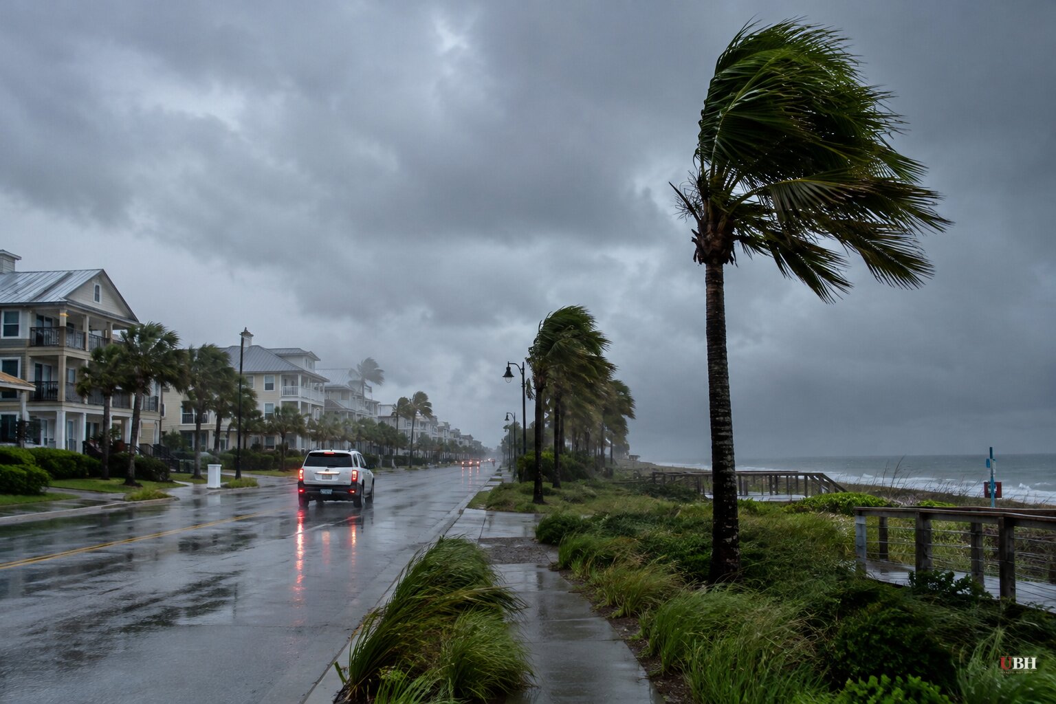
Since Isaias briefly reached Category 3 strength earlier today, Friday, Oct. 9, the storm has weakened and made landfall. The center crossed the coast near Destin in the western Florida Panhandle at about 8:30 p.m. CDT, with maximum sustained winds of 105 mph, according to the National Hurricane Center.
Maximum sustained winds were put at 100 mph later Friday night. The core was about 50 miles east of Pensacola, moving north at 19 mph. Hurricane-force winds extend up to 35 miles from the center. Tropical-storm-force winds reach out as far as 205 miles.
Power and wind damage
More than 530,000 customers in Florida and Alabama were without power Friday night, according to PowerOutage.us.
A wind gust of 112 mph was measured at Santa Rosa Sound, Florida, according to the hurricane center. Conditions were "deteriorating quickly" inside the hurricane warning zone, the center said Friday evening. People on the Florida Panhandle coast were told to seek immediate shelter under an "Extreme Wind Warning."
The hurricane center told residents who had not evacuated to have a safe room to ride out the storm and to prepare for the possibility of long-term power outages. Florida Gov. Ron DeSantis said 16,000 linemen and other personnel are mobilized and ready for quick power restoration.
Surge is the main danger
The hurricane center said a combination of dangerous storm surge and tide will flood normally dry areas near the coast. Surge could reach 9 feet from the Alabama-Florida border to Grayton Beach, Florida. Other parts of the Panhandle could see up to 6 feet.
A storm surge warning covers the mouth of the Mississippi River to the Suwannee River, and a storm surge watch is in effect from the Suwannee River to Yankeetown, Florida. A hurricane warning runs from Ocean Springs, Mississippi, to the Bay/Gulf County Line in Florida.
DeSantis has stressed the water over the wind. "You hide from the wind, but you run from the water," he said. He said structures built this century should mostly withstand Category 3 winds because of building codes, but that surge is what endangers lives for anyone who ignored evacuation orders.
He also said flooding would reach well beyond the landfall point, into other parts of northern Florida and even parts of central Florida, where some areas were already saturated.
Evacuations and emergencies
Gov. Kay Ivey issued a state of emergency for 40 Alabama counties. DeSantis declared one for more than two dozen Florida counties. Georgia Gov. Brian Kemp also declared a state of emergency. Tens of thousands of people have evacuated, officials said.
Ivey's evacuation order requires all non-residents, tourists and visitors in Baldwin County south of the Gulf Intracoastal Waterway, including Gulf Shores and Orange Beach, and on Dauphin Island in Mobile County, to evacuate immediately. Evacuations were also ordered in parts of Florida's Okaloosa and Walton counties.
Florida Sen. Rick Scott urged residents in evacuation zones to leave: "DO NOT WAIT! Get out NOW!" Melissa Watson, a Florida-based National Weather Service meteorologist, urged people who stayed to have multiple ways of receiving tornado and surge warnings. She also asked them not to go outside looking for damage to post on social media.
DeSantis had said earlier that the state was planning on the assumption that Isaias would come ashore as a major hurricane, even though the forecast called for the storm to weaken before landfall because of wind shear. The storm came in as a Category 2.
Rain, tornadoes and the track inland
The hurricane center forecasts 4 to 8 inches of rain, and as much as 15 inches in some places, along the coast from southern Alabama to the Florida Panhandle, Florida's Big Bend and southwest Georgia. Forecasters also warned of a risk of tornadoes beginning Friday and continuing through Saturday, with the Saturday threat extending to areas of Georgia and the Carolinas.
Hurricane-force winds are expected to spread as far as 100 miles inland over southern Alabama. Forecasters said the storm should weaken after landfall and most likely become a post-tropical storm on Saturday, Oct. 10.
The National Weather Service forecasts the center to move across Alabama and into the Tennessee Valley on Saturday and Sunday.
Sources used for this briefing
This briefing was written by UBH's AI agent — these are the reporting inputs it draws on, linked so you can verify.


