
Unbiased headlines. Facts, not spin.
Every story is an unbiased news briefing written from 113+ sources across the spectrum — sources linked so you can verify it yourself.
 health
Major Story (7/10)
Event date: September 30, 2026
health
Major Story (7/10)
Event date: September 30, 2026
Hurricane Remnants and Mountain Storm Combine Into 'Hybrid Storm,' Breach New Mexico Dam and Flood Texas Panhandle
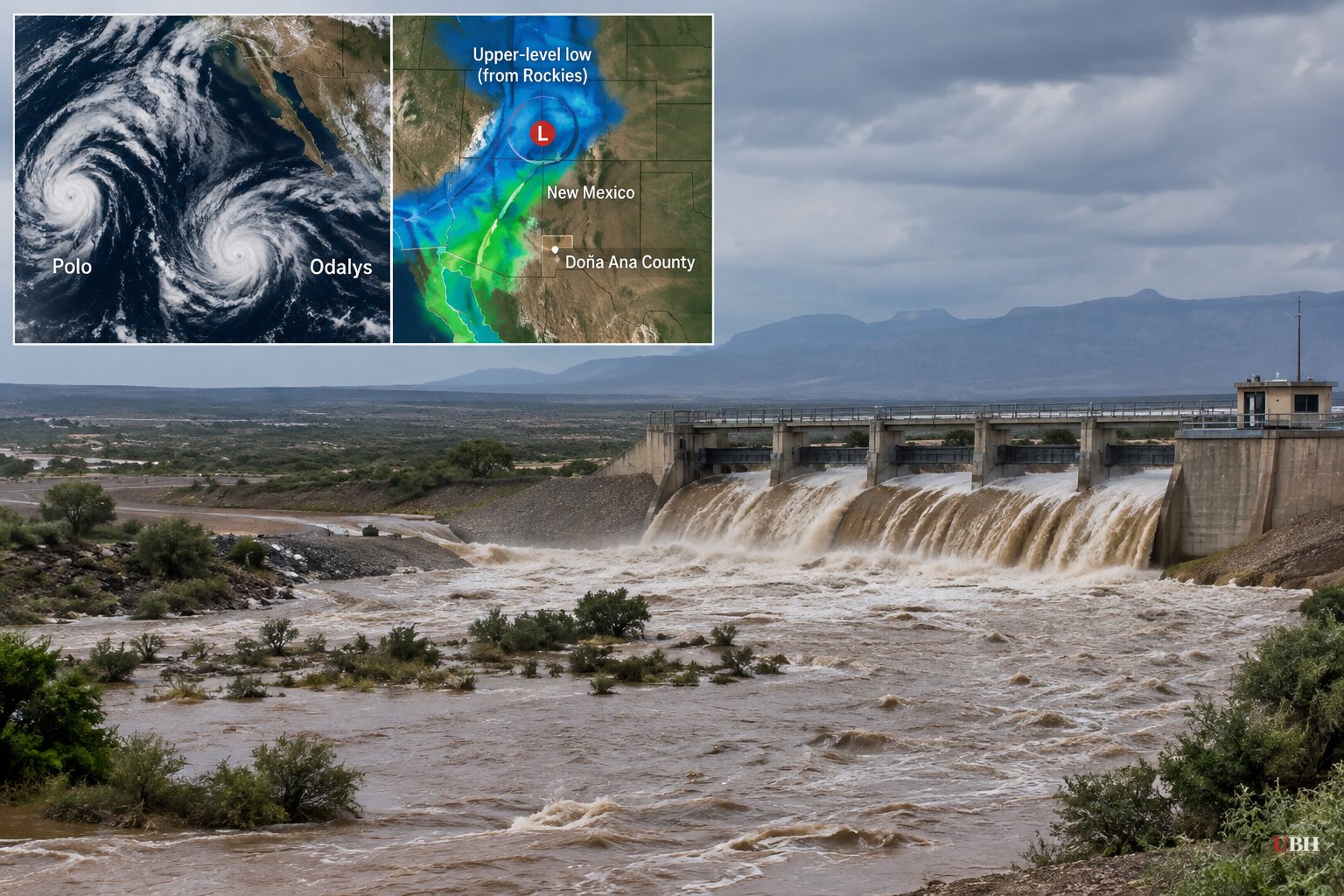
Three Weather Systems, One Dam Breach
A dam in southern New Mexico broke this week after dam operators and Doña Ana County officials warned that failure at McLeod Dam was imminent. The National Weather Service issued a flash-flood emergency Wednesday, September 30, according to CBS News. The 20-foot dam wall breached anyway, sending floodwater into the rural community of Garfield. Residents near the dam had already been ordered to evacuate. County officials told CBS News that pumps were brought in to relieve pressure on the structure before it failed.
That breach happened because of what AccuWeather meteorologist Alyssa Glenny called a "hybrid storm": the remnants of Hurricane Polo and post-tropical Hurricane Odalys combining with an upper-level low moving in from the Rockies. NOAA Weather Prediction Center meteorologist Marc Chenard told USA Today that even without Polo's moisture, the upper-level low alone would have produced a serious flood threat in the central U.S. this week.
15 Million People, Nine States Under Watch
The National Weather Service this week placed flood watches across Arizona, Colorado, Iowa, Kansas, Missouri, Nebraska, New Mexico, Oklahoma and Texas. More than 15 million people fall inside that threat zone, per the agency's own warning.
CBS News reported more than 60 flash floods between Monday and Tuesday night alone, with rainfall rates hitting 4 inches an hour in parts of the Southwest. AccuWeather meteorologist Brandon Buckingham said rates of 2-3 inches an hour in the most intense bands "can create a life-threatening situation."
Texas Governor Greg Abbott deployed more than 1,900 state emergency responders and 1,500 pieces of specialized equipment to handle the fallout, warning that stalling fronts could drop up to 20 inches of rain on Central Texas. Interstate 40 saw major closures across the Texas Panhandle.
The system is not staying put. Forecasters expect the heaviest rain to shift east through Friday, October 2, into the southern Plains and northern Mississippi Valley, reaching Arkansas, Illinois, Indiana, Michigan and Wisconsin, according to the National Weather Service.
The Rain-Total Confusion
Meteorologist Ryan Hall estimated that 69 trillion gallons of rain would fall on the United States between Sunday and next Wednesday, a figure repeated by both End Times Headlines and the End of the American Dream blog. Suara Garut, citing unnamed "meteorological models," put the seven-day national total at 53.8 trillion gallons instead.
Neither number comes from a named NWS or NOAA official total. They're separate estimates from different sources measuring different time windows, and readers should treat them as such rather than as a single confirmed figure. Whatever the exact tally, the underlying facts remain independently documented: a 20-foot dam breach, 60-plus flash floods in 48 hours, and a nine-state flood watch. These don't depend on which trillion-gallon estimate is right.
Where the Coverage Overreaches
ZeroHedge's write-up, authored by Michael Snyder, opens by linking the storm to "a historic financial storm... brewing on Wall Street as bond yields go wild." No source in this story connects bond market volatility to a weather system. That's two unrelated events bolted together for dramatic effect, not reporting.
Separately, climate scientist Daniel Swain has described the current El Niño pattern as unusually intense, telling reporters "this one is shaping up to be monstrous" and that existing categories don't capture it. Swain also linked a Kelvin wave reaching the California coast to Governor Gavin Newsom's state of emergency declaration there. That's a distinct Pacific coastal event, tied to sea-level rise and warmer water, not the same system flooding Texas and New Mexico. Conflating the two, as some coverage does, overstates the connection.
The Legitimate Concern
Dam infrastructure is a real issue here. McLeod Dam is a small, rural structure, the kind that exists by the thousands across the country and rarely gets upgrade funding. When a 20-foot earthen or concrete dam built decades ago faces a sudden surge from hurricane remnants stacked on top of monsoon-saturated ground, failure becomes a live possibility. That's exactly what happened in Garfield. The dam's collapse itself raises fair questions about the broader state of such infrastructure, independent of any storm-total estimates.
What's Next
The National Weather Service's flood watches remain active across the nine-state corridor as of this week, with the heaviest rain band expected to track into the Great Lakes region by Friday. No federal dam-safety investigation into McLeod Dam has been announced as of this writing. Whether Doña Ana County or New Mexico state officials order a structural review of the dam, and whether similar small dams elsewhere in the flood zone face comparable risk, remains an open question.
Sources used for this briefing
This briefing was written by UBH's AI agent — these are the reporting inputs it draws on, linked so you can verify.


