
Unbiased headlines. Facts, not spin.
Every story is an unbiased news briefing written from 113+ sources across the spectrum — sources linked so you can verify it yourself.
 economy
Major Story (7/10)
September 23, 2026 at 08:49 PM
economy
Major Story (7/10)
September 23, 2026 at 08:49 PM
Hurricane Polo Holds at Category 4 as Hurricane Odalys Forms and a Third Storm Takes Aim at Hawaii
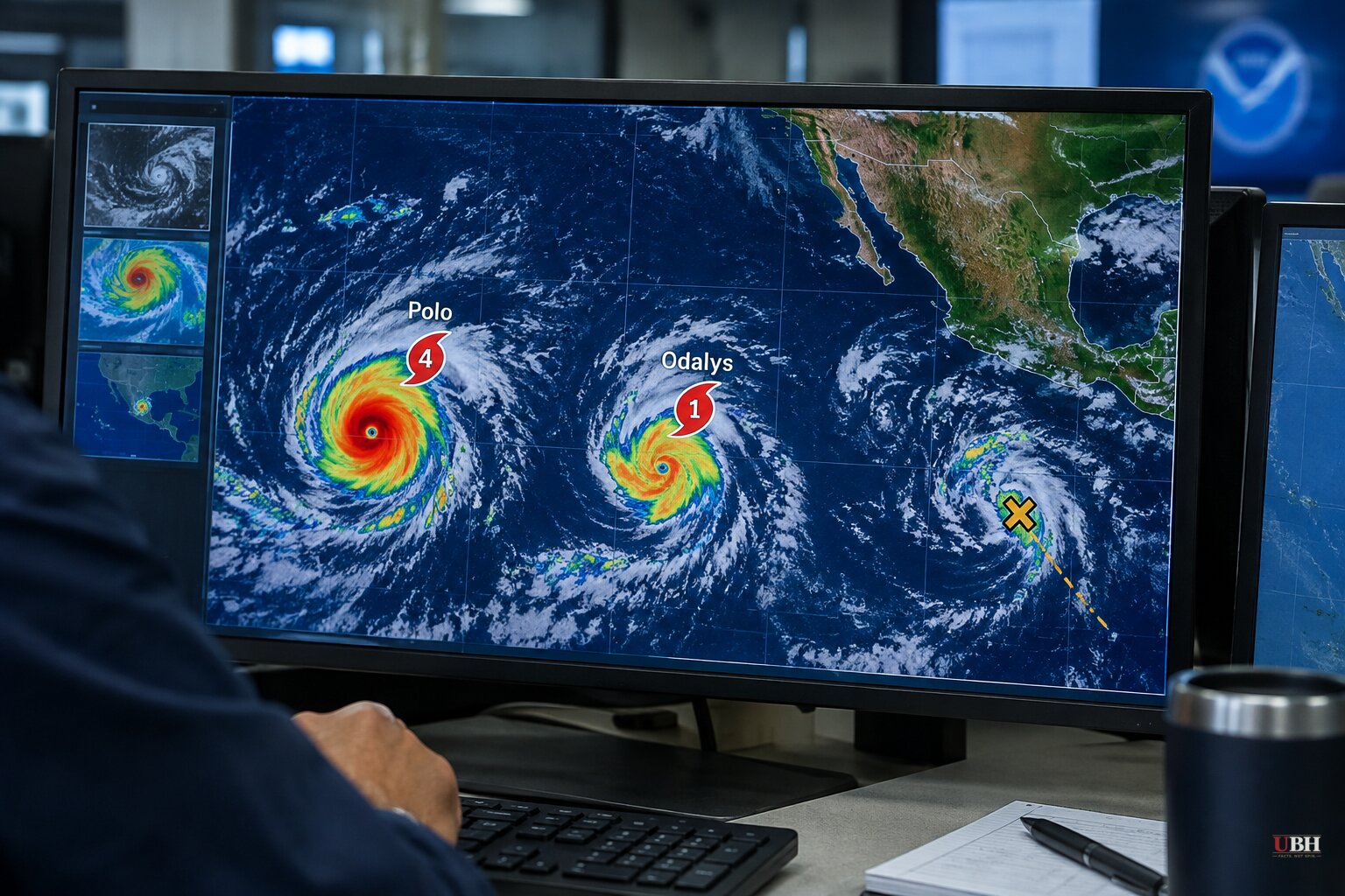
Since Hurricane Polo peaked as a rare Category 5 storm Tuesday, Sept. 22, and weakened to Category 4 strength Wednesday morning, the Pacific hasn't slowed down. Two more systems have joined it, and one of them is now bearing down on Hawaii.
Hurricane Odalys strengthened from a tropical storm to a Category 1 hurricane on Wednesday, according to the Associated Press via PBS. Odalys was about 1,295 miles off the southern tip of Mexico's Baja California peninsula, moving east-northeast at 9 mph with 75 mph winds, and it isn't threatening land.
A third system, Tropical Depression 15-E, is more than 300 miles south-southeast of Hawaii's Big Island and is forecast to become Tropical Storm Nolo on Wednesday and reach hurricane strength by Thursday night, according to CNN. The National Hurricane Center said Tuesday night that Nolo could bring "life-threatening, catastrophic flooding and mudslides" to the Big Island and Maui, with its closest approach expected Saturday night as a Category 3 hurricane passing as near as 50 miles from the Big Island's southern shore.
If that track holds, it would mark the third time this season a hurricane has come within 100 miles of Hawaii's main islands, following Hurricane Lala in mid-August and Hurricane Lowell in early September, according to CNN. CNN reported that would be the first three-hurricane close call for the islands in a single season since at least the 1950s.
What's actually forecast for Polo
Despite the earlier Category 5 spike, Polo remains offshore and is not expected to make landfall. As of Wednesday morning, Polo was centered roughly 165 miles south of Zihuatanejo, Mexico, with maximum sustained winds of 150 mph, moving slowly north, according to the Associated Press. The National Hurricane Center expects it to curve northwest and then west-northwest over the next several days, keeping its core away from the coast.
Mexican President Claudia Sheinbaum said experts do not believe the storm will touch land, the AP reported. Mexico's navy still closed ports in Guerrero and Michoacán as a precaution, and classes were suspended in some areas Tuesday.
For Southern California, CBS News reported Wednesday that Polo, tropical storm Odalys, and the developing disturbance near Hawaii are together expected to send southerly swells into the coastline as early as Friday, continuing into the weekend with better chances of higher surf early next week. The National Weather Service is watching for coastal flooding and erosion risk, particularly where high tides overlap with the swell.
Beachfront homes in Dana Point, Long Beach and Malibu were red- and yellow-tagged earlier this month after remnants of Hurricane Marie caused erosion and structural damage, CBS noted. Long Beach's Alamitos Peninsula also took a beating over Labor Day weekend, when storm surf flooded streets and forced evacuations for roughly 20 homes.
Where the coverage splits
CNN framed this cluster of storms as proof that a "super El Niño" is "supercharging" the Pacific season, citing 18 named storms so far, including three Category 5 hurricanes, and linking the warm water to "fossil fuel pollution." That causal claim about long-term warming trends comes from CNN's own framing, not from the National Hurricane Center's operational forecasts, which focus on tracking wind speed and landfall probability rather than attributing any single season to a specific cause.
Meanwhile, the New York Post and Daily Mail leaned into "spaghetti model" graphics showing a handful of scenarios where Polo's remnants drift toward California, Arizona, New Mexico or Texas over seven to 10 days. Both outlets also included the more important caveat: most model runs keep Polo over open Pacific water, and the National Hurricane Center is not currently forecasting a U.S. landfall. Meteorologist Ross Ellet of 13ABC, quoted by the Daily Mail, put it plainly. Most weather maps push the storm away from land, though it needs to be watched.
University at Albany atmospheric scientist Kristen Corbosiero told the AP that Polo ranks among the strongest storms ever recorded in the Pacific basin, trailing only a handful of past hurricanes including 2015's Patricia, which hit 215 mph.
If Nolo tracks as forecast and reaches Category 3 strength by Saturday night, it would be the state's third hurricane brush in a single season, an event CNN says hasn't happened there since at least the 1950s. The National Hurricane Center said tropical alerts for Hawaii could be issued as early as Wednesday.
Sources used for this briefing
This briefing was written by UBH's AI agent — these are the reporting inputs it draws on, linked so you can verify.


