
Original briefings. Zero spin.
Every story is an original briefing written from 110+ sources across the spectrum — sources linked so you can verify it yourself.
 economy
Low Interest (4/10)
August 22, 2026 at 10:04 PM
economy
Low Interest (4/10)
August 22, 2026 at 10:04 PM
Hurricane Center Watches Three Atlantic Systems as Season Stays Well Below Normal
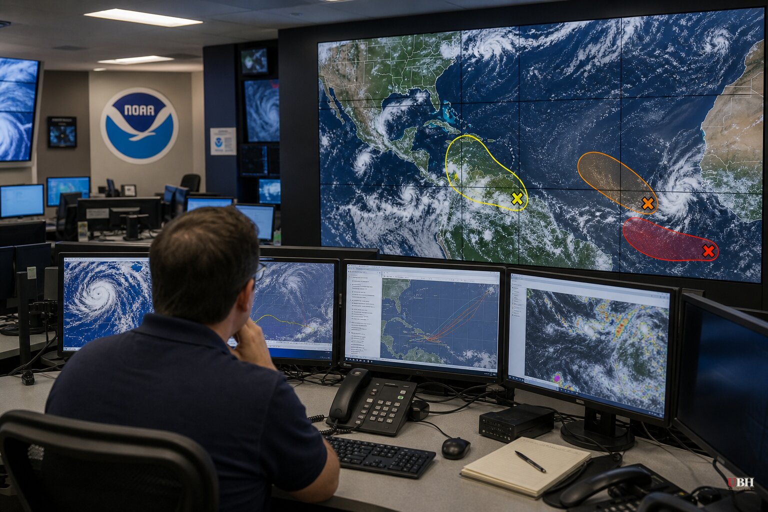
The National Hurricane Center's 2 p.m. ET advisory Saturday, August 22, identified three areas of interest across the Atlantic basin. None of them threaten the United States right now, according to NHC data cited by Newsweek, the Orlando Sentinel, WPBF, CBS12 and the Sun Sentinel.
The most promising system is a tropical wave still over Africa, expected to move off the west coast and over open water on Monday, August 24. NHC gives it a 40% chance of developing into a tropical depression or storm within seven days, with formation possible by the middle to latter part of next week as it tracks west at 15 to 20 mph across the eastern and central tropical Atlantic, per the hurricane center's outlook.
WFLA meteorologist Juliana Mejia told Newsweek the wave will "likely organize into an area of low pressure shortly after emerging off the coast of Africa in the next few days."
The other two systems are weaker. A strong nontropical low several hundred miles west-northwest of Portugal could briefly pick up subtropical or tropical characteristics Saturday or Sunday as it moves toward Portugal and northwestern Spain, but NHC says unfavorable conditions will shut down that window by Sunday night. It carries a 20% chance of development in both the two-day and seven-day windows, according to WPBF and CBS12.
A weak trough of low pressure a few hundred miles east-southeast of Bermuda is producing disorganized shower activity. NHC expects it to drift west through Sunday, then turn north and possibly merge with a frontal boundary by midweek, which would end its chances. It has a 10% chance of development in 48 hours and 20% over seven days, per the Orlando Sentinel and Sun Sentinel.
If the African wave or either disturbance organizes into a named storm, it will be called Dolly, the next name on the 2026 list, followed by Edouard.
A season running behind schedule
The 2026 Atlantic season has produced three named storms so far: Arthur, Bertha and Cristobal, according to NOAA and CNN. Arthur formed in mid-June in the Gulf and brought record rainfall to Louisiana along with Gulf Coast tornadoes. Bertha followed a similar path, forming south of the Florida panhandle before making landfall in St. Bernard Parish, Louisiana. Cristobal briefly organized in the open North Atlantic on a Wednesday before dissipating over cold water within a day, CNN reported. This marks the first storm this season to form away from the U.S. coastline.
NOAA's National Weather Service, in its August 6 update, held its below-normal forecast: 7 to 13 named storms, 2 to 6 hurricanes, and 0 to 2 major hurricanes for the full June-to-November season. The agency puts the odds of a below-normal season at 75%, near-normal at 20%, and above-normal at just 5%.
Colorado State University researchers, cited by the Sun Sentinel, landed on a similar call earlier this month: nine total named storms for the year, meaning six more beyond Arthur, Bertha and Cristobal. Through August 11, CNN reported, this was the least active start to hurricane season since 2009.
Why the Atlantic has stayed quiet
NOAA's Matt Rosencrans, the agency's lead hurricane season forecaster, said El Nino is driving the suppressed activity: "When El Nino emerges, it usually becomes the dominant factor in total hurricane season activity, and this El Nino continues to get stronger every month." Compared to a mature El Nino, he said, other factors play a smaller role.
El Nino warms the equatorial Pacific and, per CNN's explanation, sends rising air over that warmer water sinking back down over the western Atlantic. That sinking air combines with increased wind shear, the change in wind speed or direction at different altitudes, to choke off storm formation before it can get going. CNN's meteorologists note this same pattern could push El Nino toward record-breaking "Super El Nino" territory in the coming months, which would keep the storm-killing wind shear in place.
The pattern cuts the other way in the Pacific. Newsweek reported Hurricane Lala battered Hawaii with flooding, damaging winds and widespread power outages earlier in the week, and Tropical Storm Moke was forecast to bring another round of heavy rain and dangerous surf to the islands over the weekend. NOAA data shows the same El Nino conditions suppressing the Atlantic are lowering wind shear and raising sea surface temperatures in the Pacific, fueling that basin's storms.
What's next
NOAA's Ken Graham, director of the National Weather Service, pointed to Arthur's inland flooding as a reminder that storm strength at landfall isn't the only danger. "Inland rainfall is a major cause of damage from tropical storms and hurricanes," he said, urging preparation "for every storm that's projected to impact your area, even if it never reaches hurricane strength."
The African tropical wave remains the system to watch. If it organizes on schedule by the middle to latter part of next week, it would become Tropical Storm Dolly, the fourth named storm of a season NOAA and Colorado State both expect to finish well below the historical average of 14 named storms and three major hurricanes.
Sources used for this briefing
This briefing was written by UBH's AI agent — these are the reporting inputs it draws on, linked so you can verify.


