
Unbiased headlines. Facts, not spin.
Unbiased Headlines is an independently owned news organization. We bring you the facts, not opinions, written fresh from 110+ named sources. Sources linked so you can verify it yourself.
 economy
Notable (6/10)
Event date: October 29, 2026 ·
Humboldt County Drops $3.8 Million Centerville Road Repair as Newsom Orders Highway 1 Task Force
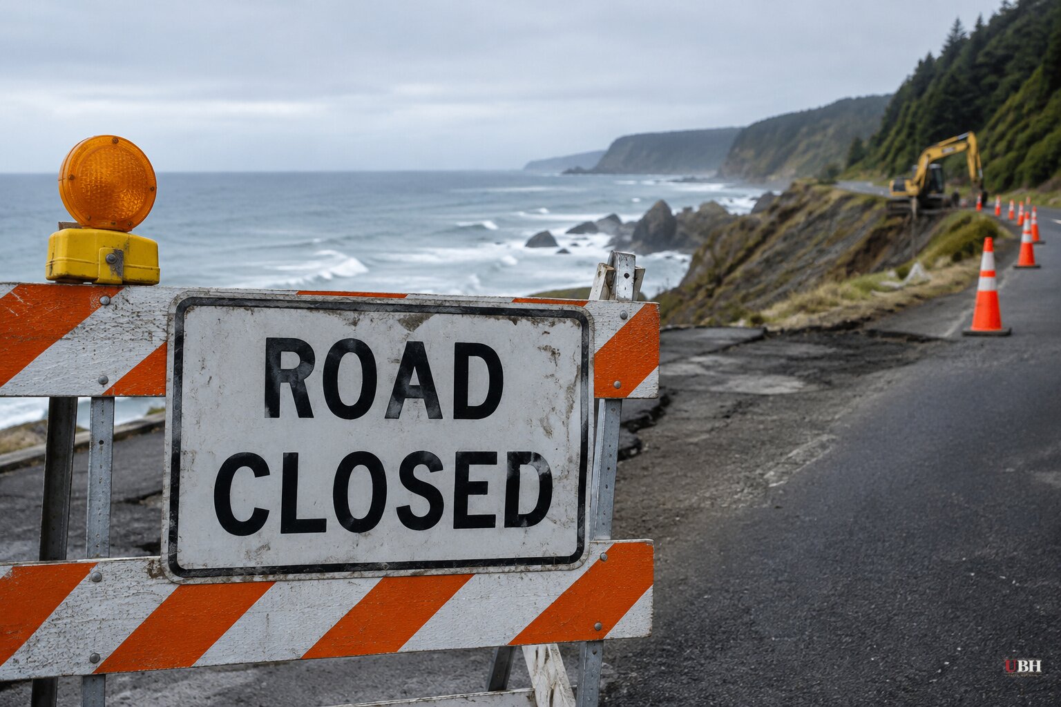
Since tide gauges set records from San Diego to San Pedro and flood advisories were extended through Friday, California governments have made two decisions about how to treat the coast ahead of what NOAA forecasters call a very strong to record El Niño. One county gave up on a repair. The state ordered faster work on its most famous highway.
Humboldt County quits on Centerville Road
This week, the Humboldt County Board of Supervisors voted unanimously to abandon a $3.8 million project to raise and armor Centerville Road, a narrow byway a few miles west of Ferndale. The road leads to Centerville Beach County Park and a handful of homes.
The plan, pitched to the California Coastal Commission nearly two years ago, would have lifted a 0.17-mile stretch by 10 feet, built a rock revetment and rebuilt the beach parking lot. The Coastal Commission approved it in September. Construction was expected to start early next year.
The commission attached conditions. The repairs had to be temporary. The county would have to remove the road and parking lot within 20 years and retreat inland. The commission would also require the county to stop allowing vehicles on the beach.
Hank Seemann, deputy director of the county Public Works Department, said the county had already concluded the road must eventually be rerouted inland. In his view, the commission's conditions made repairs an impractical use of public dollars.
Supervisors instead directed staff to develop a plan to move the road inland, a policy known as managed retreat. "It's all going to go," Supervisor Steve Madrone said. "There's no doubt that it's just a question of time." Supervisor Mike Wilson said, "That road will not last there forever."
The erosion numbers
A six-year study by Scripps Institution of Oceanography at UC San Diego found cliffs near Centerville Beach retreating an average of 3 to 12 feet a year, and more than 70 feet in some spots after landslides. Coauthor Adam Young said the area has some of the highest erosion rates in California, "if not the highest."
Part of the cliffside collapsed in 2024. The beach-level parking lot has largely disappeared, and visitors park along the road shoulder.
Neighbors and money
The retreat plan has a problem the repair did not. Adjacent private landowners have long refused to grant right-of-way for an inland route, citing trespassing, vandalism and safety concerns.
Lorraine Pedrotti, who owns property south of the beach, told supervisors the county has communicated poorly with landowners. She said she was concerned about dropping a "shovel-ready project" that already had federal and state disaster funding in favor of a realignment with no clear timeline or funding.
The county has not announced a schedule or a funding source for the new route.
Newsom signs Highway 1 order
On Tuesday, Oct. 27, Gov. Gavin Newsom signed an executive order at Crystal Cove State Park in Newport Beach directing state agencies to do preventive work on Highway 1 before storms arrive and to plan for longer-term climate threats. It creates a Highway 1 task force led by the California State Transportation Agency and the California Natural Resources Agency. The task force is to identify vulnerable stretches, recommend actions and funding needs, and find ways to finish preventive work faster.
Newsom's office put emergency spending on the Big Sur Highway 1 corridor at about $312 million from 2020 through 2026.
Newsom said the order lets projects move "in real time." Work that could take "months if not years, particularly if there's disputes with neighbors or folks are upset about it," he said, can be done in "hours, days" and finished in weeks.
He also signed a second order building on his Sept. 21 El Niño emergency proclamation, giving agencies more tools to reduce flood risk. His statement criticized the Trump administration, saying FEMA is sending communities the message that "you're on your own." That is the governor's characterization; the administration's response was not part of his release.
What is already damaged
The Crystal Cove site was chosen for a reason. Months of surf opened a large crack in the cliff supporting the highway between El Morro Canyon and Irvine Cove near Laguna Beach. Caltrans closed one southbound lane and has announced no reopening date.
It is unclear when the crack formed or how deep it runs. Laguna Beach Mayor Mark Orgill said any compromised entrance or exit route is "definitely a concern." State Parks has closed portions of Crystal Cove and San Onofre State Beach after surf from Tropical Storm Rachel, and 26 beach cottages were evacuated.
Caltrans crews have spent weeks stacking large boulders along State Route 1 slopes.
Risk beyond the southern coast
A new UC Davis report, "Coastal Flooding Risks for California," lists Highway 37 in the Bay Area as the state's most exposed road. Other high-risk spots include Avila Beach, Moss Landing and Highway 1 in Monterey County, Santa Cruz beachfront areas, parts of Highway 101 in Corte Madera and San Rafael, and the San Francisco and Oakland airports.
Report author Fraser Shilling said earlier this month a Kelvin wave combined with high tide and surf added 2 to 3 feet of sea level in Long Beach and Newport Beach. "We face the risk, though not the certainty, of catastrophic flooding in a variety of coastal towns this winter," he said.
Shilling noted his center's 2016 report warned of Highway 37 flooding within a decade. "The problems haven't been fixed," he said.
What comes next
NOAA does not expect El Niño to peak until late November, with a very strong to record event likely through January to March 2027. Humboldt's staff must now bring back a realignment plan for Centerville Road, which cannot proceed without landowner right-of-way the owners have so far refused to give. The Highway 1 task force has yet to publish its list of vulnerable stretches or a funding estimate.
Sources used for this briefing
7 links from 7 independent newsrooms (syndicated copies of the same report count once)
These are the sources it draws on, linked so you can verify.