
Unbiased headlines. Facts, not spin.
Unbiased Headlines is an independently owned news organization. We bring you the facts, not opinions, written fresh from 110+ named sources. Sources linked so you can verify it yourself.
 energy
Notable (5/10)
Event date: October 24, 2026 ·
NOAA Forecasts Warmer, Wetter Winter Under Very Strong El Niño, but Does Not Predict Snowfall
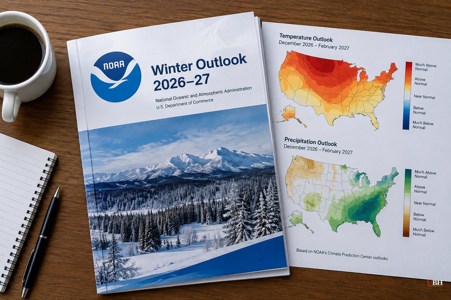
NOAA's U.S. Winter Outlook for December 2026 through February 2027 is built around a very strong El Niño. The agency released it Thursday, Oct. 15.
The headline call: warmer-than-average temperatures across the northern U.S., wetter-than-average conditions from California to Florida and along the Eastern Seaboard, and drought improvement across most of the country, including parts of the East, the Southern Great Plains and the Southwest.
What NOAA is and is not forecasting
"As we know from decades of observations, a very strong El Niño will likely bring a southward and eastward shift to the jet stream for the contiguous U.S., which tilts the odds toward stormier weather across the South," said Ken Graham, director of NOAA's National Weather Service.
Part or all of 41 of the Lower 48 states are forecast to run warmer than normal. No state, or part of a state, is forecast to run cooler than average.
The outlook says nothing about how much snow will fall. NOAA says snow is generally not predictable more than a week out. Above-average precipitation covers rain, snow and ice, and a warmer-than-average season can still include cold snaps and individual storms.
Graham put it plainly at the briefing: "Even in the winter months, it doesn't mean you're not going to have snow. It doesn't mean you might not have a snowstorm. So it doesn't erase the risk."
How strong the El Niño is
NOAA's Climate Prediction Center said in its Oct. 8 update that a strong-to-very-strong El Niño is likely through January-March 2027, with odds above 83%. The center also put an 83% chance on the event reaching a historic-strength threshold during October-December. That threshold is a three-month relative Niño-3.4 index of at least +2.5°C.
"Super El Niño" is an informal label, not an official NOAA category. Strength raises the odds of the typical pattern. It does not guarantee any local result.
Snow: the north loses, the south may gain
The Weather Company's James Belanger said the pattern will be tough on snow lovers. "This is going to be a winter that's really difficult for them to find what they're looking for," he said.
NOAA meteorologists expect below-normal snow across much of the northern U.S., including the Northeast, Great Lakes, Upper Midwest and Northern Rockies. The Southern Rockies and parts of the Southeast and Southwest may get more than usual.
AccuWeather's forecast is sharper. It expects Chicago, Boston, New York and Philadelphia to get about half or less of their normal winter snow. Salt Lake City is the only big metro it expects to see above-normal snowfall.
Belanger's holiday forecast was blunt: outside the Southern Rockies, "Santa's gonna find a barren landscape when he returns in late December."
The Washington, D.C. exception
The Mid-Atlantic is where the forecasts diverge from the northern pattern. CNN Weather analyzed January-March snowfall from 1959 through 2026 and found that past El Niño winters tended to run above average across the southern U.S. and into the Mid-Atlantic. The analysis describes historical relationships, not this winter's snowfall.
Jon Gottschalck, chief of the Operational Prediction Branch at NOAA's Climate Prediction Center and lead forecaster for the winter outlook, said El Niño-fueled nor'easters are "very strong, energetic and they're very wet." CNN reported that could bring above-average snowfall to Washington and Baltimore.
WJLA's Storm Alert Weather team is more cautious. Its early outlook calls for a wetter winter that is near to slightly milder than average, with the best chance of accumulating snow in January and February.
Last winter shows how little a seasonal signal can promise. Reagan National Airport recorded 10.6 inches in 2025-26, below the 1991-2020 seasonal normal of 13.7 inches. La Niña conditions were present that winter and faded to ENSO-neutral by spring.
One storm can swing a season. In the strong El Niño winter of 2015-16, a January blizzard dropped 17.8 inches at Reagan National. That same winter, catastrophic flooding hit South Carolina.
Flood risk and the warming backdrop
Graham also flagged the downside of the rain. "While higher chances of rain and snow may bring relief to drought-afflicted areas, too much precipitation on dry soil can fuel destructive flash floods and mudslides," he said. El Niño years are also associated with coastal flooding on the East and West coasts.
NOAA says the U.S. winter has warmed about 4°F (2.2°C) over the past 50 years, a rise it attributes predominantly to human-caused climate change. That trend sits on top of whatever El Niño adds this season.
Graham said seasonal outlooks help communities prepare. "Earlier and better decisions saves lives," he said.
NOAA's Weather Prediction Center updates its three-month outlook monthly. The next update is scheduled for Nov. 19, and NOAA's Climate Prediction Center will issue its own El Niño update before then.
Sources used for this briefing
7 links from 7 independent newsrooms (syndicated copies of the same report count once)
These are the sources it draws on, linked so you can verify.