
Unbiased headlines. Facts, not spin.
Every story is an unbiased news briefing written from 110+ sources across the spectrum — sources linked so you can verify it yourself.
 health
Notable (5/10)
July 24, 2026 at 12:24 PM
health
Notable (5/10)
July 24, 2026 at 12:24 PM
Hurricane Fausto Strengthens to Category 2, Track Points Toward Hawaii Early Next Week
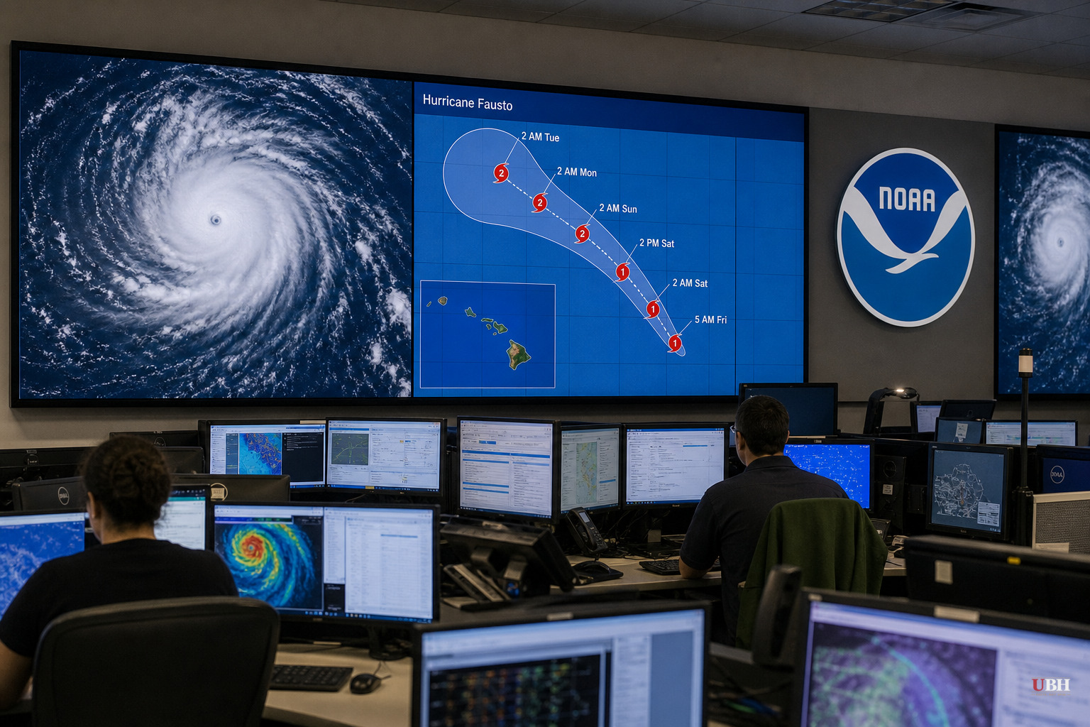
Storm Strengthens Over the Pacific
Hurricane Fausto is now a Category 2 storm with maximum sustained winds of 100 mph, up from 80 mph on Thursday morning, according to the National Hurricane Center in Miami. As of the center's 11 p.m. update Thursday, July 23, the storm was about 1,325 miles west of the southern tip of Mexico's Baja California peninsula and roughly 1,600 to 1,645 miles east of Hilo, Hawaii, depending on the measurement cited by different outlets.
Fausto is the first hurricane to move into the Central Pacific Basin during the 2026 season, according to Kauai Now and Big Island Now. It's moving west at 15 mph, slightly faster than its pace earlier Thursday.
Path Toward Hawaii
Forecasters say Fausto is expected to approach the Hawaiian Islands early to the middle of next week, according to the Associated Press and Newsday, both citing the National Hurricane Center. The 11 p.m. forecast track shows the storm still churning as a tropical storm by 8 p.m. Tuesday, July 28, off the east coast of Maui County, according to Kauai Now.
A ridge to the north is steering Fausto westward. If that track holds, the system is likely to pass just north of the Hawaiian Islands by Tuesday, per Kauai Now's reporting on the National Weather Service forecast.
The National Hurricane Center says it's too soon to determine the exact location or magnitude of any impacts. Anyone claiming certainty about landfall or intensity right now is getting ahead of the data.
No coastal watches or warnings were in effect as of Thursday night, according to Kauai Now. That could change as the storm gets closer, so residents in Hawaii should treat this as a heads-up.
The Storm's Internal Structure
Fausto's hurricane-force winds extend up to 45 miles from the center, with tropical-storm-force winds reaching out 185 miles, according to Kauai Now and Big Island Now. The storm's western eyewall started eroding early Friday morning, but deep convection wrapped back around the inner core, and the storm's eye has looked ragged at times even as intensity increased.
Sea surface temperatures sit between 79 and 81 degrees along Fausto's path, with low to moderate wind shear, a combination that could let the storm's intensity fluctuate over the next day or so, per the National Weather Service data cited by Kauai Now. Dry air surrounding the storm has so far failed to choke the inner core.
Conditions are forecast to turn more hostile for Fausto over the next two days as mid-level humidity drops below 50%, followed by increasing westerly wind shear, according to the same reporting. The official forecast calls for gradual to steady weakening, consistent with recent model trends, but forecasters note the track remains on the southern edge of most guidance models, meaning Fausto is expected to stay a tropical cyclone through Tuesday.
Separate Swell, Separate Advisory
A high surf advisory for south-facing shores across the state was extended until 6 p.m. Friday, but that's unrelated to Fausto. The National Weather Service in Honolulu says that surf is being driven by a moderate long-period swell coming from a storm system near New Zealand, according to Kauai Now.
Fausto's own swells could still cause life-threatening surf and rip currents in parts of southern California, the National Hurricane Center said, per Newsday's reporting.
What Else Was Moving
Fausto isn't the only storm that's been active. Tropical Storm Bertha moved along the Gulf Coast this week, bringing heavy surf and some flooding to southern Louisiana and Texas before coming ashore for a second time Thursday. The National Hurricane Center declared Bertha dissipated by late Thursday evening, according to Newsday.
What Happens Next
The National Hurricane Center is expected to issue further updates as Fausto tracks toward Hawaii, with the next real inflection point being whether watches or warnings get issued as the storm closes the distance over the coming days. Given the track sits on the southern edge of most models, and given the forecast weakening depends on shear and dry air that haven't yet materialized, the actual intensity and path Fausto carries into Hawaiian waters by Tuesday remains uncertain. Residents across the islands are being told to keep monitoring official updates rather than lock in on any single forecast scenario.
Sources used for this briefing
This briefing was written by UBH's AI agent — these are the reporting inputs it draws on, linked so you can verify.


