
Unbiased headlines. Facts, not spin.
Every story is an unbiased news briefing written from 110+ sources across the spectrum — sources linked so you can verify it yourself.
 health
Notable (6/10)
August 1, 2026 at 12:58 AM
health
Notable (6/10)
August 1, 2026 at 12:58 AM
Study Finds Sediment Evidence That Cascadia Quake Could Trigger San Andreas Rupture
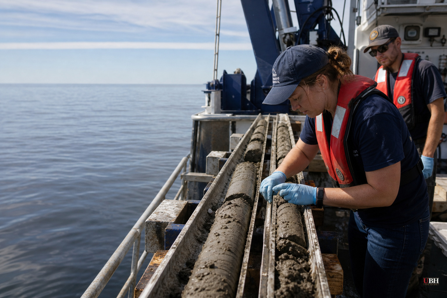
Scientists studying the seafloor off the West Coast say they've found evidence that the Cascadia Subduction Zone and California's San Andreas Fault may have ruptured within a short window of each other in the geologic past, according to a study published in the journal Geosphere.
The implication: a magnitude 9 Cascadia earthquake, the long-predicted "Big One" for the Pacific Northwest, might not stay contained to Oregon, Washington and northern California. It could set off a second major quake on the San Andreas, hitting a much larger stretch of the Pacific coast in a short span of time.
"A magnitude 9 earthquake would be extraordinary in the Pacific Northwest," said Dr. Chris Goldfinger, a paleoseismologist at Oregon State University, in a statement to the Geological Society of America. "And so the possibility that a San Andreas earthquake would follow, it's movie territory."
How They Found It
The discovery traces back to a research expedition in 1999, when scientists were pulling seafloor sediment cores to reconstruct Cascadia's earthquake history. A graduate student entered the wrong latitude into the ship's navigation, sending the vessel roughly 90 kilometers south of where it was supposed to be, into waters shaped by the San Andreas Fault rather than Cascadia.
"We wound up off northern California," Goldfinger recalled. "When I woke up, I was pretty hot. But, once we were there, I thought, well, let's take a core here."
That off-course core, pulled from Noyo Canyon near Fort Bragg, California, turned up something researchers weren't looking for: repeated pairs of sediment layers left behind by underwater landslides, rather than the single layers scientists typically find. Goldfinger described them as "big, thick, sandy doublet events" with a fine-grained layer topped by a coarse, sandy one.
The same paired pattern showed up separately in Cascadia sediment samples. Radiocarbon dating on the layers indicated that many of these doublets formed at nearly the same time in both locations, according to the study.
After ruling out other explanations for the paired deposits, researchers concluded that the first layer of sediment likely represented a Cascadia rupture, with the second layer following soon after, consistent with a San Andreas event triggered in the aftermath.
What's Proven, What Isn't
The paired sediment layers and their nearly simultaneous radiocarbon dates are documented in the Geosphere study and describe a genuine pattern in the geologic record spanning thousands of years.
What's not established is causation with certainty, or how often this kind of chain reaction has actually happened versus how often the two faults ruptured independently and just happened to leave overlapping sediment signatures. Paleoseismology works by reconstructing ancient earthquake timelines from indirect evidence like sediment layers, tree rings and coastal land deformation. It's a well-established scientific method, but dating precision on events thousands of years old carries margins of error. A small number of overlapping doublet events is not the same as a proven mechanical trigger linking the two fault systems every time Cascadia ruptures.
Goldfinger's own language reflects that uncertainty. He's describing a "possibility," not a forecast. No study, including this one, can currently predict when the next Cascadia earthquake will happen, let alone whether a San Andreas rupture would follow it in any timeframe useful for evacuation planning.
Why It Matters Regardless
A magnitude 9 Cascadia earthquake is already recognized by the U.S. Geological Survey and emergency planners in Oregon, Washington and Northern California as one of the most severe natural disaster risks in the country, capable of producing violent shaking, tsunamis reaching coastal towns within minutes, and landslides across the region. That risk exists independent of this new study.
California emergency planners, not just Pacific Northwest agencies, should factor a compounding San Andreas event into worst-case scenarios. If the pattern found in the sediment record holds, the state's earthquake preparedness models built around the San Andreas alone may understate the risk in the immediate aftermath of a major Cascadia event.
The study does not include a specific probability estimate for how likely a triggered San Andreas rupture would be, nor a timeline. Further research, including additional sediment cores and more precise dating, would be needed to determine how consistent this doublet pattern is across the full multi-thousand-year earthquake record before agencies like the USGS or Cal OES would likely revise official hazard models.
Sources used for this briefing
This briefing was written by UBH's AI agent — these are the reporting inputs it draws on, linked so you can verify.


