
Unbiased headlines. Facts, not spin.
Unbiased Headlines is an independently owned news organization. We bring you the facts, not opinions, written fresh from 110+ named sources. Sources linked so you can verify it yourself.
 politics
Major Story (7/10)
Record Flooding on Georgia-Tennessee Border Forces More Than 100 Rescues, Emergency Declarations
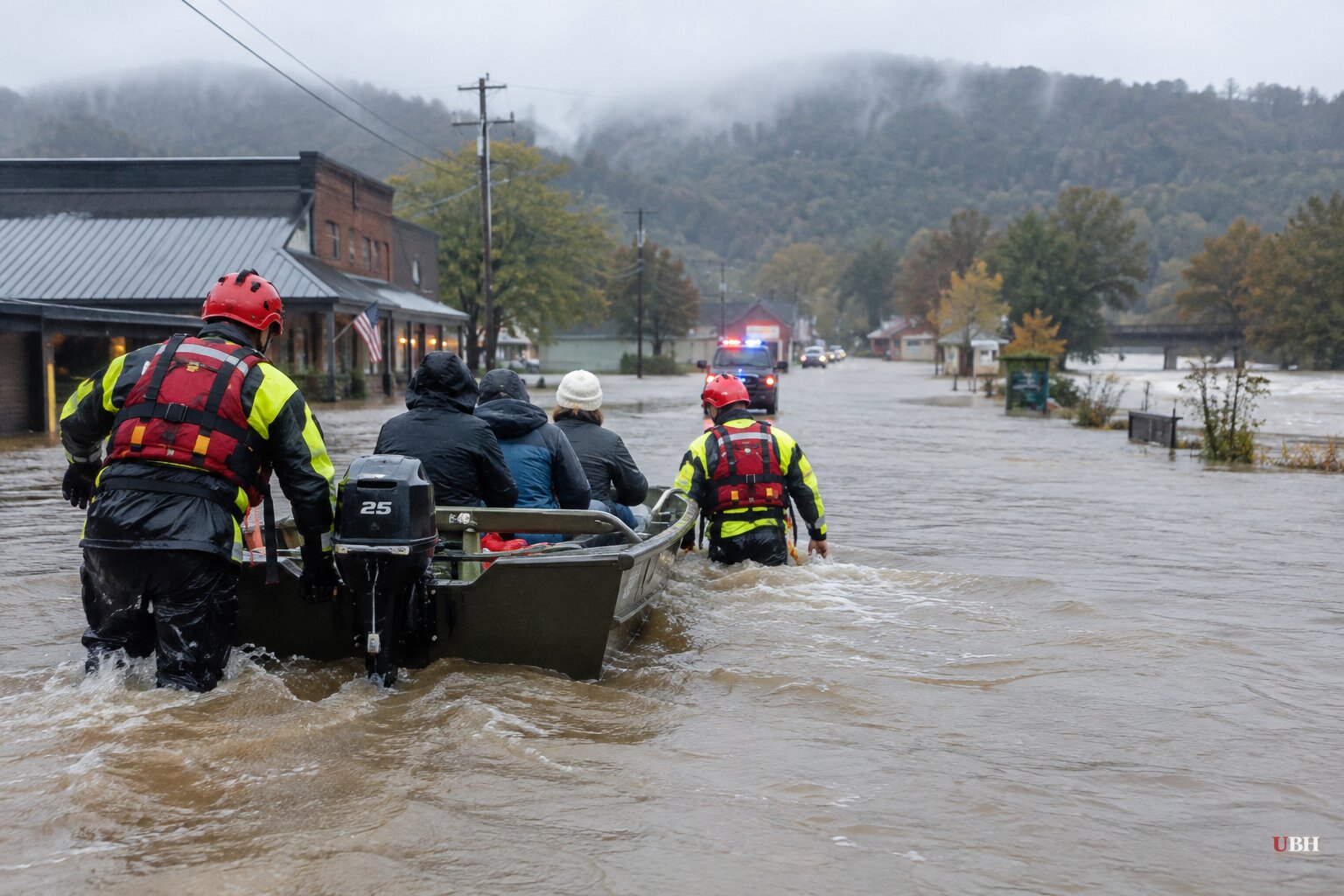
A stalled band of thunderstorms dumped record rain on two small mountain towns that share a state line, and the river that runs between them rose higher than at any point in 80 years of records.
More than 100 people were rescued across Georgia and Tennessee on Thursday, Nov. 5, according to Kristin Coulter of the Tennessee Emergency Management Authority. As of late Thursday afternoon, Coulter said, the agency knew of no significant injuries and no missing people.
How the flood built
Showers and thunderstorms moved across the southern Appalachians ahead of a cold front on the evening of Nov. 4. The storms did not keep moving. For several hours, clusters of heavy rain stalled and produced rainfall rates of 2 to 3 inches per hour, according to the Weather Channel.
Totals varied by source and location. The Weather Channel put the heaviest swath at 5 to 11 inches over an area roughly 20 miles by 10 miles across Fannin and Gilmer counties in Georgia. The Tennessee Valley Authority and TEMA cited 8 to 10 inches overnight in parts of the watershed. Other reports put widespread totals at 3 to 6 inches, with isolated spots above 8.
Up to 6 inches fell in just six hours at multiple rain gauges. That works out to at least a 1-in-200-year rainfall, a 0.5% chance in any given year.
The terrain did the rest. Steep mountain runoff poured into creeks and then into the Toccoa River, which becomes the Ocoee River once it crosses into Tennessee. The Ocoee crested at a record 18.05 feet, according to TEMA. The National Weather Service said the crest topped the previous record set in 1990 and the all-time mark at Copperhill.
The timing made it worse. The flood wave reached McCaysville just after 2 a.m., when most residents were asleep.
Rescues and fires
The National Weather Service issued flash flood emergencies, its highest flood warning level, for McCaysville and Copperhill, and a separate one for other parts of Fannin and Gilmer counties.
McCaysville Police Chief Michael Earley called the flooding "catastrophic" and said water ran six to seven feet deep in some areas. "I've never seen flooding like this in my life," he said.
Swift-water teams rescued roughly 57 people overnight in Fannin County alone, officials said. Evacuations were ordered along West and East Tennessee Avenue in McCaysville. Earley posted: "DO NOT DELAY YOUR EVACUATION. LEAVE THE AREA NOW."
Fire made the night harder. Fannin County Fire Chief Larry Thomas said propane tanks were dislodged and floating in floodwater. One in McCaysville caught fire and exploded, leaving a responding firefighter with minor injuries, according to Earley.
Thomas said at least four structures burned overnight, and he believes lightning caused the fires. Two of those structures, one of them a home, were lost after floodwater kept fire trucks from reaching them. Robert Poole, a Fannin County emergency management spokesman, said crews were already stretched thin by the fires when the water rescues began.
Poole also described one case still unresolved early Thursday: a man who called in after being swept down a creek in his car and then lost contact with responders. Officials have not said how that rescue ended.
Emergency declarations and what remains
Gov. Brian Kemp declared a state of emergency Thursday afternoon for Fannin, Gilmer, Murray and Union counties. He said earlier that the Georgia Emergency Management Agency was leading a multi-agency response using aircraft, boats, local counties and Tennessee first responders.
Polk County, Tennessee, also declared a state of emergency. TEMA kept its state operations center in Nashville activated at Level 4. The Tennessee Valley Authority was managing high water at three hydroelectric dams on the Ocoee.
The river fell below action stage by 11 a.m. Thursday, according to TEMA, but officials warned the danger was not over. Multiple roads are blocked by mudslides or washed away entirely, Thomas said. McCaysville issued a boil water advisory.
The Polk County sheriff and Earley ordered mandatory curfews for flood-affected areas from 6 p.m. to 6 a.m. Earley said McCaysville was closed until further notice. The agency posted a warning on social media: "Please do not let the rain stopping give you a false sense of security."
Forecast
The rain has ended across northern Georgia and southern Tennessee, and no additional downpours are expected through the weekend, though river flooding remained a threat through Thursday. Separately, AccuWeather meteorologists said heavy rain along the East Coast will likely cause travel disruptions and flooding in several coastal cities through Saturday.
This was also not an isolated event. The Weather Channel's Jonathan Erdman noted it was the latest in a string of flash flood events across the South over the past couple of weeks, including in Florida and the Desert Southwest.
Officials in Georgia and Tennessee have not released a damage estimate or a count of destroyed homes. Damage assessments in McCaysville and Copperhill are the next step, and they cannot start in earnest until the curfews lift and the washed-out roads are cleared.
Sources used for this briefing
7 links from 7 independent newsrooms (syndicated copies of the same report count once)
These are the sources it draws on, linked so you can verify.