
Unbiased headlines. Facts, not spin.
Unbiased Headlines is an independently owned news organization. We bring you the facts, not opinions, written fresh from 110+ named sources. Sources linked so you can verify it yourself.
 energy
Notable (5/10)
Event date: November 16, 2026 ·
Pacific Northwest Faces Up to 70% Odds of a Warmer Winter as El Niño Strengthens, With No Rain Signal
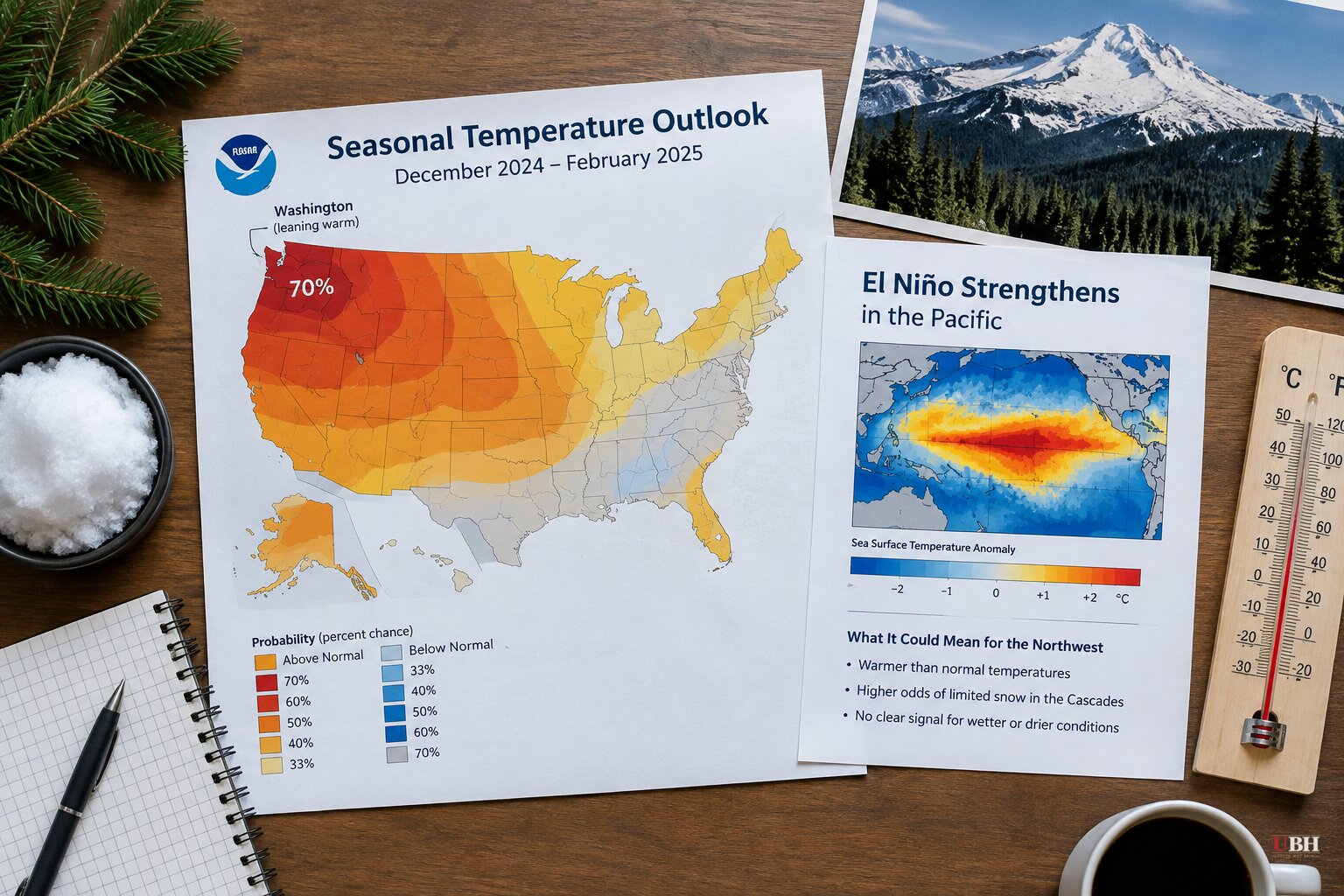
The regional picture for the Pacific Northwest has come into focus following the latest seasonal outlook from NOAA's Climate Prediction Center. For Washington, it is a warm winter with an open question on precipitation.
The CPC's latest seasonal outlook gives the Pacific Northwest and western Washington up to a 70% chance of warmer-than-average temperatures from December through February. On precipitation, it shows no real trend toward above, near or below average. KIRO Newsradio meteorologist Ted Buehner called that split typical of an El Niño winter.
The Pacific keeps warming
According to the latest CPC information, sea surface temperatures from the coast of Peru west to around the dateline are running 2.5 to more than 4°C above average. That is roughly 4 to more than 7°F.
The event looks to peak around the end of the year. It is set to become one of the strongest on record going back to 1950.
The Washington State Department of Ecology classifies El Niño as "very strong" when ocean surface temperatures run at least 2°C above normal. By that measure, this event is past the threshold.
NOAA data show "a high likelihood of this very strong event continuing through mid-winter before weakening rapidly to a moderate or weak event sometime in late winter or spring," the University of Washington's Washington State Climate Office said.
As of Oct. 8, the CPC put at least an 83% chance on a "strong to very strong" El Niño through March 2027. NOAA also forecast a 97% chance that El Niño lasts through early spring 2027.
Why snowpack is the problem
A warm winter with plenty of precipitation is bad for mountain snow. Higher snow levels mean more precipitation falling as rain instead of snow at lower and middle elevations of the Cascades. Snow that does accumulate can be more vulnerable to warm, rainy systems later in the season.
The reverse also fails. Cold air with relatively little precipitation gives the right temperatures but not enough storms, and the snowpack still struggles to build. Either path, a KIRO 7 weather analysis said, is "not particularly good news" for building and maintaining mountain snowpack.
The typical El Niño storm track makes this worse for Washington. The storm track tends to spend more time moving weather systems into California and across the southern tier of the nation than through the Pacific Northwest. Quartz notes that the Pacific Northwest and Ohio Valley often run drier, and adds that none of this is guaranteed.
The counterargument from forecasters
The same KIRO 7 analysis pushes back on reading too much into the label. "El Niño isn't a winter forecast by itself," it said. Even a very strong event only shifts the odds toward certain weather patterns, and it does not determine what happens on any particular day, week or even month.
Its argument: a handful of big Cascade snowstorms, combined with relatively few prolonged warm and rainy periods, could still leave "respectable mountain snowpack and a decent ski season."
History offers a caution too. The 1982-83, 1997-98 and 2015-16 events, the ones most often called "super" El Niños, each played out differently, according to Quartz. NOAA has no official category by that name. Other climate patterns can also override the El Niño signal.
South gets the water, West gets the risk
The contrast with the rest of the West is sharp. The CPC outlook gives a stronger wetter-than-average signal for California and much of the southern tier. KIRO 7 pointed to a strong storm already hitting California with flooding and heavy Sierra Nevada snow as fitting the pattern.
Buehner noted that the Southwest could use the moisture in the form of rain and mountain snow given its years of dry conditions. He also noted that heavy rainfall can create flooding and landslides there, particularly in areas with recent wildfires.
For Washington, the practical stakes are water supply and recreation. Buehner wrote that a lower-than-normal snowpack by next spring would make it four years in a row, with water resources short during those years and limits on agricultural irrigation in much of eastern Washington. The warm odds are the firmest part of the forecast. The precipitation line is blank.
The next test comes as the event nears its expected peak around the end of the year. Whether the Cascades get the few big storms the KIRO 7 analysis describes, or a string of warm rain events, will help decide how much snow is on the mountains by the time the El Niño starts to fade in late winter or spring.
Sources used for this briefing
6 links from 6 independent newsrooms (syndicated copies of the same report count once)
These are the sources it draws on, linked so you can verify.