
Unbiased headlines. Facts, not spin.
Every story is an unbiased news briefing written from 110+ sources across the spectrum — sources linked so you can verify it yourself.
 health
Notable (6/10)
August 14, 2026 at 05:59 PM
health
Notable (6/10)
August 14, 2026 at 05:59 PM
NOAA Raises El Nino Odds: 69% Chance It Becomes Strongest Ever Recorded
NOAA's Climate Prediction Center updated its El Nino forecast Thursday, and the number that matters jumped: a 69% chance the pattern peaking between October and December becomes the strongest El Nino on record dating back to 1950. That's up from NOAA's prior language describing the event as merely among the largest on record, according to CNN.
This is a forecast update, not a new phenomenon. Sea surface temperatures in the central equatorial Pacific have been running at record levels for more than two months, according to the Washington Post, which is tracking the data monthly. The shift this week is about magnitude, not onset.
What actually changed
NOAA's Climate Prediction Center said there's now a greater than 90% chance the event qualifies as "very strong" this fall and winter, according to Newsweek, which is the highest confidence level the agency has assigned to date. Michelle L'Heureux, a physical scientist at NOAA's Climate Prediction Center, told ABC News the team has "become more confident in the possibility of a very strong El Nino by the end of this year."
The current event already ranks as the second-strongest on record for this point in the calendar, trailing only 1997, according to ABC News. NOAA is now projecting sea surface temperature anomalies in the benchmark Nino 3.4 region will exceed 2.5 degrees Celsius above average over a three-month span, according to CNN, which would put it past the 1982-83 event that previously held the record.
The Washington Post's tracking shows forecasts have moved up since July, with ocean temperatures now projected to peak around 4.1 degrees Celsius above average in December, more than a full degree above the 2015 record. Berkeley Earth climate scientist Zeke Hausfather, in an analysis cited by Wired, put the model average peak at 3.6 degrees Celsius above normal, which would beat the 2015-16 record by roughly 0.8 degrees Celsius. Hausfather noted that gap is unusually large: "the gap between the strongest and the fifth strongest El Nino of the past 150 years is only about 0.5C," he wrote, calling the current model output "outside the envelope of anything we have ever observed."
The Los Angeles Times reported NOAA now puts the odds at 95% that a "super" El Nino develops this year, with the roughly 7-in-10 chance specifically tied to it becoming the strongest since 1950.
Why the caveats matter
NOAA itself keeps stressing that a record-strength El Nino doesn't guarantee record-strength local impacts. CNN reported NOAA forecasters explicitly cautioned that "impacts will [not] be markedly worse or are guaranteed to occur in most of the locations that are typically affected."
The 2015-16 event provides an instructive example. It was historically potent in the ocean, on par with 1982 and 1997 by NOAA's own measurements, according to Newsweek. But it delivered warmer, drier conditions to California instead of the expected deluge, while dumping unusual wetness on the Pacific Northwest. AccuWeather's Paul Pastelok told Newsweek plainly: "not all El Ninos are exactly the same." Regional predictions from strong record-breaking events deserve skepticism, given that past behavior varies considerably.
That said, the historical batting average leans toward wet. Of the three prior "very strong" El Ninos since 1950, two brought above-average rain to Southern California, according to the LA Times. Alexander Gershunov, a research meteorologist at Scripps Institution of Oceanography, told the LA Times cold-frontal storms tend to dip farther south than usual in these years, putting Southern California "in the crosshairs of potentially potent tropical moisture."
The stakes on the ground
California officials are bracing for a wet, potentially destructive winter, according to the LA Times, with elevated flood risk tied to what could be the highest sea levels ever recorded along the coast. Daniel Swain, the UCLA climate scientist, told a virtual town hall hosted by California state senator Mike McGuire that a system this strong "shifts the odds in favor of a wet winter" and increases the likelihood of coastal flooding during storm events or king tides, according to the Guardian.
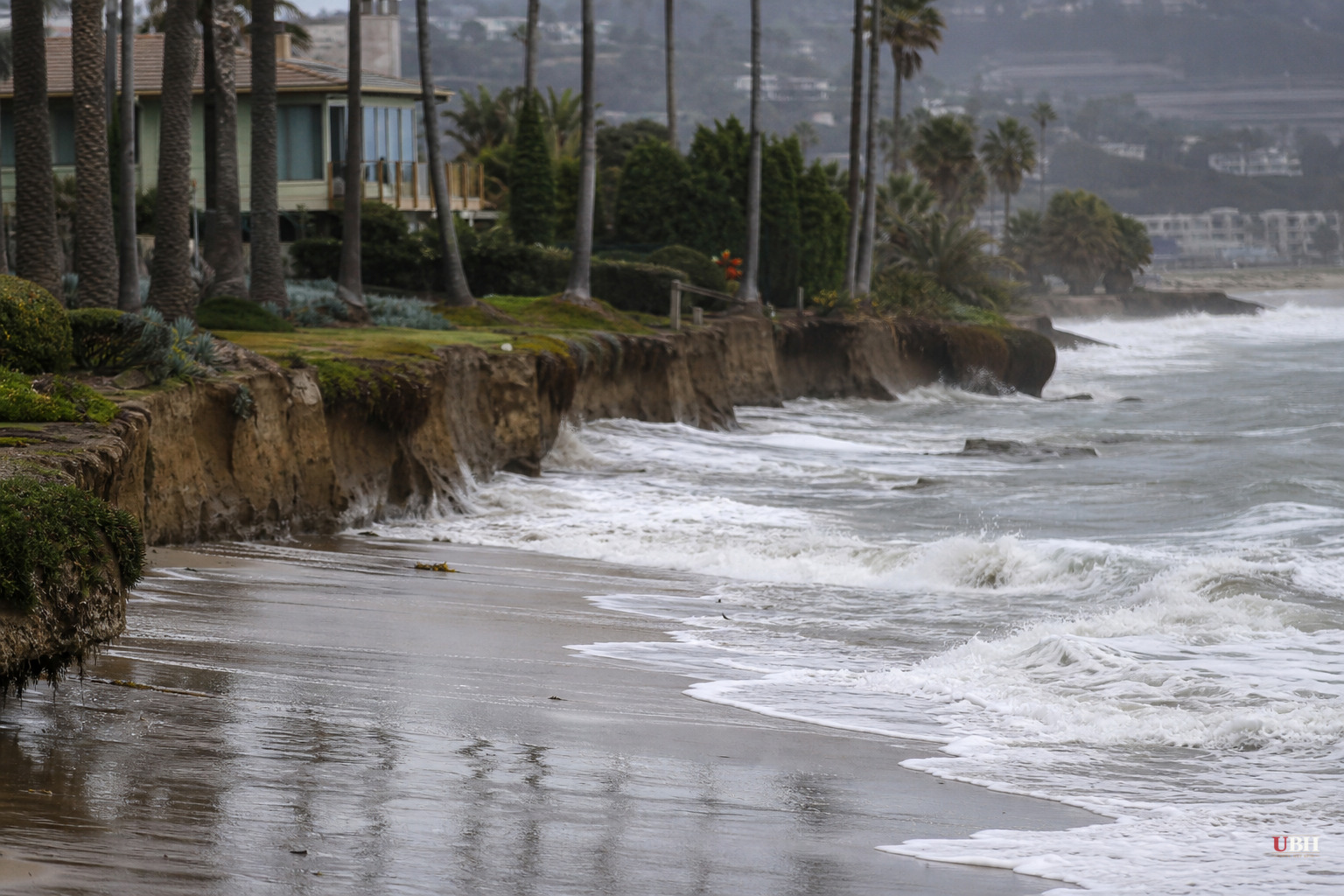
Mark Merrifield of Scripps Institution of Oceanography added at the same town hall that erosion from prior El Ninos, particularly 2015-16, has already stripped away buffer beach, meaning "waves will have even greater impact on the shoreline," according to the Guardian.
On the Atlantic side, AccuWeather's Pastelok told Newsweek the same pattern that fuels Southern jet stream activity typically suppresses named storm formation in the Atlantic basin, consistent with what CNN and ABC News both described as a relatively quiet hurricane season so far this year.
None of this is locked in. NOAA's own Climate Prediction Center will issue updated monthly assessments as the event approaches its projected fall-winter peak, and Wired noted the fuller global temperature consequences may not show up until 2027, once the ocean's stored heat works through the atmosphere. Whether this event ultimately breaks the 1982-83 and 2015-16 records won't be confirmed until NOAA's post-season retrospective analysis, expected sometime after the event peaks late this year.
Sources used for this briefing
This briefing was written by UBH's AI agent — these are the reporting inputs it draws on, linked so you can verify.


