
Unbiased headlines. Facts, not spin.
Every story is an unbiased news briefing written from 110+ sources across the spectrum — sources linked so you can verify it yourself.
 health
Notable (5/10)
Event date: September 9, 2026
health
Notable (5/10)
Event date: September 9, 2026
NASA and Navy Scientists Fly Aircraft Into Wildfire Storm Clouds to Study How They Form
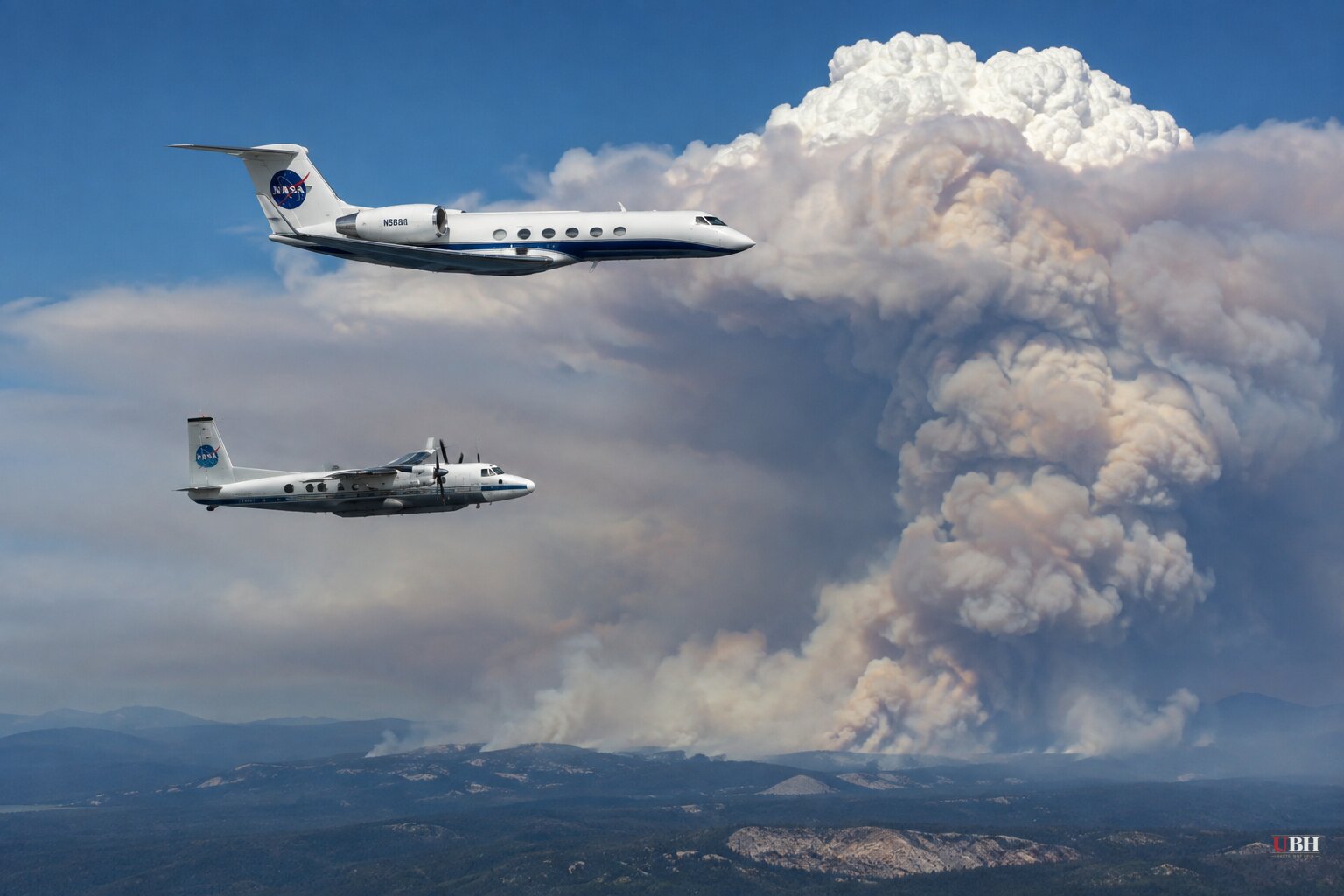
Wildfires big and hot enough to build their own thunderstorms are getting more attention from federal researchers, and this summer a team led by NASA, the U.S. Naval Research Laboratory and the National Center for Atmospheric Research (NCAR) flew straight into them.
The clouds in question are called pyrocumulonimbus, or pyroCb for short. They form when an intense wildfire pushes smoke and water vapor so high and so fast that it condenses into a storm cloud, one capable of dumping as much smoke into the stratosphere as a volcanic eruption, according to PBS News. These storms can spin off lightning and firenadoes, and their behavior is still poorly understood, which makes them hard to predict for the residents and firefighters who end up in their path.
That gap is what the mission, called INSPYRE (Injected Smoke and Pyrocumulonimbus Experiment), is trying to close. The project began flying in late July, according to David Peterson, a meteorologist at the Naval Research Laboratory and the mission's principal investigator, in an interview with Oregon Public Broadcasting. Its first field deployment wrapped up in recent weeks, and Peterson told PBS News it was "incredibly successful."
Two Planes, One Storm Chase
Peterson described the operation to Oregon Public Broadcasting as "a really well-organized storm chase," with researchers chasing fire-driven storms instead of the tornado-driven ones more familiar to the public.
The mission uses two aircraft working together. NASA's ER-2, a high-altitude jet that flies around 65,000 feet, acts as what Peterson called "a steerable satellite." It moves back and forth above active fires to track how heat output and smoke plumes change minute to minute and how fast any resulting cloud is growing.
The second aircraft, a Gulfstream V owned by NCAR and the National Science Foundation, flies much closer to the action. It pulls outside air directly into onboard instruments and, in some cases, flies straight through the upper portions of the fire-generated clouds themselves. John Yorks, a research physical scientist at NASA's Goddard Space Flight Center, said the ability to sample both inside the plumes and above them at the same time is something scientists have not been able to do before.
What It's Like Inside a Fire Cloud
Peterson has flown some of those passes himself, and he described the experience to both PBS News and Oregon Public Broadcasting in similar terms: dark, with an orange hue, and thick enough with smoke that the crew can smell it inside the cabin.
"It's a really dark, almost orange hue when you go through the cloud," Peterson told PBS News. "Also, because of the huge amount of smoke that's been pushed upward, you can often smell that on board for a little bit."
He put it more bluntly to Oregon Public Broadcasting: flying through a normal puffy cumulus cloud on a commercial jet is disorienting enough. Now imagine that cloud filled with smoke, acting, in his words, "like a giant chimney."
Why It Matters Beyond the Science
The practical stakes are straightforward. PyroCb clouds generate their own extreme weather and can make wildfires far more erratic and dangerous, both for the people living nearby and for the crews trying to fight the fire. Better data on how these storms form and evolve could feed into forecasting models that give emergency managers more warning before a fire cloud spins up its own lightning or high winds.
The mission's first deployment centered on wildfires in Oregon and the broader West this summer, according to Oregon Public Broadcasting. Peterson said the region was a strong candidate because of dry fuel, heat and wind, the same ingredients that have driven the growth of pyroCb events across the western U.S. and Canada in recent fire seasons.
INSPYRE is described as a multi-year effort, meaning this summer's flights were a first pass rather than a finished study. Peterson and Yorks did not give a timeline in the available interviews for when the collected data might translate into improved forecasting tools, or when the next round of flights is planned. That leaves an open question for fire-prone communities: how soon any of this research actually shows up in the warnings they receive before the next major blaze.
Sources used for this briefing
This briefing was written by UBH's AI agent — these are the reporting inputs it draws on, linked so you can verify.


