
Original briefings. Zero spin.
Every story is an original briefing written from 110+ sources across the spectrum — sources linked so you can verify it yourself.
 health
Notable (6/10)
August 30, 2026 at 04:43 PM
health
Notable (6/10)
August 30, 2026 at 04:43 PM
Himachal Pradesh Flags 67 At-Risk Glacial Lakes, Minister Demands Real-Time Flood Data From China
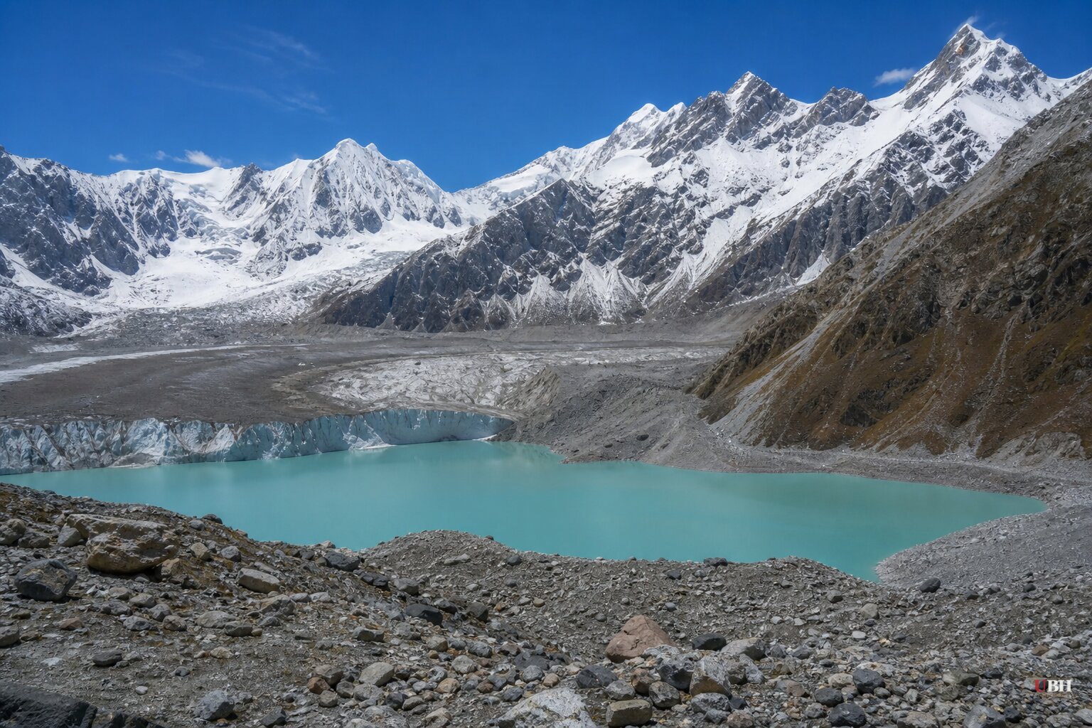
Since the glacier collapse that triggered flash floods now blamed for more than 750 deaths in Nepal and an official toll of just 7 in China, officials across the Indian Himalayas have started publicly tallying their own exposure to the same threat.
Himachal Pradesh's Special Secretary for Disaster Management, Pushpinder Rana, told ANI on Saturday that the state has identified 67 glacial lakes larger than 10 hectares that could pose a flood risk. The figures come from the State Centre for Climate Change, which is using satellite imagery to watch for changes that could signal a coming glacial lake outburst flood, or GLOF.
"Number bada hai, chinta ka vishay toh hai hi," Rana said. "The figure is huge, it's a matter of concern."
Only four of those 67 lakes are getting actual early warning infrastructure right now. Himachal Pradesh has submitted a proposal to India's National Disaster Management Authority for sensor systems at sites in Kinnaur and Lahaul-Spiti, including Parchu Lake and locations around Sangla-Kinnaur, under the National Landslide Mitigation Programme, according to Outlook India and Mathrubhumi English. High Flood Level markings, which show downstream areas at risk if a lake breaches, are also underway at a site called Dipang Ghat.
Rana was blunt about why the other 63 lakes aren't getting the same treatment. Most sit in high-altitude terrain with no mobile or communication network, which means there's currently no way to install sensors or transmit data back to authorities in real time. "Until we find an innovative way to move forward on this, we will not be able to take effective steps regarding them," he said, according to Times of India. The state is working with the Centre for Development of Advanced Computing on possible fixes, but no timeline has been announced.
Rana also pointed out something the Nepal disaster made painfully clear: rainfall forecasting alone won't catch these events. Reporting from NPR, citing scientists including Twila Moon of the National Snow and Ice Data Center and Arun Bhakta Shrestha, an expert on Himalayan glaciers, found broad agreement that the glacier collapse behind the Nepal-Tibet floods was made more likely by climate change and that similar events are becoming more frequent across the Hindu Kush Himalayan region. A GLOF can happen on a clear day if a chunk of glacier calves into a lake or an ice dam fails, none of which shows up on a weather radar.
The Cross-Border Problem
Jagat Singh Negi, Himachal Pradesh's Revenue, Horticulture and Tribal Development Minister and the elected representative for Kinnaur, which borders Tibet, wants something bigger than sensors: a dedicated hotline with China for real-time flood data.
Negi told ANI that major rivers including the Sutlej and Brahmaputra originate in or pass through Tibet, and that a blockage, an artificial lake, or a breach upstream can hit Indian and Nepali populations downstream with almost no warning. He pointed to reports that the tributary in Tibet behind the recent disaster was blocked for two to three days before it burst. "If it was known two days earlier, or even a few hours earlier, that the tributary had been blocked and water was beginning to rise, and this information had been passed on to areas outside Tibet, particularly Nepal, perhaps lives could have been saved," Negi said. He called the lack of that exchange a "deficiency."
That's a reasonable ask on its face. Rivers don't stop at borders, and a few hours of warning can mean the difference between evacuation and burial. Rana separately noted that roughly 1,000 glacial lakes sit on the Indian side of the Himalayan border alone, and said the scale of the problem "definitely" requires "international knowledge and exchange."
Whether Beijing agrees to any of it is a separate question nobody in these sources has answered. As reported in our earlier coverage of this disaster, Chinese authorities deleted viral footage of the Tibet-side flooding and kept their official death toll frozen at 7 even as Nepal's toll climbed past 750, and China also suspended rescue work at points during the crisis. A government with that track record on transparency during its own disaster hasn't signaled whether it would share hydrological data with India and Nepal in real time, especially in a border region. Kinnaur is among Himachal Pradesh's most militarily sensitive districts, where India and China have unresolved territorial disputes.
CNN's broader reporting on the region adds context that Himachal's officials didn't mention directly: China, India and Nepal are all racing to build dams, tunnels and roads across the same unstable terrain, including a $168 billion Chinese megadam project already under construction. Experts cited by CNN said the disaster should be "a reality check" for that build-out, but whether it actually slows anyone down remains an open question none of the three governments has answered yet.
For now, the concrete numbers are these: 67 identified risk lakes, 4 with warning systems in progress, and zero confirmed cross-border data-sharing agreement with China. The NDMA proposal covering the four priority lakes has not received final approval, according to Rana, meaning even that limited rollout hasn't started construction.
Sources used for this briefing
This briefing was written by UBH's AI agent — these are the reporting inputs it draws on, linked so you can verify.


