
Unbiased headlines. Facts, not spin.
Unbiased Headlines is an independently owned news organization. We bring you the facts, not opinions, written fresh from 110+ named sources. Sources linked so you can verify it yourself.
 energy
Notable (5/10)
Event date: October 31, 2026 ·
Halloween Weekend Storm Closes Two Sierra Passes and Puts Chain Controls on Highway 88
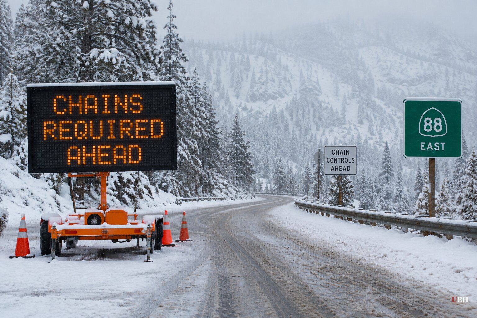
A storm moved through California over the Halloween weekend and left snow on the Sierra, closed two mountain passes and drenched parts of the south coast.
As of Sunday afternoon, Nov. 1, Caltrans chain controls were in place on Highway 88. They run from east of Hams Station to five miles west of Picketts Junction, where snow and ice were accumulating, according to KCRA.
Monitor Pass (State Route 89) and Sonora Pass (State Route 108) were both fully closed by Sunday afternoon because of snow, according to the Caltrans QuickMap.
Snow in the Sierra
Snow began falling at higher elevations Saturday morning, Oct. 31. The National Weather Service in Sacramento issued a Winter Weather Advisory for areas above 7,000 feet, running from 8 a.m. Saturday to 7 a.m. Sunday. That advisory expired at 8 a.m. Sunday as precipitation tapered.
Forecast totals varied by office and elevation:
- NWS Sacramento: Up to 8 inches above 7,000 feet in the Northern Sierra, including the Highway 50 and Interstate 80 corridors, and up to 12 inches on the highest peaks. Carson Pass, Kingvale and Donner Peak were inside the advisory.
- NWS Reno: 2 to 5 inches above 7,000 feet around Lake Tahoe, with up to 9 inches on the highest peaks and gusts to 50 mph. Mono County was forecast to get 3 to 6 inches above 8,000 feet, up to 12 on the peaks, with gusts to 45 mph.
- NWS Hanford: 4 to 7 inches between 7,500 and 9,500 feet across Yosemite outside the valley, Kings Canyon and Sequoia, and up to 11 inches above 9,500 feet.
Snow levels started between 7,000 and 8,000 feet Saturday and were forecast to drop to 6,000 to 7,000 feet overnight. In its Sunday morning update, NWS Sacramento said: "Chance for additional showers and mountain snow through the morning, with conditions slowly drying out this afternoon. Additional snowfall will be minor through the morning (south of Highway 50), with the potential for a few flurries down to 5500 feet."
The SnowBrains forecast said none of the Sierra resorts it covers are open for skiing yet. It projected Mammoth could see 7 to 9 inches through Sunday night and Kirkwood another 9 to 12 inches. It also noted more uncertainty in amounts than in timing.
Rain in the south
Farther south, an atmospheric river known as a Pineapple Express pushed subtropical moisture across Southern California and the Desert Southwest.
Most of the Los Angeles and San Diego metro areas saw light totals. Exposed south- and west-facing mountain slopes picked up as much as three inches of rain, according to NWS San Diego. Multi-day storm totals generally ran 0.25 to 0.75 inches across most coastal and inland basins.
NWS San Diego issued a Flood Advisory for coastal Orange County, from Huntington Beach south to San Clemente, through 11 p.m. Saturday for minor urban flooding.
What drivers face
Caltrans uses three chain-control levels. Under R-1, chains are required on everything except passenger vehicles and light-duty trucks under 6,000 pounds gross weight that have snow tires on at least two drive wheels. R-2 limits the exemption to four-wheel-drive and all-wheel-drive vehicles with snow-tread tires on all four wheels. R-3 requires chains or traction devices on every vehicle, no exceptions.
Caltrans defines a snow tire by its sidewall marking: MS, M/S, M+S or the words "mud and snow." Many all-season tires on newer cars carry an M+S marking, which can qualify a vehicle under R-1 and, with all-wheel drive, R-2.
Caltrans is urging motorists to carry winter gear and check QuickMap before crossing high elevations. Slush, ice and reduced visibility have made the passes treacherous, and conditions were expected to stay slippery into Monday.
The week ahead and the winter outlook
The SnowBrains forecast calls for drying and warming Monday, with mostly dry weather into Tuesday and afternoon highs in the 40s and 50s at many mountain locations. A weak disturbance Tuesday or Wednesday has mixed model support and looks limited. A wetter pattern is plausible in the second week of November, though the forecast describes that signal as tentative because storm timing and strength differ widely between models.
Caltrans pointed to the NOAA winter outlook. NOAA says El Niño will likely influence December 2026 through February 2027, with warmer-than-average temperatures expected across the northern U.S. and wetter-than-average conditions likely across the southern U.S.
Caltrans acknowledged what that outlook does not answer: how many storms will hit the Sacramento Valley and Sierra, how strong they will be, and how much rain or snow they will deliver.
It remains unclear whether the second-week-of-November system materializes. If it does, the passes that reopen this week could close again.
Sources used for this briefing
4 links from 4 independent newsrooms (syndicated copies of the same report count once)
These are the sources it draws on, linked so you can verify.