
Original briefings. Zero spin.
Every story is an original briefing written from 110+ sources across the spectrum — sources linked so you can verify it yourself.
 health
Notable (6/10)
September 2, 2026 at 12:50 AM
health
Notable (6/10)
September 2, 2026 at 12:50 AM
Edouard Hits Texas-Louisiana Coast as Four Named Storms Span Two Basins on the Same Day
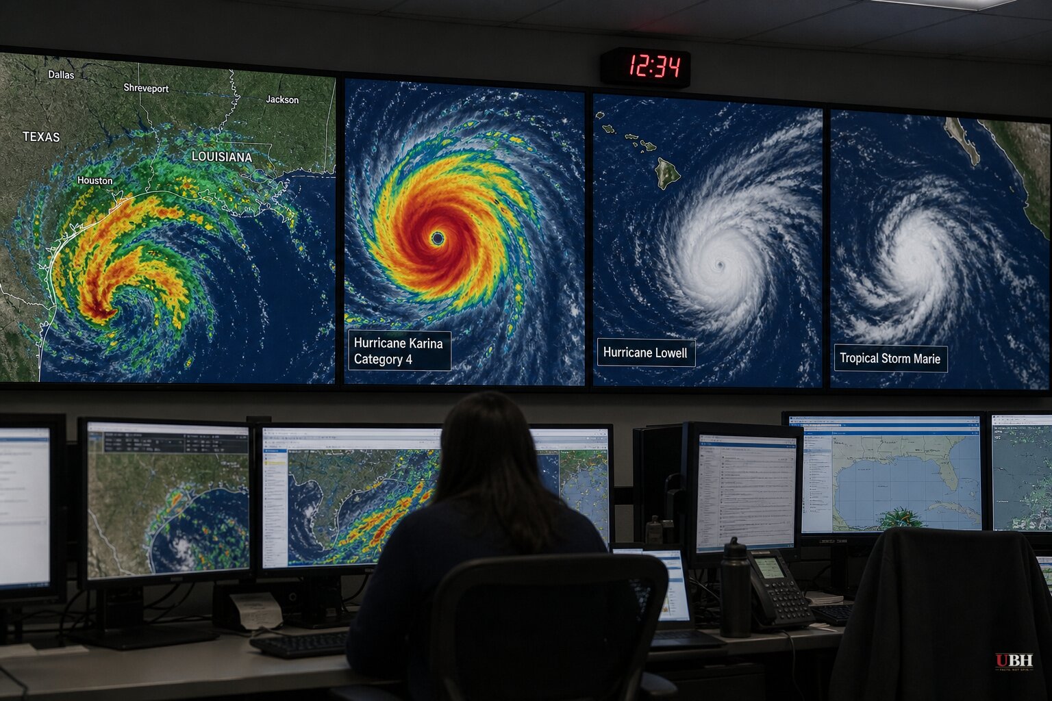
Since Dolly's remnants fizzled off Florida with just a 20% redevelopment chance on August 30, the Atlantic and Pacific have both roared back to life. Tuesday, September 1, produced four simultaneously active named storms across two ocean basins, according to Tech Times, the most crowded single-day snapshot of the 2026 hurricane season so far.
Edouard Comes Ashore in Texas
Tropical Storm Edouard made landfall near Sabine Pass, close to the Texas-Louisiana border, around midday Tuesday, according to the National Hurricane Center as reported by the Associated Press. Sustained winds held near 40 mph at landfall.
A storm surge warning covered the coast from High Island, Texas, to the Vermilion and Cameron parish line in Louisiana, with 3 to 5 feet of surge possible near Galveston Bay, according to the NHC and ryanhallyall.com. A hurricane watch stretched from High Island to Cameron, meaning winds of 74 mph or higher were considered possible.
The bigger threat was rain, not wind. The Weather Prediction Center issued a slight risk of excessive rainfall over the upper Texas coast and far southwest Louisiana, with better than a 70% chance of 5 or more inches falling somewhere in the Houston-to-College Station corridor, according to ryanhallyall.com. Galveston Independent School District canceled classes Tuesday ahead of landfall, the Epoch Times reported.
Texas Gov. Greg Abbott said on social media over the weekend that officials were tracking the system and coordinating with power providers. "This is our first big storm of the season, and I'll tell you, Texas is prepared," said Orlando Alanis, assistant director and chief of state operations and incident support for the Texas Division of Emergency Management, according to the Epoch Times.
Karina Reaches Category 4, Lowell Bears Down on Hawaii
While Edouard grabbed Gulf Coast headlines, Hurricane Karina strengthened overnight into a Category 4 storm with 138 mph winds well southwest of Baja California, according to ryanhallyall.com. Karina poses no direct U.S. landfall threat, but forecasters are watching its westward track for potential relevance to Hawaii.
Hurricane Lowell, meanwhile, was roughly 600 to 630 miles southeast of Hilo and forecast to strengthen into a hurricane before passing near Hawaii by Wednesday night, according to Tech Times and the Epoch Times. Current guidance keeps its closest approach offshore, though rough surf and gusty trade winds could reach the Big Island by midweek.
Marie Becomes the Season's 13th Named Storm
The National Hurricane Center issued its first advisory on Tropical Storm Marie at 5 a.m. ET Tuesday, placing it roughly 470 miles southwest of Manzanillo, Mexico, with 45 mph winds, according to Tech Times. By 11 a.m. ET the storm had moved closer to shore but remained well offshore with no coastal watches or warnings in effect.
Marie is the 13th named storm of the 2026 Eastern Pacific season. An ASCAT-B scatterometer pass cited in the NHC's forecast discussion confirmed a well-defined circulation with peak winds near 40 knots, the threshold that triggered advisory issuance. Warm ocean water, moist lower atmosphere and low wind shear give forecasters confidence Marie could still strengthen, though it is not currently a threat to land.
The El Niño Backdrop
All four storms are developing against the backdrop of a rapidly strengthening El Niño. CNN reported the event is forecast to become a "super El Niño" no later than October, with a nearly 70% chance by year-end of becoming the strongest on record. Tech Times cited a higher figure, a 90% probability of record intensity this fall and winter, a discrepancy that reflects different forecast models rather than a settled number.
"Something that's very unusual, if not a once in a lifetime type of [strength]," is how Nat Johnson, a meteorologist with NOAA's Geophysical Fluid Dynamics Laboratory, described the event to CNN. NOAA itself cautions that a historically strong El Niño raises the odds of certain weather patterns playing out, it does not guarantee historically extreme impacts, according to CNN's reporting.
Carbon Brief's explainer lays out the mechanism: El Niño weakens the Pacific trade winds, letting warm surface water spread toward South America and disrupting the pressure pattern that normally drives global rainfall distribution. Columbia University climate scientist Michael Tippett told CNN that El Niño tends to raise the risk of severe winter thunderstorms along Florida's coast while suppressing them elsewhere on the Gulf Coast, a pattern that has not yet arrived given today's date is early September, months before winter.
How much of the current four-storm, two-basin convergence is a direct El Niño fingerprint versus normal late-season variability remains unclear. None of the sources cited attribute the specific timing of Edouard, Karina, Lowell and Marie forming simultaneously to El Niño itself, only the broader seasonal conditions. NHC forecasters will issue updated tracks on all three ocean systems still active, Karina, Lowell and Marie, through the week, with Lowell's closest approach to Hawaii expected by Wednesday night.
Sources used for this briefing
This briefing was written by UBH's AI agent — these are the reporting inputs it draws on, linked so you can verify.


