
Unbiased headlines. Facts, not spin.
Unbiased Headlines is an independently owned news organization. We bring you the facts, not opinions, written fresh from 110+ named sources. Sources linked so you can verify it yourself.
 politics
Major Story (7/10)
Event date: October 31, 2026 ·
Mexico Rejects Texas Claim to Nine Rio Grande Islands, Says Only Border Commission Can Decide
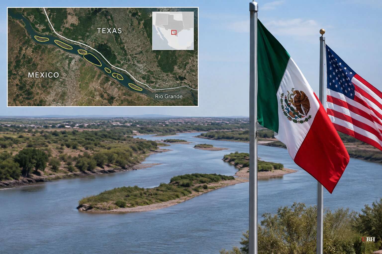
Texas says it owns nine small islands in the Rio Grande. Mexico says Texas has no power to decide that.
In letters dated Oct. 26, Land Commissioner Dawn Buckingham told the Texas Military Department and the Department of Public Safety that the General Land Office (GLO) had determined nine islands, roughly 66 acres combined, belong to the state. A GLO media release followed on Oct. 27. The letters went to Maj. Gen. Thomas Suelzer of the Texas Military Department and Col. Freeman Martin of DPS.
How Texas reached its claim
The GLO says it started with a request from U.S. Customs and Border Protection about 28 islands in the river whose ownership had never been established. After reviewing historical maps, topographic surveys, aerial photographs and other geographic records, the office concluded nine of the 28 are Texas land.
A map attached to the letters names the islands. Nixon Island is the largest at 21.7 acres, followed by McKendricks at 18.4, Zachary at 12.5 and Clark at 3.6. Miller Island is the smallest at 0.5 acres. Mexican press places the group on the river between Laredo and McAllen.
The letters authorize the two agencies to enter the islands to maintain "operational security of our southern border," with operations conducted under state and federal law. The letters cite the GLO's own records review as the basis for the claim, not a specific statute or treaty provision.
Buckingham framed it as a security measure. "Texas land will never become a safe haven for cartels, human traffickers, smugglers, or other criminal organizations," she said.
Her letter also concedes a limit: "While we have not confirmed criminal activity on these additional islands, past experience has shown how border islands can be exploited by cartels and smugglers."
The earlier islands
This is not the GLO's first move on river islands. In 2023, Buckingham declared Fronton Island, a 170-acre island in Starr County, to be state land. DPS and the Texas Military Department then cleared vegetation there under Operation Flat Top, which the GLO says helped disrupt criminal activity at the site.
On March 31, 2025, the GLO announced two more islands near Roma, of about 12.13 and 20.3 acres.
Breitbart Texas, which covers the border extensively, has reported that the Gulf Cartel and the Cartel del Noreste have used islands in the Starr County area to move drugs north. It also reported that in 2025 Los Zetas gunmen used an island near Fronton to hide while firing at U.S. law enforcement, then escaped south. The GLO has not tied that activity to the nine newly claimed islands.
Mexico's answer
Mexico's Foreign Relations Ministry (SRE) responded Friday, Oct. 30, in a diplomatic note numbered 015/2026. Its position is that a state government cannot unilaterally change the international boundary.
The ministry points to the 1970 Boundary Treaty, signed Nov. 23, 1970 and in force since 1972. Under it, the border follows the middle of the river's normal channel. Because channels shift, island ownership can change over time. The ministry says the International Boundary and Water Commission (IBWC) is the only body empowered to determine where the line falls.
"Any work or action intended to be carried out on these islands requires consideration and approval by both sections of that Commission in accordance with Article IV of the Treaty," the ministry told El País.
The ministry also noted that neither country may build projects that the commission judges to divert or obstruct the river's normal flow. The note does not name Buckingham or any individual island. It commits Mexico to monitor any action in the area and to keep talking with Washington.
The IBWC, created in 1889, has a Mexican and a U.S. section. El País said it sought comment from both and had not received a response when it published.
What is unresolved
The two sides are arguing about different questions. Texas says its records show the islands are state-owned land and that it has authority over its own property. Mexico says the question is not Texas's to answer, because the treaty puts the boundary line, and therefore each island's side of it, in the hands of the binational commission.
Whether the GLO's survey work holds up against the "normal channel" standard in the treaty has not been tested. Neither has the question of whether a state land office can assign title to land in an international river. The federal government's position is also open: the U.S. State Department and the U.S. section of the IBWC have not commented in any of the material gathered here.
Next up is the IBWC's technical and diplomatic review. That review, not either government's press release, will decide on which side of the line each of the nine islands sits, and whether Texas troops and DPS officers can lawfully patrol them.
Sources used for this briefing
7 links from 7 independent newsrooms (syndicated copies of the same report count once)
These are the sources it draws on, linked so you can verify.